 |
|
|
|
Location
& QuickFacts
|
FAA
Information Effective: |
2007-07-05 |
|
Airport
Identifier: |
ID29 |
|
Airport
Status: |
Operational |
|
Longitude/Latitude: |
115-59-01.5220W/46-41-50.6590N
-115.983756/46.697405 (Estimated) |
|
Elevation: |
2249 ft / 685.50 m (Surveyed) |
|
Land: |
14 acres |
|
From
nearest city: |
18 nautical miles NE of Orofino, ID |
|
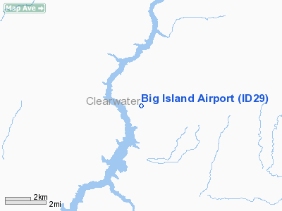
Location: |
Clearwater County, ID |
|
Magnetic Variation: |
18E (1985) |
Owner
& Manager
|
Ownership: |
Privately
owned |
|
Owner: |
Clearwater-potlatch Timber Pr
CLEARWATER-POTLATCH TIMBER PROTECTIVE ASSOCIATION. |
|
Address: |
10250 Hwy 12
Orofino, ID 83544 |
|
Phone number: |
208-476-4114 |
|
Manager: |
Chief Pilot |
|
Address: |
10250 Hwy 12
Orofino, ID 83544 |
|
Phone number: |
208-476-5612 |
Airport
Operations and Facilities
|
Airport
Use: |
Private |
|
Wind
indicator: |
Yes |
|
Segmented Circle: |
No |
|
Control
Tower: |
No |
|
Landing
fee charge: |
No |
|
Sectional chart: |
Great Falls |
|
Region: |
ANM - Northwest Mountain |
|
Boundary
ARTCC: |
ZSE - Seattle |
|
Tie-in
FSS: |
BOI - Boise |
|
FSS
on Airport: |
No |
|
FSS
Phone: |
208-332-0200 |
|
FSS
Toll Free: |
1-800-WX-BRIEF |
|
Runway Information
Runway 01/19
|
Dimension: |
2600
x 150 ft / 792.5 x 45.7 m |
|
Surface: |
TURF, |
|
|
Runway 01 |
Runway 19 |
|
Traffic
Pattern: |
Left |
Left |
|
Obstruction: |
200 ft trees, 20.0 ft from runway |
150 ft trees, 300.0 ft from runway |
|
Radio Navigation
Aids
|
ID |
Type |
Name |
Ch |
Freq |
Var |
Dist |
|
GVV |
NDB |
Grain |
|
280.00 |
18E |
46.6 nm |
|
MQG |
VOR/DME |
Nez Perce |
019X |
108.20 |
20E |
41.3 nm |
|
MLP |
VOR/DME |
Mullan Pass |
125X |
117.80 |
20E |
47.7 nm |
Remarks
- CTN;
DEER/ELK/HORSES & CATTLE ON RWY.
- (A52-1)
TREES 50' TO 500' FROM RWY BOTH SIDES.
Big Island Airport
Address:
Clearwater County, ID
Tel:
208-476-4114, 208-476-5612
Images
and information placed above are from
http://www.airport-data.com/airport/ID29/
We
thank them for the data!
| General
Info |
| Country |
United
States |
| State |
IDAHO
|
| FAA ID |
ID29 |
| Latitude |
46-41-50.659N
|
| Longitude |
115-59-01.522W
|
| Elevation |
2249 feet
|
| Near City |
OROFINO
|
We don't guarantee the information is fresh and accurate. The data may
be wrong or outdated.
For more up-to-date information please refer to other sources.
|
|


