 |
|
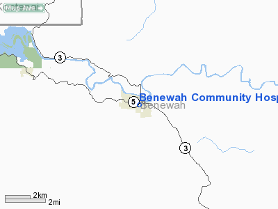
Benewah Community Hospital Heliport |
Location
& QuickFacts
|
FAA
Information Effective: |
2007-07-05 |
|
Airport
Identifier: |
ID14 |
|
Airport
Status: |
Operational |
|
Longitude/Latitude: |
116-34-02.6030W/47-18-50.6740N
-116.567390/47.314076 (Estimated) |
|
Elevation: |
2235 ft / 681.23 m (Estimated) |
|
Land: |
0 acres |
|
From
nearest city: |
0 nautical miles N of St Maries, ID |
|
Location: |
Benewah County, ID |
|
Magnetic Variation: |
19E (1985) |
Owner
& Manager
|
Ownership: |
Publicly
owned |
|
Owner: |
Benewah County |
|
Address: |
Courthouse
St Maries, ID 83861 |
|
Phone
number: |
208-245-3212 |
|
Manager: |
Benewah Community Hospital |
|
Address: |
229 7th St
St Maries, ID 83861 |
|
Phone number: |
208-245-5551 |
Airport Operations and Facilities
|
Airport
Use: |
Private |
|
Segmented Circle: |
No |
|
Control
Tower: |
No |
|
Lighting
Schedule: |
DUSK-DAWN |
|
Sectional chart: |
Great Falls |
|
Region: |
ANM - Northwest Mountain |
|
Boundary
ARTCC: |
ZSE - Seattle |
|
Tie-in
FSS: |
BOI - Boise |
|
FSS
Phone: |
208-332-0200 |
|
FSS
Toll Free: |
1-800-WX-BRIEF |
|
Runway Information
Helipad H1
|
Dimension: |
30
x 30 ft / 9.1 x 9.1 m |
|
Surface: |
CONC, |
|
|
Runway H1 |
Runway |
|
Traffic
Pattern: |
Left |
Left |
|
Radio Navigation
Aids
|
ID |
Type |
Name |
Ch |
Freq |
Var |
Dist |
|
SFF |
NDB |
Felts |
|
365.00 |
19E |
37.6 nm |
|
SKA |
TACAN |
Fairchild |
051X |
|
19E |
47.9 nm |
|
COE |
VOR/DME |
Coeur D'alene |
025X |
108.80 |
19E |
29.5 nm |
|
MLP |
VOR/DME |
Mullan Pass |
125X |
117.80 |
20E |
38.5 nm |
|
PUW |
VOR/DME |
Pullman |
027X |
109.00 |
20E |
46.9 nm |
|
GEG |
VORTAC |
Spokane |
102X |
115.50 |
21E |
45.6 nm |
|
SFF |
VOT |
Spokane/felts Field |
|
114.00 |
|
37.7 nm |
|
GEG |
VOT |
Spokane Intl |
|
109.60 |
|
43.7 nm |
Benewah Community Hospital Heliport
Address:
Benewah County, ID
Tel:
208-245-3212,
208-245-5551
Images
and information placed above are from
http://www.airport-data.com/airport/ID14/
We
thank them for the data!
| General
Info |
| Country |
United
States |
| State |
IDAHO
|
| FAA ID |
ID14 |
| Latitude |
47-18-50.674N
|
| Longitude |
116-34-02.603W
|
| Elevation |
2235 feet
|
| Near City |
ST MARIES
|
We don't guarantee the information is fresh and accurate. The data may
be wrong or outdated.
For more up-to-date information please refer to other sources.
|
|


