 |
|
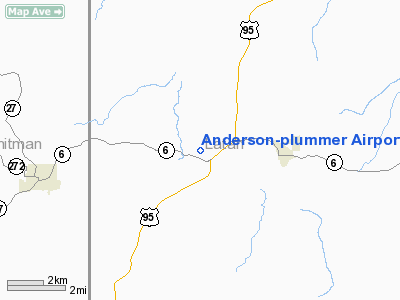
Anderson - Plummer Airport |
Location
& QuickFacts
|
FAA
Information Effective: |
2007-07-05 |
|
Airport
Identifier: |
ID10 |
|
Airport
Status: |
Operational |
|
Longitude/Latitude: |
116-57-30.5950W/46-55-27.6130N
-116.958499/46.924337 (Estimated) |
|
Elevation: |
2580 ft / 786.38 m (Estimated) |
|
Land: |
0 acres |
|
From
nearest city: |
3 nautical miles SW of Potlatch, ID |
|
Location: |
Latah County, ID |
|
Magnetic Variation: |
19E (1985) |
Owner & Manager
|
Ownership: |
Privately owned |
|
Owner: |
Sherrel Anderson |
|
Address: |
Rfd 2, Box 33
Potlatch, ID 83855 |
|
Phone number: |
208-875-0167 |
|
Manager: |
Sherrel Anderson |
|
Address: |
Rfd 2, Box 33
Potlatch, ID 83855 |
|
Phone number: |
208-875-0167 |
Airport
Operations and Facilities
|
Airport
Use: |
Private |
|
Wind
indicator: |
Yes |
|
Segmented Circle: |
No |
|
Control
Tower: |
No |
|
Landing
fee charge: |
No |
|
Sectional chart: |
Great Falls |
|
Region: |
ANM - Northwest Mountain |
|
Boundary
ARTCC: |
ZSE - Seattle |
|
Tie-in
FSS: |
BOI - Boise |
|
FSS
on Airport: |
No |
|
FSS
Phone: |
208-332-0200 |
|
FSS
Toll Free: |
1-800-WX-BRIEF |
|
Runway Information
Runway 03/21
|
Dimension: |
1850
x 50 ft / 563.9 x 15.2 m |
|
Surface: |
TURF, |
|
|
Runway 03 |
Runway 21 |
|
Traffic
Pattern: |
Left |
Left |
|
Radio Navigation
Aids
|
ID |
Type |
Name |
Ch |
Freq |
Var |
Dist |
|
SFF |
NDB |
Felts |
|
365.00 |
19E |
48.0 nm |
|
PUW |
VOR/DME |
Pullman |
027X |
109.00 |
20E |
18.6 nm |
|
MQG |
VOR/DME |
Nez Perce |
019X |
108.20 |
20E |
32.8 nm |
|
GEG |
VORTAC |
Spokane |
102X |
115.50 |
21E |
47.2 nm |
|
SFF |
VOT |
Spokane/felts Field |
|
114.00 |
|
47.8 nm |
|
GEG |
VOT |
Spokane Intl |
|
109.60 |
|
48.2 nm |
Based
Aircraft
|
Aircraft
based on field: |
2 |
|
Single
Engine Airplanes: |
2 |
Anderson-plummer Airport
Address:
Latah County, ID
Tel:
208-875-0167
Images
and information placed above are from
http://www.airport-data.com/airport/ID10/
We
thank them for the data!
| General
Info |
| Country |
United
States |
| State |
IDAHO
|
| FAA ID |
ID10 |
| Latitude |
46-55-27.613N
|
| Longitude |
116-57-30.595W
|
| Elevation |
2580 feet
|
| Near City |
POTLATCH
|
We don't guarantee the information is fresh and accurate. The data may
be wrong or outdated.
For more up-to-date information please refer to other sources.
|
|


