 |
|
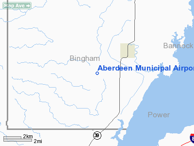
Aberdeen Municipal Airport |
|
|
Location
& QuickFacts
|
FAA
Information Effective: |
2007-07-05 |
|
Airport
Identifier: |
U36 |
|
Airport
Status: |
Operational |
|
Longitude/Latitude: |
112-52-51.9790W/42-55-15.6800N
-112.881105/42.921022 (Estimated) |
|
Elevation: |
4470 ft / 1362.46 m (Surveyed) |
|
Land: |
44 acres |
|
From
nearest city: |
2 nautical miles SW of Aberdeen, ID |
|
Location: |
Bingham County, ID |
|
Magnetic Variation: |
16E (1985) |
Owner
& Manager
|
Ownership: |
Publicly
owned |
|
Owner: |
City Of Aberdeen |
|
Address: |
P O Box 190
Aberdeen, ID 83210 |
|
Phone
number: |
208-397-4161 |
|
Manager: |
Jeff Driscoll |
|
Address: |
P.o. Box 21
Aberdeen, ID 83210 |
|
Phone number: |
208-221-2211 |
Airport Operations and Facilities
|
Airport
Use: |
Open
to public |
|
Wind
indicator: |
Yes |
|
Segmented Circle: |
Yes |
|
Control
Tower: |
No |
|
Lighting
Schedule: |
DUSK-DAWN
ACTVT MIRL RY 06/24 - CTAF. |
|
Beacon
Color: |
Clear-Green (lighted land airport) |
|
Landing
fee charge: |
No |
|
Sectional chart: |
Salt Lake City |
|
Region: |
ANM - Northwest Mountain |
|
Boundary
ARTCC: |
ZLC - Salt Lake City |
|
Tie-in
FSS: |
BOI - Boise |
|
FSS
on Airport: |
No |
|
FSS
Phone: |
208-332-0200 |
|
FSS
Toll Free: |
1-800-WX-BRIEF |
|
NOTAMs
Facility: |
BOI (NOTAM-d service avaliable) |
|
Federal Agreements: |
N |
Airport Communications
Airport
Services
|
Bottled
Oxygen: |
NONE |
|
Bulk
Oxygen: |
NONE |
|
Runway Information
Runway 06/24
|
Dimension: |
3650
x 50 ft / 1112.5 x 15.2 m |
|
Surface: |
ASPH, Fair Condition |
|
Edge
Lights: |
Medium |
|
|
Runway 06 |
Runway 24 |
|
Traffic
Pattern: |
Left |
Left |
|
Markings: |
Basic, Good Condition |
Basic, Good Condition |
|
Obstruction: |
15 ft road, 210.0 ft from runway
+4' FENCE AT 0', 100' RIGHT. |
3 ft fence, 200.0 ft from runway
+3' FENCE AT 0', 55' RIGHT. |
|
Radio Navigation
Aids
|
ID |
Type |
Name |
Ch |
Freq |
Var |
Dist |
|
SWU |
NDB |
Sweden |
|
350.00 |
15E |
44.0 nm |
|
AOC |
NDB |
Arco |
|
200.00 |
15E |
45.5 nm |
|
MLD |
VOR/DME |
Malad City |
121X |
117.40 |
17E |
47.3 nm |
|
BYI |
VOR/DME |
Burley |
088X |
114.10 |
18E |
48.0 nm |
|
PIH |
VORTAC |
Pocatello |
073X |
112.60 |
17E |
10.5 nm |
Remarks
- IREG
WINTER MAINTENANCE.
- CONSIDERABLE
AGRICULTURE OPS DURING GROWING SEASON.
- +30
FT SPRINKLER AND TERRAIN AT 230 FT FM SW END OF RY MAY BE IN POSITION.
- ESTABD
PRIOR TO 15 MAY 1959.
Based
Aircraft
|
Aircraft
based on field: |
5 |
|
Single
Engine Airplanes: |
4 |
|
Multi
Engine Airplanes: |
1 |
Operational Statistics
Time Period: 2006-01-28
- 2007-01-27
|
Aircraft
Operations: |
145/Week |
|
General
Aviation Local: |
33.3% |
|
General
Aviation Itinerant: |
66.7% |
Aberdeen Municipal Airport
Address:
Bingham County, ID
Tel:
208-397-4161,
208-221-2211
Images
and information placed above are from
http://www.airport-data.com/airport/U36/
We
thank them for the data!
| General
Info |
| Country |
United
States |
| State |
IDAHO
|
| FAA ID |
U36 |
| Latitude |
42-55-15.680N
|
| Longitude |
112-52-51.979W
|
| Elevation |
4470 feet
|
| Near City |
ABERDEEN
|
We don't guarantee the information is fresh and accurate. The data may
be wrong or outdated.
For more up-to-date information please refer to other sources.
|
|


