 |
|
| Waimea-Kohala Airport |
| IATA: MUE â ICAO: PHMU â FAA LID: MUE
Location of airport in Hawaii
|
| Summary |
| Airport type |
Public |
| Operator |
Hawaii Department of Transportation |
| Serves |
Kamuela, Hawaii |
| Elevation AMSL |
2,671 ft / 814 m |
| Coordinates |
20°00â²05â³N 155°40â²05â³W / 20.00139°N 155.66806°W / 20.00139; -155.66806 (Waimea-Kohala Airport)Coordinates: 20°00â²05â³N 155°40â²05â³W / 20.00139°N 155.66806°W / 20.00139; -155.66806 (Waimea-Kohala Airport) |
| Website |
hawaii.gov/mue |
| Runways |
| Direction |
Length |
Surface |
| ft |
m |
| 4/22 |
5,197 |
1,584 |
Asphalt |
| Statistics (2007) |
| Aircraft operations |
2,685 |
| Based aircraft |
11 |
| Source: Hawaii DOT, FAA |
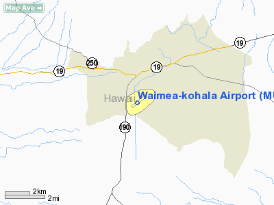
Waimea-Kohala Airport (IATA: MUE, ICAO: PHMU, FAA LID: MUE) is an airport located one nautical mile (1.85 km) southwest of Kamuela (also known as Waimea), an unincorporated town in Hawaiâi County, Hawaiâi, United States.
The only scheduled commercial airline is Pacific Wings, with service formerly subsidized by the Essential Air Service program. Beginning April 1, 2007, Pacific Wings began subsidy free service. Facilities and aircraft
Waimea-Kohala Airport covers an area of 90 acres (36 ha) at an elevation of 2,671 feet (814 m) above mean sea level. It has one runway designated 4/22 with an asphalt surface measuring 5,197 by 100 feet (1,584 x 30 m).
The airport has one taxiway and an aircraft parking apron at the west end of the runway serving the passenger terminal and general aviation facilities. No fueling or airport traffic control tower facilities are provided. An aircraft rescue and fire fighting facility shares space in the airport maintenance facility.
For the 12-month period ending May 31, 2007, the airport had 2,685 aircraft operations, an average of 223 per month: 50% scheduled commercial, 22% general aviation, 15% air taxi, and 3% military. At that time there were 11 aircraft based at this airport: 64% single-engine and 36% glider.
Airlines and destinations
| Airlines |
Destinations |
| Pacific Wings |
Honolulu, Kahului |
The above content comes from Wikipedia and is published under free licenses – click here to read more.
Location
& QuickFacts
|
FAA Information Effective: |
2007-07-05 |
|
Airport
Identifier: |
MUE |
|
Airport
Status: |
Operational |
|
Longitude/Latitude: |
155-40-05.1860W/20-00-04.7770N
-155.668107/20.001327 (Estimated) |
|
Elevation: |
2671 ft / 814.12 m (Surveyed) |
|
Land: |
90
acres |
|
From
nearest city: |
1 nautical miles SW of Kamuela, HI |
|
Location: |
Hawaii County, HI |
|
Magnetic Variation: |
11E (1985) |
Owner
& Manager
|
Ownership: |
Publicly owned |
|
Owner: |
State Of Hawaii Airports Div |
|
Address: |
400 Rodgers Blvd, Suite 700
Honolulu, HI 96819 |
|
Phone
number: |
808-838-8701 |
|
Manager: |
Chauncey Wong Yuen
ARPT MAINT/OPNS MYRON SHIMAMOTO 808-885-4520. |
|
Address: |
73-200 Kupipi Street
Kailua-kona, HI 96740-2645 |
|
Phone number: |
808-327-9520 |
Airport
Operations and Facilities
|
Airport Use: |
Open to public |
|
Wind
indicator: |
Yes |
|
Segmented
Circle: |
Yes |
|
Control
Tower: |
No |
|
Lighting
Schedule: |
DUSK-DAWN
ACTVT MIRL RY 04/22 - CTAF. |
|
Beacon
Color: |
Clear-Green (lighted land airport) |
|
Landing
fee charge: |
No |
|
Sectional
chart: |
Hawaiian Islands |
|
Region: |
AWP - Western-Pacific |
|
Boundary
ARTCC: |
ZHN - Honolulu Control Facility |
|
Tie-in
FSS: |
HNL - Honolulu |
|
FSS
on Airport: |
No |
|
FSS
Phone: |
808-836-8049 |
|
FSS
Toll Free: |
1-800-WX-BRIEF |
|
NOTAMs
Facility: |
MUE (NOTAM-d service avaliable) |
|
Certification type/date: |
III A S 06/20 |
|
Federal Agreements: |
N1 |
Airport
Communications
Airport
Services
|
Fuel available: |
100LL
CALL DOUGLAS AIRCRAFT (808) 885-3300. |
|
Airframe Repair: |
NONE |
|
Power Plant Repair: |
NONE |
|
Bottled
Oxygen: |
NONE |
|
Bulk
Oxygen: |
NONE |
|
Runway Information
Runway 04/22
|
Dimension: |
5197 x 100 ft / 1584.0 x 30.5 m |
|
Surface: |
ASPH, Good Condition |
|
Weight
Limit: |
Single wheel: 55000 lbs.
Dual wheel: 90000 lbs.
Dual
tandem wheel: 150000 lbs. |
|
Edge
Lights: |
Medium |
|
|
Runway 04 |
Runway 22 |
|
Longitude: |
155-40-26.6520W |
155-39-43.7190W |
|
Latitude: |
19-59-48.9210N |
20-00-20.6320N |
|
Elevation: |
2662.00
ft |
2671.00
ft |
|
Alignment: |
52 |
127 |
|
Traffic
Pattern: |
Right |
Left |
|
Markings: |
Non-precision instrument, Good Condition |
Non-precision instrument, Good Condition |
|
Crossing
Height: |
43.00
ft |
36.00
ft |
|
VASI: |
4-box on right side |
4-box on left side |
|
Visual
Glide Angle: |
2.50° |
3.00° |
|
Runway
End Identifier: |
Yes |
Yes |
|
Obstruction: |
, 50:1 slope to clear |
9 ft fence, 300.0 ft from runway, 11:1 slope
to clear
+4' TRRN 165' SE CNTRLN & 0' FM THR BOTH ENDS RWY 4-22. |
|
Radio Navigation
Aids
|
ID |
Type |
Name |
Ch |
Freq |
Var |
Dist |
|
BSF |
NDB |
Bradshaw |
|
339.00 |
10E |
14.9 nm |
|
POA |
NDB |
Pahoa |
|
332.00 |
11E |
48.1 nm |
|
MUE |
VOR/DME |
Kamuela |
080X |
113.30 |
11E |
0.2 nm |
|
UPP |
VORTAC |
Upolu Point |
070X |
112.30 |
11E |
15.5 nm |
|
IAI |
VORTAC |
Kona |
104X |
115.70 |
11E |
29.0 nm |
|
ITO |
VORTAC |
Hilo |
116X |
116.90 |
11E |
40.8 nm |
Remarks
- < 4200? ACFT LARGE MSL. 3500? SMALL>
- OCNL
FLOCKS OF PIGEONS ON ARPT AND NEAR RY 04/22.
- PPR
FOR TRANSIENT PARKING.
- PPR
FM ARPT MGR PHONE (808)329-2484 FOR TRANSPORTATION OF CLASS A &
B EXPLOSIVES IN OR OUT OF AIRPORT.
- ALL
HELICOPTERS CONFINE OPNS TO PAVED AREAS ONLY.
- RY
04 30 FT TREES 275 FT R OF CNTRLN 3000 FT FM APCH END RY.
- GLIDER
ACTIVITY ON AND INVOF ARPT.
Based
Aircraft
|
Aircraft
based on field: |
8 |
|
Single
Engine Airplanes: |
4 |
|
Gliders: |
4 |
Operational Statistics
Time Period: 2004-06-01
- 2005-05-31
|
Aircraft
Operations: |
52/Week |
|
Commerical: |
59.7% |
|
Air Taxi: |
15.1% |
|
General
Aviation Local: |
11.2% |
|
General
Aviation Itinerant: |
11.2% |
|
Military: |
2.8% |
Waimea-kohala Airport
Address:
Hawaii County, HI
Tel:
808-838-8701,
808-327-9520
Images
and information placed above are from
http://www.airport-data.com/airport/MUE/
We
thank them for the data!
| General
Info |
| Country |
United
States |
| State |
HAWAII
|
| FAA ID |
MUE
|
| Latitude |
20-00-04.777N
|
| Longitude |
155-40-05.186W
|
| Elevation |
2671 feet
|
| Near City |
KAMUELA
|
We don't guarantee the information is fresh and accurate. The data may
be wrong or outdated.
For more up-to-date information please refer to other sources.
|
|


