 |
|
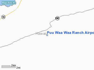
Puu Waa Waa Ranch Airport |
Location
& QuickFacts
|
FAA Information Effective: |
2007-07-05 |
|
Airport
Identifier: |
HI13 |
|
Airport
Status: |
Operational |
|
Longitude/Latitude: |
155-50-59.9900W/19-47-19.0500N
-155.849997/19.788625 (Estimated) |
|
Elevation: |
2250 ft / 685.80 m (Estimated) |
|
Land: |
0
acres |
|
From
nearest city: |
10 nautical miles NE of Kailua/kona, HI |
|
Location: |
Hawaii County, HI |
|
Magnetic Variation: |
11E (1985) |
Owner
& Manager
|
Ownership: |
Privately owned |
|
Owner: |
F. Newell Bohnett |
|
Address: |
Po Box 1536
Kailua-kona, HI 96740 |
|
Phone
number: |
808-325-7433 |
|
Manager: |
F. Newell Bohnett |
|
Address: |
Po Box 1536
Kailua-kona, HI 96740 |
|
Phone number: |
808-325-7433 |
Airport
Operations and Facilities
|
Airport Use: |
Private |
|
Wind
indicator: |
Yes |
|
Segmented
Circle: |
No |
|
Control
Tower: |
No |
|
Landing
fee charge: |
No |
|
Sectional
chart: |
Hawaiian Islands |
|
Region: |
AWP - Western-Pacific |
|
Boundary
ARTCC: |
ZHN - Honolulu Control Facility |
|
Tie-in
FSS: |
HNL - Honolulu |
|
FSS
on Airport: |
No |
|
FSS
Phone: |
808-836-8049 |
|
FSS
Toll Free: |
1-800-WX-BRIEF |
|
Runway Information
Runway 02/20
|
Dimension: |
2950 x 40 ft / 899.2 x 12.2 m |
|
Surface: |
ASPH, |
|
|
Runway 02 |
Runway 20 |
|
Traffic
Pattern: |
Left |
Right |
|
Radio Navigation
Aids
|
ID |
Type |
Name |
Ch |
Freq |
Var |
Dist |
|
BSF |
NDB |
Bradshaw |
|
339.00 |
10E |
14.5 nm |
|
MUE |
VOR/DME |
Kamuela |
080X |
113.30 |
11E |
16.2 nm |
|
IAI |
VORTAC |
Kona |
104X |
115.70 |
11E |
12.8 nm |
|
UPP |
VORTAC |
Upolu Point |
070X |
112.30 |
11E |
24.8 nm |
|
ITO |
VORTAC |
Hilo |
116X |
116.90 |
11E |
47.6 nm |
Based
Aircraft
|
Aircraft
based on field: |
2 |
|
Single
Engine Airplanes: |
1 |
|
Multi
Engine Airplanes: |
1 |
Puu Waa Waa Ranch Airport
Address:
Hawaii County, HI
Tel:
808-325-7433
Images
and information placed above are from
http://www.airport-data.com/airport/HI13/
We
thank them for the data!
| General
Info |
| Country |
United
States |
| State |
HAWAII
|
| FAA ID |
HI13
|
| Latitude |
19-47-19.050N
|
| Longitude |
155-50-59.990W
|
| Elevation |
2250 feet
|
| Near City |
KAILUA/KONA
|
We don't guarantee the information is fresh and accurate. The data may
be wrong or outdated.
For more up-to-date information please refer to other sources.
|
|


