 |
|
| Port Allen Airport |
| IATA: PAK – ICAO: PHPA – FAA LID: PAK
Location of airport in Hawaii
|
| Summary |
| Airport type |
Public |
| Operator |
Hawaii Department of Transportation |
| Serves |
Hanapepe, Hawaii |
| Elevation AMSL |
24 ft / 7 m |
| Coordinates |
21°53′49″N 159°36′11″W / 21.89694°N 159.60306°W / 21.89694; -159.60306 (Port Allen Airport)Coordinates: 21°53′49″N 159°36′11″W / 21.89694°N 159.60306°W / 21.89694; -159.60306 (Port Allen Airport) |
| Website |
hawaii.gov/pak |
| Runways |
| Direction |
Length |
Surface |
| ft |
m |
| 9/27 |
2,450 |
747 |
Asphalt |
| Statistics (2008) |
| Aircraft operations |
5,535 |
| Based aircraft |
10 |
| Source: Federal Aviation Administration |
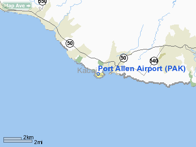
Port Allen Airport (IATA: PAK, ICAO: PHPA, FAA LID: PAK) is a regional airport of the State of Hawai'i. It is located 1 nautical mile (1.9 km; 1.2 mi) southwest of the unincorporated town of Hanapepe on the south shore of the island of Kaua'i. Most flights to Port Allen Airport originate from commuter airports on the other Hawaiian islands by unscheduled air taxis and general aviation. Facilities and aircraft
Port Allen Airport covers an area of 179 acres (72 ha) at an elevation of 24 feet (7 m) above mean sea level. It has one runway designated 9/27 with an asphalt surface measuring 2,450 by 60 feet (747 x 18 m).
The airport has separate parking areas for fixed wing aircraft and helicopters and a public parking area. There are no other public facilities at the airport. Access to the airport is provided by Kaalani Road, which connects the airport with Lolokai Road and Highway 50. The principal planned improvements are the development of helicopter lease lots to the eastern end of the airport, construction of public comfort stations and minor roadway improvements.
For the 12-month period ending December 31, 2008, the airport had 5,535 aircraft operations, an average of 15 per day: 59% air taxi, 40% general aviation, and 1% military. At that time there were 10 aircraft based at this airport: 40% helicopter, 10% glider and 50% ultralight.
Authority
Port Allen Airport is part of a centralized state structure governing all of the airports and seaports of Hawai'i. The official authority of Port Allen Airport is the Governor of Hawai'i. He or she appoints the Director of the Hawai'i State Department of Transportation who has jurisdiction over the Hawai'i Airports Administrator.
The Hawai'i Airports Administrator oversees six governing bodies: Airports Operations Office, Airports Planning Office, Engineering Branch, Information Technology Office, Staff Services Office, Visitor Information Program Office. Collectively, the six bodies have authority over the four airport districts in Hawai'i: Hawai'i District, Kaua'i District, Mau'i District and the principal O'ahu District. Port Allen Airport is a subordinate of the Kaua'i District officials.
The above content comes from Wikipedia and is published under free licenses – click here to read more.
Location
& QuickFacts
|
FAA Information Effective: |
2007-07-05 |
|
Airport
Identifier: |
PAK |
|
Airport
Status: |
Operational |
|
Longitude/Latitude: |
159-36-11.9580W/21-53-48.7260N
-159.603322/21.896868 (Estimated) |
|
Elevation: |
24
ft / 7.32 m (Surveyed) |
|
Land: |
179 acres |
|
From
nearest city: |
1 nautical miles SW of Hanapepe, HI |
|
Location: |
Kauai County, HI |
|
Magnetic Variation: |
11E (1985) |
Owner
& Manager
|
Ownership: |
Publicly owned |
|
Owner: |
Hawaii St Arpts Div |
|
Address: |
400 Rodgers Blvd, Suite 700
Honolulu, HI 96819 |
|
Phone
number: |
808-838-8701 |
|
Manager: |
Roy Sakata
ACTING KAUAI AIRPORT DISTRICT MANAGER |
|
Address: |
Lihue Arpt
Lihue, HI 96766 |
|
Phone number: |
808-246-1400 |
Airport
Operations and Facilities
|
Airport Use: |
Open to public |
|
Wind
indicator: |
Yes |
|
Segmented
Circle: |
Yes |
|
Control
Tower: |
No |
|
Landing
fee charge: |
No |
|
Sectional
chart: |
Hawaiian Islands |
|
Region: |
AWP - Western-Pacific |
|
Traffic
Pattern Alt: |
800 ft |
|
Boundary
ARTCC: |
ZHN - Honolulu Control Facility |
|
Tie-in
FSS: |
HNL - Honolulu
FOR AVN INFO 2200-0600 CTC HONOLULU FSS ON 122.6. |
|
FSS
on Airport: |
No |
|
FSS
Phone: |
808-836-8049 |
|
FSS
Toll Free: |
1-800-WX-BRIEF |
|
NOTAMs
Facility: |
LIH (NOTAM-d service avaliable) |
|
Federal Agreements: |
NGY |
Airport
Communications
|
Runway Information
Runway 09/27
|
Dimension: |
2450 x 60 ft / 746.8 x 18.3 m |
|
Surface: |
ASPH, Good Condition |
|
Weight
Limit: |
Single wheel: 18000 lbs.
ARPT RSTRD BY OWNER TO ACFT WEIGHING LESS THAN 12500 LBS. |
|
|
Runway 09 |
Runway 27 |
|
Traffic
Pattern: |
Right |
Left |
|
Markings: |
Basic, Fair Condition |
Basic, Fair Condition |
|
Displaced
threshold: |
189.00
ft |
0.00 ft |
|
Runway
End Identifier: |
No |
No |
|
Centerline
Lights: |
No |
No |
|
Touchdown
Lights: |
No |
No |
|
Radio Navigation
Aids
|
ID |
Type |
Name |
Ch |
Freq |
Var |
Dist |
|
NBS |
TACAN |
Barking Sands Pmrf |
073X |
|
12E |
13.2 nm |
|
SOK |
VORTAC |
South Kauai |
101X |
115.40 |
11E |
4.2 nm |
|
LIH |
VORTAC |
Lihue |
082X |
113.50 |
11E |
15.3 nm |
Remarks
- VEHICLES
PARKED ALONG SHORELINE FRONTING APCH END RY 09.
- NOISE
ABATEMENT: AVOID OVERFLIGHT OF THE SALT POND, STATE RECREATIONAL BEACH
PARK. RESIDENTIAL
AND COMMERCIAL AREAS NORTH OF AIRFIELD.
- ULTRALIGHTS
ON AND INVOF ARPT.
- SKYDIVING
ON AND INVOF ARPT.
- DAILY
HELICOPTER ACTIVITY ON AND INVOF ARPT.
Based
Aircraft
|
Aircraft
based on field: |
9 |
|
Helicopters: |
5 |
|
Gliders: |
1 |
|
Ultralights: |
3 |
Operational Statistics
Time Period: 2004-01-02
- 2004-12-31
|
Aircraft
Operations: |
121/Week |
|
Air Taxi: |
58.2% |
|
General
Aviation Local: |
29.1% |
|
General
Aviation Itinerant: |
12.7% |
Port Allen Airport
Address:
Kauai County, HI
Tel:
808-838-8701,
808-246-1400
Images
and information placed above are from
http://www.airport-data.com/airport/PAK/
We
thank them for the data!
| General
Info |
| Country |
United
States |
| State |
HAWAII
|
| FAA ID |
PAK
|
| Latitude |
21-53-48.726N
|
| Longitude |
159-36-11.958W
|
| Elevation |
24 feet
|
| Near City |
HANAPEPE
|
We don't guarantee the information is fresh and accurate. The data may
be wrong or outdated.
For more up-to-date information please refer to other sources.
|
|


