 |
|
|
|
|
|
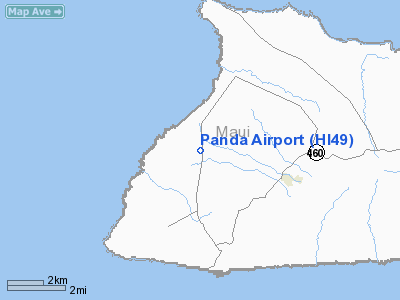
Location
& QuickFacts
|
FAA Information Effective: |
2007-07-05 |
|
Airport
Identifier: |
HI49 |
|
Airport
Status: |
Operational |
|
Longitude/Latitude: |
157-15-30.8610W/21-08-52.5540N
-157.258573/21.147932 (Estimated) |
|
Elevation: |
250 ft / 76.20 m (Estimated) |
|
Land: |
21
acres |
|
From
nearest city: |
17 nautical miles W of Kaunakakai, HI |
|
Location: |
Maui County, HI |
|
Magnetic Variation: |
10E (2000) |
Owner
& Manager
|
Ownership: |
Privately owned |
|
Owner: |
John Hutton Corp |
|
Address: |
2005 Kalia Rd.
Honolulu, HI 96815 |
|
Phone number: |
808-941-1566 |
|
Manager: |
John Weiser Jr |
|
Address: |
2005 Kalia Rd.
Honolulu, HI 96815 |
|
Phone number: |
808-552-2867 |
Airport
Operations and Facilities
|
Airport Use: |
Private |
|
Wind
indicator: |
Yes |
|
Segmented
Circle: |
No |
|
Control
Tower: |
No |
|
Lighting
Schedule: |
RDO-CTL
ACTVT LIRL RY 07/25 - 122.8. |
|
Landing fee charge: |
No |
|
Sectional chart: |
Hawaiian Islands |
|
Region: |
AWP - Western-Pacific |
|
Boundary ARTCC: |
ZHN - Honolulu Control Facility |
|
Tie-in FSS: |
HNL - Honolulu |
|
FSS on Airport: |
No |
|
FSS Phone: |
808-836-8049 |
|
FSS Toll Free: |
1-800-WX-BRIEF |
Airport
Communications
|
Runway Information
Runway 07/25
|
Dimension: |
1920 x 55 ft / 585.2 x 16.8 m |
|
Surface: |
TURF, |
|
Edge
Lights: |
Low |
|
|
Runway 07 |
Runway 25 |
|
Traffic
Pattern: |
Left |
Left |
|
Radio Navigation
Aids
|
ID |
Type |
Name |
Ch |
Freq |
Var |
Dist |
|
LLD |
NDB |
Lanai |
|
353.00 |
11E |
27.7 nm |
|
HN |
NDB |
Ewabe |
|
242.00 |
11E |
45.5 nm |
|
HHI |
NDB |
Wheeler |
|
373.00 |
11E |
47.7 nm |
|
VYI |
NDB |
Valley Island |
|
327.00 |
11E |
48.5 nm |
|
NGF |
TACAN |
Kaneohe Bay |
093X |
|
11E |
33.6 nm |
|
MKK |
VORTAC |
Molokai |
108X |
116.10 |
11E |
5.1 nm |
|
CKH |
VORTAC |
Koko Head |
086X |
113.90 |
11E |
25.9 nm |
|
LNY |
VORTAC |
Lanai |
124X |
117.70 |
11E |
28.2 nm |
|
HNL |
VORTAC |
Honolulu |
095X |
114.80 |
11E |
38.9 nm |
|
OGG |
VORTAC |
Maui |
098X |
115.10 |
11E |
49.2 nm |
|
HNL |
VOT |
Honolulu |
|
111.00 |
|
39.2 nm |
Remarks
- RY
07 TRI-COLOR VASI.
- CONDL-VFR;
PVT USE.
Based
Aircraft
|
Aircraft
based on field: |
1 |
|
Multi
Engine Airplanes: |
1 |
Panda Airport
Address:
Maui County, HI
Tel:
808-941-1566, 808-552-2867
Images
and information placed above are from
http://www.airport-data.com/airport/HI49/
We
thank them for the data!
| General
Info |
| Country |
United
States |
| State |
HAWAII
|
| FAA ID |
HI49
|
| Latitude |
21-08-52.554N
|
| Longitude |
157-15-30.861W
|
| Elevation |
250 feet
|
| Near City |
KAUNAKAKAI
|
We don't guarantee the information is fresh and accurate. The data may
be wrong or outdated.
For more up-to-date information please refer to other sources.
|
|


