 |
|
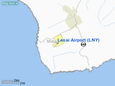
| LÄnaÊ»i Airport |
| IATA: LNY â ICAO: PHNY â FAA LID: LNY
Location of airport in Hawaii
|
| Summary |
| Airport type |
Public |
| Operator |
Hawaiʻi Department of Transportation |
| Serves |
LÄnaÊ»i City, HawaiÊ»i |
| Elevation AMSL |
1,308 ft / 399 m |
| Coordinates |
20°47â²08â³N 156°57â²05â³W / 20.78556°N 156.95139°W / 20.78556; -156.95139 |
| Website |
hawaii.gov/lny |
| Runways |
| Direction |
Length |
Surface |
| ft |
m |
| 3/21 |
5,001 |
1,524 |
Asphalt |
| Statistics (2007) |
| Aircraft operations |
6,760 |
| Source: Federal Aviation Administration |
LÄnaÊ»i Airport (IATA: LNY, ICAO: PHNY, FAA LID: LNY) is a public airport located three nautical miles (6 km) southwest of LÄnaÊ»i City, serving as the only airport of the island of LÄnaÊ»i, HawaiÊ»i in the United States. Facilities and aircraft
Lanai Airport covers an area of 505 acres (204 ha) at an elevation of 1,308 feet (399 m) above mean sea level. It has one runway designated 3/21 with an asphalt surface measuring 5,001 by 150 feet (1,524 x 46 m).
For the 12-month period ending March 16, 2007, the airport had 6,760 aircraft operations, an average of 18 per day: 65% scheduled commercial, 22% air taxi, 12% general aviation, and 2% military.
Airlines and destinations
| Airlines |
Destinations |
| Island Air |
Honolulu |
| Mokulele Express operated by Mokulele Airlines |
Honolulu |
The above content comes from Wikipedia and is published under free licenses – click here to read more.
|
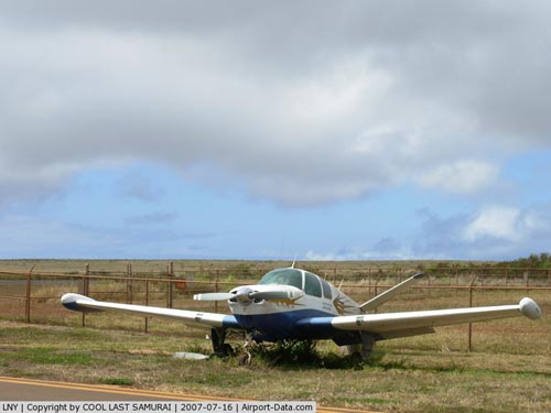 |
(Click on the photo to enlarge) |
|
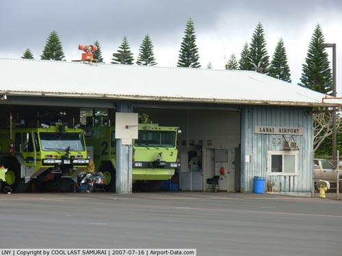 |
(Click on the photo to enlarge) |
Location
& QuickFacts
|
FAA Information Effective: |
2007-07-05 |
|
Airport
Identifier: |
LNY |
|
Airport
Status: |
Operational |
|
Longitude/Latitude: |
156-57-05.1050W/20-47-08.2000N
-156.951418/20.785611 (Estimated) |
|
Elevation: |
1308 ft / 398.68 m (Surveyed) |
|
Land: |
505 acres |
|
From
nearest city: |
3 nautical miles SW of Lanai City, HI |
|
Location: |
Maui County, HI |
|
Magnetic Variation: |
11E (1990) |
Owner
& Manager
|
Ownership: |
Publicly owned |
|
Owner: |
Hawaii St Arpts Div |
|
Address: |
Honolulu Intl Arpt
Honolulu, HI 96819 |
|
Phone
number: |
808-836-6432 |
|
Manager: |
James Davis
ARPT OPNS/MAINT MAN/AOM/MR. G. ALBORO PHONE 565-6757, CELL
PHONE 281-9899. |
|
Address: |
Kahului Arpt
Kahului, HI 96732 |
|
Phone number: |
808-872-3830 |
Airport
Operations and Facilities
|
Airport Use: |
Open to public |
|
Wind
indicator: |
Yes |
|
Segmented
Circle: |
No |
|
Control
Tower: |
No |
|
Lighting
Schedule: |
DUSK-DAWN
ACTVT MIRL RY 03/21 - CTAF. |
|
Beacon
Color: |
Clear-Green (lighted land airport) |
|
Landing
fee charge: |
No |
|
Sectional
chart: |
Hawaiian Islands |
|
Region: |
AWP - Western-Pacific |
|
Boundary
ARTCC: |
ZHN - Honolulu Control Facility |
|
Tie-in
FSS: |
HNL - Honolulu |
|
FSS
on Airport: |
No |
|
FSS
Phone: |
808-836-8049 |
|
FSS
Toll Free: |
1-800-WX-BRIEF |
|
NOTAMs
Facility: |
LNY (NOTAM-d service avaliable) |
|
Certification
type/date: |
I A S 05/1973
ARPT CLSD TO ACR OPNS WITH MORE THAN 10 PSGR SEATS 1930-0600
EXCP PPR; CALL 808-565-7333/6757. |
|
Federal Agreements: |
NGY |
Airport
Communications
Airport
Services
|
Airframe Repair: |
NONE |
|
Power Plant Repair: |
NONE |
|
Bottled
Oxygen: |
NONE |
|
Bulk
Oxygen: |
NONE |
|
Runway Information
Runway 03/21
|
Dimension: |
5001 x 150 ft / 1524.3 x 45.7 m |
|
Surface: |
ASPH, Good Condition |
|
Weight
Limit: |
Single wheel: 75000 lbs.
Dual wheel: 110000 lbs.
Dual
tandem wheel: 170000 lbs. |
|
Edge
Lights: |
Medium |
|
|
Runway 03 |
Runway 21 |
|
Longitude: |
156-57-23.4210W |
156-56-46.7870W |
|
Latitude: |
20-46-50.3880N |
20-47-26.0110N |
|
Elevation: |
1305.00
ft |
1309.00
ft |
|
Alignment: |
44 |
127 |
|
ILS
Type: |
ILS/DME |
|
|
Traffic
Pattern: |
Left |
Left |
|
Markings: |
Precision instrument, Good Condition |
Non-precision instrument, Good Condition |
|
Crossing
Height: |
50.00
ft |
43.00
ft |
|
VASI: |
4-box on left side |
4-light PAPI on left side
PAPI RY 21 OTS INDEFLY. |
|
Visual
Glide Angle: |
3.00° |
3.00° |
|
Runway
End Identifier: |
|
No |
|
Centerline
Lights: |
No |
No |
|
Touchdown
Lights: |
No |
No |
|
Obstruction: |
, 50:1 slope to clear
LGTD WINDSOCK 0 FT FM RY END 200 FT LEFT. |
20 ft ant, 1000.0 ft from runway, 250 ft right
of centerline, 40:1 slope to clear |
|
Radio Navigation
Aids
|
ID |
Type |
Name |
Ch |
Freq |
Var |
Dist |
|
LLD |
NDB |
Lanai |
|
353.00 |
11E |
1.5 nm |
|
VYI |
NDB |
Valley Island |
|
327.00 |
11E |
29.1 nm |
|
LNY |
VORTAC |
Lanai |
124X |
117.70 |
11E |
1.6 nm |
|
MKK |
VORTAC |
Molokai |
108X |
116.10 |
11E |
24.4 nm |
|
OGG |
VORTAC |
Maui |
098X |
115.10 |
11E |
30.7 nm |
Remarks
- SEE
AREA NOTICES, TFC ADVYS AT NON-TWR ARPTS.
- PHEASANTS
ON & IN VCNTY OF ARPT.
- 24
HRS PPR FOR CLASS A AND B EXPLOSIVES AND 4 HRS PPR FOR HAZARDOUS MATERIAL
IN/OUT OF ARPT CTC 808-565-7333/6757.
- DUE
TO RAMP LIMITATIONS ALL ACFT PARKING LIMITED TO ONE HR EXCP VIA PPR
CALL 808-565-6757/6611.
- (A58-21A)
LGTD WINDSOCK 0 FT FM RY END 200 FT LEFT.
- FIXED
WING TRANSIENT PARKING SW SIDE OF RAMP.
- POSSIBLE
SEVERE UPDRAFTS/DOWNDRAFTS FROM 2 MILE FINAL APPROACH TO RUNWAY 3 THRESHHOLD.
Operational
Statistics
Time Period: 2006-03-16
- 2007-03-16
|
Aircraft
Operations: |
130/Week |
|
Commerical: |
64.8% |
|
Air Taxi: |
21.6% |
|
General
Aviation Local: |
10.7% |
|
General
Aviation Itinerant: |
1.5% |
|
Military: |
1.5% |
Lanai Airport
Address:
Maui County, HI
Tel:
808-836-6432,
808-872-3830
Images
and information placed above are from
http://www.airport-data.com/airport/LNY/
We
thank them for the data!
| General
Info |
| Country |
United
States |
| State |
HAWAII
|
| FAA ID |
LNY
|
| Latitude |
20-47-08.200N
|
| Longitude |
156-57-05.105W
|
| Elevation |
1308 feet
|
| Near City |
LANAI
CITY |
We don't guarantee the information is fresh and accurate. The data may
be wrong or outdated.
For more up-to-date information please refer to other sources.
|
|


