|
|
Kona International At Keahole Airport |
| Kona International Airport at KeÄhole |
 |
| IATA: KOA â ICAO: PHKO â FAA LID: KOA
Location of the Kona International Airport
|
| Summary |
| Airport type |
Public |
| Operator |
Hawaii Department of Transportation |
| Serves |
Kailua-Kona, Hawaii |
| Location |
Kalaoa, Hawaii |
| Elevation AMSL |
47 ft / 14 m |
| Coordinates |
19°44â²20â³N 156°02â²44â³W / 19.73889°N 156.04556°W / 19.73889; -156.04556 (Kona International Airport)Coordinates: 19°44â²20â³N 156°02â²44â³W / 19.73889°N 156.04556°W / 19.73889; -156.04556 (Kona International Airport) |
| Website |
hawaii.gov/koa |
| Runways |
| Direction |
Length |
Surface |
| ft |
m |
| 17/35 |
11,000 |
3,353 |
Asphalt |
| Statistics (2007) |
| Aircraft operations |
150,624 |
| Based aircraft |
59 |
| Source: Federal Aviation Administration |
Kona International Airport at KeÄhole (IATA: KOA, ICAO: PHKO, FAA LID: KOA) is an airport on the Island of HawaiÊ»i, in Kalaoa CDP, HawaiÊ»i County, HawaiÊ»i, United States. The airport serves leeward, or Western HawaiÊ»i island, including the town of Kailua-Kona and the major resorts of the North Kona and South Kohala districts. History
Much of the airport runway is built on a relatively recent lava flow: the 1801 HuÊ»ehuÊ»e flow from HualÄlai. This flow extended the shoreline out an estimated 1 mi (1.6 km), adding some 4 km (1.5 sq mi) of land to the island and creating KeÄhole Point. The airport was moved to this location and dedicated on July 1, 1970, when the previous smaller airstrip was converted into the Old Kona Airport State Recreation Area.
Construction crews from Bechtel Corporation had used three million pounds of dynamite to flatten the lava flow (which was riddled with Lava tubes) within 13-months.
In its first full year, 515,378 passengers passed through the new open-air tropical-style terminals. The aquaculture ponds and solar energy experiments at the nearby Natural Energy Laboratory of Hawaii Authority (NELHA) can be seen during landing and take-off.
It was originally known as Ke-Ähole Airport, since the Ê»Ähole fish (Kuhlia sandvicensis) was found nearby.
The main runway was extended in 1993 to make it the largest in the Hawaiian Islands outside of Honolulu, when it was renamed KeÄhole-Kona International Airport.
In 1997 it officially became known as the Kona International Airport at KeÄhole.
Facilities and aircraft
 | |
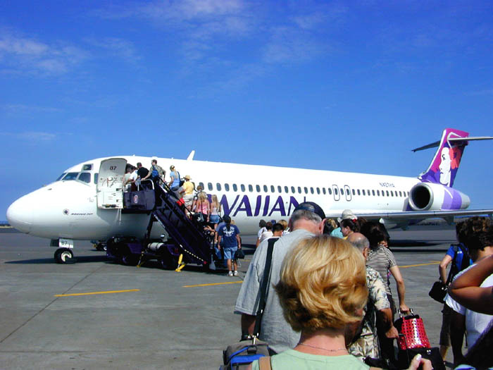
Passengers boarding a Hawaiian Airlines Boeing 717 at Kona International |
Kona International at Keahole Airport covers an area of 2,700 acres (1,093 ha) at an elevation of 47 feet (14 m) above mean sea level. It has one runway designated 17/35 with an asphalt surface measuring 11,000 by 150 feet (3,353 x 46 m).
The state government of Hawaiʻi facility operates a runway and a terminal complex of single story buildings along the eastern edge of the airfield for arriving and departing passengers, air cargo and mail, airport support, and general aviation operations.
Kona International is the only remaining major airport in the Hawaiian Islands where a mobile ramp is used to plane and deplane passengers. Kona International sees daily 717, 737, 757, 767, and 777 aircraft, as well as smaller inter-island aircraft, and general private aviation. The airport terminal is a rambling, open-air set of structures. Long after other airports in Hawaiʻi converted their terminals to multi-story buildings with automated jetway systems, Hawaiian Airlines could still utilize their DC-9 fleet's tailcone exits at Kailua-Kona.
An environmental impact statement was prepared in 2005 to add a second runway. The United States Air Force investigated building a second 3,950 ft (1,200 m) runway in 2009. This would be used for practicing landing C-17 military cargo planes on a short runway. Although the 11,000 ft (3,353 m) runway allows flights to Japan and Chicago, it is the only major airport in Hawaii with a single runway.
For the 12-month period ending May 31, 2007, the airport had 150,624 aircraft operations, an average of 412 per day: 50% general aviation, 22% scheduled commercial, 15% air taxi, and 13% military. At that time there were 59 aircraft based at this airport: 68% single-engine, 14% multi-engine, 14% helicopter, 2% glider and 3% ultralight.
Airlines and destinations
| Airlines |
Destinations |
| Air Canada |
Vancouver [seasonal] |
| Alaska Airlines |
Oakland, Portland (OR) [seasonal; begins November 12], San Jose (CA), Seattle/Tacoma |
| American Airlines |
Los Angeles |
| Delta Air Lines |
Los Angeles |
| Hawaiian Airlines |
Honolulu, Kahului |
| Island Air |
Kahului |
| Japan Airlines operated by JALways |
Tokyo-Narita [ends October 30] |
| Kona Shuttle operated by Miami Air International |
Oakland |
| go! Mokulele operated by Mesa Airlines |
Honolulu |
| Mokulele Airlines |
Kahului |
| United Airlines |
Denver, Kahului (Begins October 2), Los Angeles, San Francisco |
| US Airways |
Phoenix |
| WestJet |
Vancouver [seasonal] |
Accidents and incidents
- On August 25, 1977, an Air Cargo Hawaii twin-engine turbo-prop Short SC.7 Skyvan crashed and burned while attempting to land at Keahole Airport. The pilot and passenger were killed. The crash occurred about 1
+â2 mi (2.4 km) short of the runway.
- On September 10, 1989, the pilot of an Aero Commander 680 was making an emergency landing on runway 17 due to loss of power in the right engine. He crashed about â4 mi (0.4 km) southwest of the runway. One fatality and one serious injury.
Astronaut Ellison S. Onizuka Space Center
A small museum, the Astronaut Ellison S. Onizuka Space Center, is located between the passenger terminals at the airport. It is named in honor of Kona-born Ellison Onizuka who died in 1986 on the Space Shuttle Challenger. The displays include a sample of lunar soil, a space suit from Apollo 13, and personal items from Ellison Onizuka. An admission fee is charged.
The above content comes from Wikipedia and is published under free licenses – click here to read more.
|
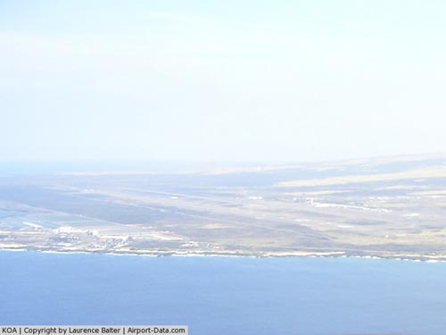
 |
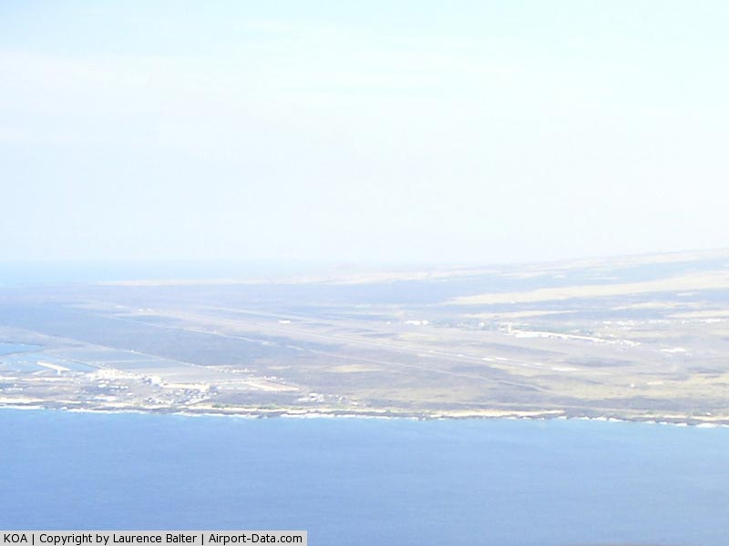
(Click on the photo to enlarge) |
|
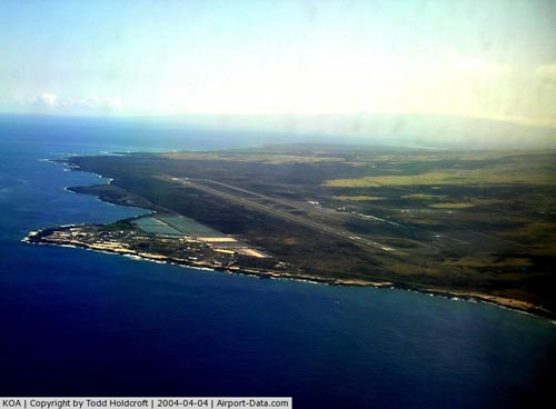
 |
(Click on the photo to enlarge) |
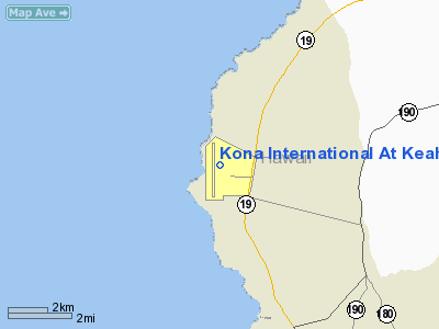
Location
& QuickFacts
|
FAA
Information Effective: |
2007-07-05 |
|
Airport
Identifier: |
KOA |
|
Airport
Status: |
Operational |
|
Longitude/Latitude: |
156-02-44.2730W/19-44-19.5570N
-156.045631/19.738766 (Estimated) |
|
Elevation: |
47 ft / 14.33 m (Surveyed) |
|
Land: |
2700 acres |
|
From
nearest city: |
6 nautical miles NW of Kailua/kona, HI |
|
Location: |
Hawaii County, HI |
|
Magnetic Variation: |
11E (1985) |
Owner
& Manager
|
Ownership: |
Publicly
owned |
|
Owner: |
Hawaii St Arpts Div |
|
Address: |
Honolulu Intl Arpt
Honolulu, HI 96819 |
|
Phone
number: |
808-838-8600 |
|
Manager: |
Chauncey Wong Yuen |
|
Address: |
73-200 Kupipi St, Kona Intl Airport At Keahole
Kailua-kona, HI 96740-2645 |
|
Phone number: |
808-327-9520 |
Airport Operations and Facilities
|
Airport
Use: |
Open
to public |
|
Wind
indicator: |
Yes |
|
Segmented Circle: |
Yes |
|
Control
Tower: |
Yes |
|
Lighting
Schedule: |
DUSK-DAWN
ACTVT HIRL RY 17/35 & TWY LGTS - CTAF. |
|
Beacon
Color: |
Clear-Green (lighted land airport) |
|
Landing
fee charge: |
No |
|
Sectional chart: |
Hawaiian Islands |
|
Region: |
AWP - Western-Pacific |
|
Boundary
ARTCC: |
ZHN - Honolulu Control Facility |
|
Tie-in
FSS: |
HNL - Honolulu |
|
FSS
on Airport: |
No |
|
FSS
Phone: |
808-836-8049 |
|
FSS
Toll Free: |
1-800-WX-BRIEF |
|
NOTAMs
Facility: |
KOA (NOTAM-d service avaliable) |
|
Certification type/date: |
I D S 04/1973 |
|
Federal Agreements: |
NGY |
Airport
Communications
Airport
Services
|
Fuel
available: |
100 A
JET-A & 100 OCTANE FUEL AVBL DAILY 0800-1700,
OTHER TIMES WITH PRIOR ARRANGMENTS, CALL 808-329-4682. |
|
Airframe
Repair: |
NONE |
|
Power
Plant Repair: |
MINOR |
|
Bottled
Oxygen: |
NONE |
|
Bulk
Oxygen: |
NONE |
|
Runway Information
Runway 17/35
|
Dimension: |
11000
x 150 ft / 3352.8 x 45.7 m |
|
Surface: |
ASPH, Good Condition |
|
Surface
Treatment: |
Saw-cut or plastic Grooved |
|
Weight
Limit: |
Single wheel: 75000 lbs.
Dual wheel: 200000 lbs.
Dual tandem wheel: 400000 lbs.
Dual dual tandem wheel: 850000 lbs.
DOUBLE DUAL TANDEM WHEEL FOR DC10-10 450000 LBS GWT; B747-SP 700000
LBS GWT; B747-100 850000 LBS GWT. |
|
Edge
Lights: |
High |
|
|
Runway 17 |
Runway 35 |
|
Longitude: |
156-02-39.4400W |
156-02-49.1050W |
|
Latitude: |
19-45-13.8790N |
19-43-25.2350N |
|
Elevation: |
47.00 ft |
37.00 ft |
|
Alignment: |
127 |
5 |
|
ILS
Type: |
ILS/DME |
|
|
Traffic
Pattern: |
Right |
Left |
|
Markings: |
Precision instrument, Good Condition |
Precision instrument, Good Condition |
|
Crossing
Height: |
60.00 ft |
60.00 ft |
|
VASI: |
4-light PAPI on left side |
4-light PAPI on left side |
|
Visual
Glide Angle: |
3.00° |
3.00° |
|
Approach
lights: |
MALSR |
|
|
Runway
End Identifier: |
No |
No |
|
Centerline
Lights: |
No |
No |
|
Touchdown
Lights: |
No |
No |
|
Obstruction: |
6 ft terrain, 400.0 ft from runway, 400 ft
left of centerline, 25:1 slope to clear |
, 50:1 slope to clear |
|
Radio Navigation
Aids
|
ID |
Type |
Name |
Ch |
Freq |
Var |
Dist |
|
BSF |
NDB |
Bradshaw |
|
339.00 |
10E |
25.6 nm |
|
MUE |
VOR/DME |
Kamuela |
080X |
113.30 |
11E |
26.3 nm |
|
IAI |
VORTAC |
Kona |
104X |
115.70 |
11E |
5.2 nm |
|
UPP |
VORTAC |
Upolu Point |
070X |
112.30 |
11E |
30.0 nm |
Remarks
- USE
MINIMUM POWER TO TAXI LANE & OUT OF PARKING SPOTS.
- MIGRATORY
BIRD ACTIVITY WITHIN A 5 NM RADIUS OF ARPT.
- ALL
WIDE-BODY AIRCRAFT CONTACT ATCT PRIOR TO ENGINE START.
- CLASS
A AND B EXPLOSIVES PROHIBITED. PPR FM ARPT MGR FOR TRANSPORTATION OF
CLASS C EXPLOSIVES AND HAZARDOUS MATERIAL IN AND OUT OF AIRPORT.
- RAMP
IMMEDIATELY IN FRONT ATCT LIMITED TO ACFT WEIGHING 30000 LBS OR LESS.
- JET
ACFT ON CARGO AND SOUTH RAMP CTC ATCT PRIOR TO ENGINE START.
- U.S.
CUSTOMS LOCATED ON NORTH RAMP.
- PUSH
BACK/PULL OUT REQUIRED FROM TERMINAL PARKING POSITIONS FOR ALL ACFT,
NO POWER OUT.
- TPA
SMALL ACFT 800' MSL; LARGE ACFT 1500' MSL.
- REQ
FOUR ENG ACFT TAXI WITH OUTBOARD ENGS AT IDLE DUE NARROW TWYS.
- ALL
HELICOPTERS CONFINE OPNS TO PAVED AREAS.
- PPR
FM AMGR FOR TRANSIENT PARKING CALL 808-327-9520.
Based
Aircraft
|
Aircraft
based on field: |
57 |
|
Single
Engine Airplanes: |
38 |
|
Multi
Engine Airplanes: |
8 |
|
Helicopters: |
8 |
|
Gliders: |
1 |
|
Ultralights: |
2 |
Major Carriers
Serving This Airport
|
Hawaiian Airlines Inc. |
32.2% |
|
Aloha Airlines Inc. |
32.2% |
|
Mesa Airlines Inc. |
19.3% |
|
United Air Lines Inc. |
9.5% |
|
American Airlines Inc. |
2.5% |
|
Northwest Airlines Inc. |
2.4% |
|
US Airways Inc. |
1.7% |
|
Delta Air Lines Inc. |
0.2% |
Most Popular Destinations
|
Honolulu
Intl (HNL) |
72.5% |
|
Kahului
(OGG) |
8.0% |
|
Los
Angeles Intl (LAX) |
6.6% |
|
San
Francisco Intl (SFO) |
3.3% |
|
Seattle-tacoma
Intl (SEA) |
2.4% |
|
John Wayne Airport-orange County (SNA) |
2.3% |
|
Chicago
O'hare Intl (ORD) |
1.8% |
|
Phoenix Sky Harbor Intl (PHX) |
1.7% |
|
Metropolitan
Oakland Intl (OAK) |
0.9% |
|
Denver
Intl (DEN) |
0.3% |
Most Popular Aircraft
|
N655BR |
4.7% |
|
N654BR |
3.9% |
|
N828AL |
3.9% |
|
N693BR |
3.8% |
|
N835AL |
3.7% |
|
N646BR |
3.5% |
|
N477HA |
3.4% |
|
N837AL |
3.4% |
|
N651BR |
3.4% |
|
N821AL |
3.3% |
Operational Statistics
Time Period: 2005-04-01 - 2006-03-31
|
Aircraft
Operations: |
410/Day |
|
Commerical: |
15.0% |
|
Air
Taxi: |
14.4% |
|
General
Aviation Local: |
45.3% |
|
General
Aviation Itinerant: |
12.5% |
|
Military: |
12.8% |
Kona International At Keahole Airport
Address:
Hawaii County, HI
Tel:
808-838-8600,
808-327-9520
Images
and information placed above are from
http://www.airport-data.com/airport/KOA/
We
thank them for the data!
| General
Info |
| Country |
United
States |
| State |
HAWAII
|
| FAA ID |
KOA |
| Latitude |
19-44-19.557N
|
| Longitude |
156-02-44.273W
|
| Elevation |
47 feet
|
| Near City |
KAILUA/KONA
|
We don't guarantee the information is fresh and accurate. The data may
be wrong or outdated.
For more up-to-date information please refer to other sources.
|
|