 |
|
|
|
|
|
Location
& QuickFacts
|
FAA
Information Effective: |
2007-07-05 |
|
Airport
Identifier: |
00HI |
|
Airport
Status: |
Operational |
|
Longitude/Latitude: |
155-58-53.9710W/19-49-57.0440N
-155.981659/19.832512 (Estimated) |
|
Elevation: |
43 ft / 13.11 m (Estimated) |
|
Land: |
7 acres |
|
From
nearest city: |
16 nautical miles N of Kailua/kona, HI |
|
Location: |
Hawaii County, HI |
|
Magnetic Variation: |
11E (1985) |
Owner
& Manager
|
Ownership: |
Privately
owned |
|
Owner: |
Kona Village Associates |
|
Address: |
Po Box 1299
Kailua-kona, HI 96745 |
|
Phone
number: |
808-325-5555 |
|
Manager: |
Fred Duerr |
|
Address: |
Po Box 1299
Kailua-kona, HI 96745 |
|
Phone number: |
808-325-5555 |
Airport Operations and Facilities
|
Airport Use: |
Private |
|
Wind indicator: |
Yes |
|
Segmented Circle: |
No |
|
Control Tower: |
No |
|
Landing fee charge: |
No |
|
Sectional chart: |
Hawaiian Islands |
|
Region: |
AWP - Western-Pacific |
|
Boundary ARTCC: |
ZHN - Honolulu Control Facility |
|
Tie-in FSS: |
HNL - Honolulu |
|
FSS on Airport: |
No |
|
FSS Phone: |
808-836-8049 |
|
FSS Toll Free: |
1-800-WX-BRIEF |
Airport Services
|
Airframe
Repair: |
NONE |
|
Power
Plant Repair: |
NONE |
|
Runway Information
Helipad H1
|
Dimension: |
1155
x 45 ft / 352.0 x 13.7 m |
|
Surface: |
ASPH, Good Condition |
|
|
Runway H1 |
Runway |
|
Traffic
Pattern: |
Left |
Left |
|
Radio Navigation
Aids
|
ID |
Type |
Name |
Ch |
Freq |
Var |
Dist |
|
BSF |
NDB |
Bradshaw |
|
339.00 |
10E |
22.3 nm |
|
MUE |
VOR/DME |
Kamuela |
080X |
113.30 |
11E |
20.2 nm |
|
IAI |
VORTAC |
Kona |
104X |
115.70 |
11E |
11.0 nm |
|
UPP |
VORTAC |
Upolu Point |
070X |
112.30 |
11E |
23.5 nm |
Operational
Statistics
Time Period: 2001-01-01 - 2001-12-31
|
Aircraft
Operations: |
34/Month |
|
Air
Taxi: |
50.0% |
|
General
Aviation Itinerant: |
50.0% |
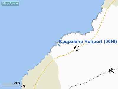
Kaupulehu Heliport
Address:
Hawaii County, HI
Tel:
808-325-5555
Images
and information placed above are from
http://www.airport-data.com/airport/00HI/
We
thank them for the data!
| General
Info |
| Country |
United
States |
| State |
HAWAII
|
| FAA ID |
00HI |
| Latitude |
19-49-57.044N
|
| Longitude |
155-58-53.971W
|
| Elevation |
43 feet
|
| Near City |
KAILUA/KONA
|
We don't guarantee the information is fresh and accurate. The data may
be wrong or outdated.
For more up-to-date information please refer to other sources.
|
|


