 |
|
Location
& QuickFacts
|
FAA
Information Effective: |
2007-07-05 |
|
Airport
Identifier: |
HI53 |
|
Airport
Status: |
Operational |
|
Longitude/Latitude: |
159-39-19.9260W/22-10-28.5480N
-159.655535/22.174597 (Estimated) |
|
Elevation: |
10 ft / 3.05 m (Estimated) |
|
Land: |
0 acres |
|
From
nearest city: |
5 nautical miles SW of Haena, HI |
|
Location: |
Kauai County, HI |
|
Magnetic Variation: |
12E (1985) |
Owner & Manager
|
Ownership: |
Publicly owned |
|
Owner: |
State Of Hawaii |
|
Address: |
|
|
Manager: |
Dept Land/natural Rsrcs |
|
Address: |
Po Box 621
Honolulu, HI 96809 |
|
Phone number: |
808-587-0300 |
Airport
Operations and Facilities
|
Airport
Use: |
Private |
|
Wind
indicator: |
No |
|
Segmented Circle: |
No |
|
Control
Tower: |
No |
|
Landing
fee charge: |
Yes |
|
Sectional chart: |
Hawaiian Islands |
|
Region: |
AWP - Western-Pacific |
|
Boundary
ARTCC: |
ZHN - Honolulu Control Facility |
|
Tie-in
FSS: |
HNL - Honolulu |
|
FSS
on Airport: |
No |
|
FSS
Phone: |
808-836-8049 |
|
FSS
Toll Free: |
1-800-WX-BRIEF |
|
Runway Information
Helipad H1
|
Dimension: |
65
x 65 ft / 19.8 x 19.8 m |
|
Surface: |
TURF, |
|
|
Runway H1 |
Runway |
|
Traffic
Pattern: |
Left |
Left |
|
Radio Navigation
Aids
|
ID |
Type |
Name |
Ch |
Freq |
Var |
Dist |
|
NBS |
TACAN |
Barking Sands Pmrf |
073X |
|
12E |
11.0 nm |
|
SOK |
VORTAC |
South Kauai |
101X |
115.40 |
11E |
17.9 nm |
|
LIH |
VORTAC |
Lihue |
082X |
113.50 |
11E |
21.7 nm |
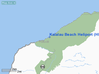
Kalalau Beach Heliport
Address:
Kauai County, HI
Tel:
808-587-0300
Images
and information placed above are from
http://www.airport-data.com/airport/HI53/
We
thank them for the data!
| General
Info |
| Country |
United
States |
| State |
HAWAII
|
| FAA ID |
HI53 |
| Latitude |
22-10-28.548N
|
| Longitude |
159-39-19.926W
|
| Elevation |
10 feet
|
| Near City |
HAENA
|
We don't guarantee the information is fresh and accurate. The data may
be wrong or outdated.
For more up-to-date information please refer to other sources.
|
|


