|
 |
|
||||
|
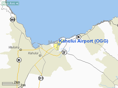
Kahului Airport (IATA: OGG, ICAO: PHOG, FAA LID: OGG) is a regional airport in the state of Hawai'i, located east of the Kahului CDP in Maui County on the island of Maui near Haleakala. Most flights into OGG originate from Honolulu International Airport; the Honolulu-Kahului corridor is one of the busiest air routes in the USA, ranking 13th in 2004 with 1,632,000 passengers. The airport code pays homage to aviation pioneer Bertram J. Hogg who worked for what is now Hawaiian Airlines flying aircraft ranging from 8-passenger Sikorsky S-38 amphibians to Douglas DC-3s and DC-9s into the late 1960s. AuthorityKahului Airport is part of a centralized state structure governing all of the airports and seaports of Hawai'i. The official authority of Kahului Airport is the Governor of Hawai'i. The Governor appoints the Director of the Hawai'i State Department of Transportation, who has jurisdiction over the Hawai'i Airports Administrator. The Hawai'i Airports Administrator oversees six governing bodies: Airports Operations Office, Airports Planning Office, Engineering Branch, Information Technology Office, Staff Services Office, Visitor Information Program Office. Collectively, the six bodies have authority over the four airport districts in Hawai'i: Hawai'i District, Kaua'i District, Mau'i District and the principal O'ahu District. Kahului Airport is a subordinate of Mau'i District officials. Facilities and aircraft
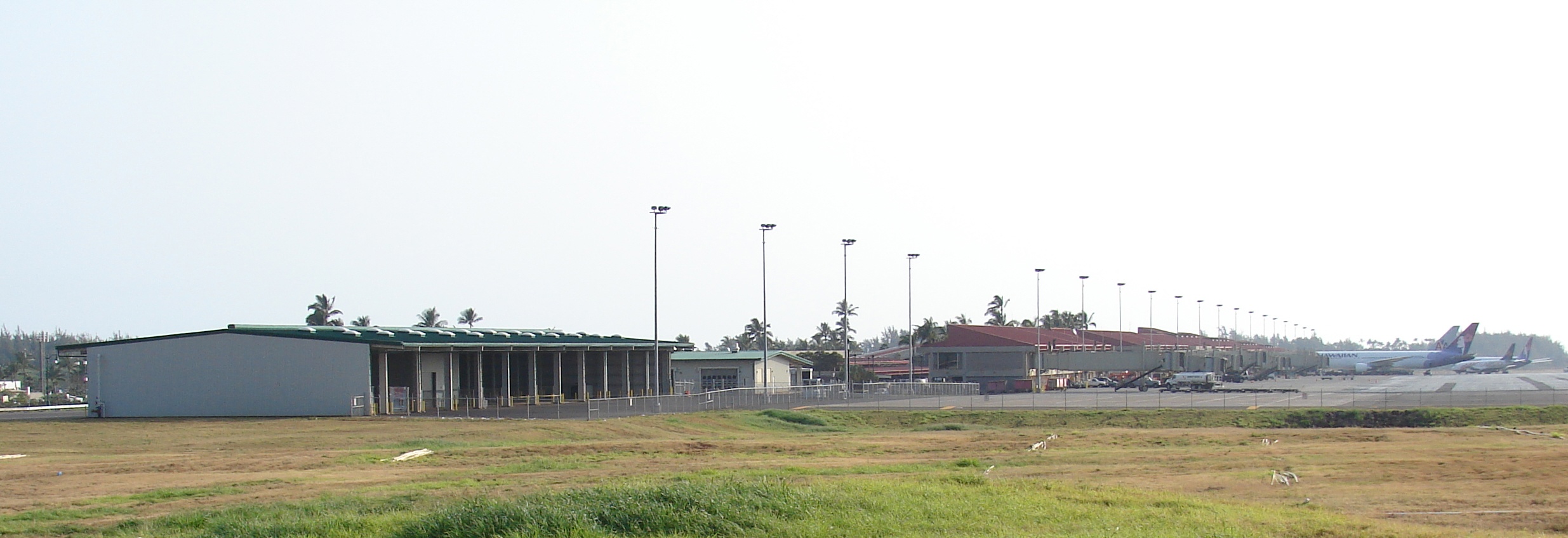
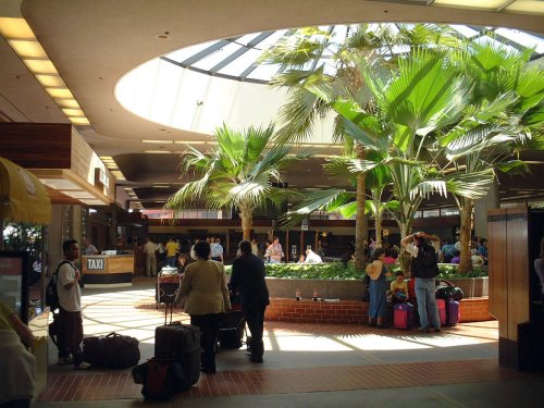
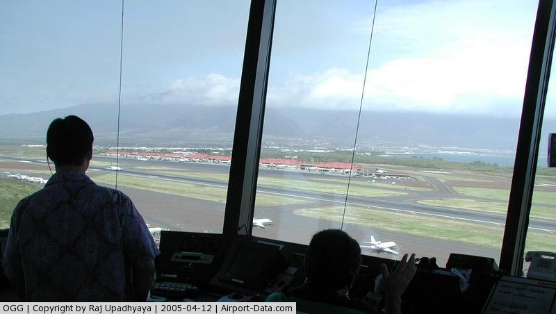
The Kahului Airport terminal building has ticketing, USDA agricultural inspection, and baggage claim areas on the ground level. There are two TSA security checkpoints, one just after the ticketing counters, and the other just before entering baggage claim. From the TSA security checkpoints, escalators and stairways lead to a central atrium on the second level and 18 gates on two concourses. Hawaii's strict laws on the export of fruits and plant life outside the state require passengers departing Kahului Airport on flights bound for U.S. mainland destinations to pass through a second USDA agricultural checkpoint located at the entrances of the overseas departure gate areas (Gates 1-7 and Gates 23-40). Passengers in possession of any fruits or plants will not be permitted past these checkpoints and will be prevented to board their aircraft unless they are surrendered to USDA agricultural inspectors. A total of 18 jetways are available for enplaning or deplaning passengers (there are six gate hold areas designated A-F with 3 jetways each). Gates with odd numbers are outfitted with jetway systems, while gates with even numbers are designated as emergency exits and have stairs that leads to the tarmac below. The Department of Transportation Airport Planning Division acknowledged that the margin of safety of an expanded 9,600 feet runway for the larger planes it hopes to accommodate will be no different than the margin of safety for mainland bound aircraft currently used on the existing 7,000ft runway. The airport's terminal design and gates were clustered primarily to handle inter-island flights on narrow-body aircraft like the Boeing 717 and Boeing 737. However, Kahului experienced a boom of long-haul overseas flights from the mainland United States using a mix of wide-body aircraft like the Boeing 767 and Boeing 777, as well as long-range narrow-bodied aircraft, such as the Boeing 737-700, Boeing 737-800 and Boeing 757. Given the original design and purpose of the airport, the aircraft used for inter-island flights can be accommodated at all gates, while those used for overseas operations cannot. Aircraft used for these two types of air carrier operations affects gate assignments, thus gate restrictions will affect the aircraft mix that can be accommodated. The airport is currently going through several phases of expansion, authorized by the Hawai'i State Legislature. A long term goal has been set to prepare Kahului Airport for eventual elevation to permanent international airport status with potential regular service routes from Canada and Japan. Current flights from Canada use United States border preclearance facilities in Vancouver, Calgary or Edmonton. Kahului Airport covers an area of 1,391 acres (563 ha) at an elevation of 54 feet (16 m) above mean sea level. It has two asphalt paved runways 2/20 is 6,995 by 150 feet (2,132 x 46 m) and 5/23 is 4,990 by 150 feet (1,521 x 46 m). It also has an asphalt helipad designated H1 which measures 125 by 125 feet (38 x 38 m). Most commercial flights use runway 2. For the 12-month period ending March 31, 2009, the airport had 247,337 aircraft operations, an average of 677 per day: 54% air taxi, 34% scheduled commercial, 11% general aviation and 3% military. At that time there were 56 aircraft based at this airport: 29% single-engine, 23% multi-engine, 45% helicopter and 4% ultralight. Airlines and destinations
DisastersAloha Airlines Flight 243 On April 28, 1988, Aloha Airlines flight 243, a Boeing 737-200 interisland flight from Hilo Airport to Honolulu International Airport carrying 89 passengers and 6 crew members experienced rapid decompression when an 18 foot section of the fuselage roof and sides were torn from the aircraft. One flight attendant was sucked out of the aircraft and died. Several passengers sustained life-threatening injuries including instances of massive head wounds. The aircraft declared an emergency and landed at Kahului Airport with slight difficulty. Noise created by the rush of air rendered vocal communication useless, and the pilots had to use hand signals during landing. Investigations of the disaster, headquartered at Honolulu International Airport, concluded that the accident was caused by metal fatigue. The disaster caused almost all major United States air carriers to retire their oldest aircraft models. Aloha Island Air Flight 1712 On October 28, 1989, Aloha Island Air flight 1712, a de Havilland Canada DHC-6 Twin Otter aircraft, collided with mountainous terrain near Halawa Valley, Molokai, while en route on a scheduled passenger flight from Kahului Airport to Molokai Airport in Hoolehua. The NTSB determined the cause of the accident was the airplane's controlled flight into terrain as a result of the decision of the captain to continue the flight under visual flight rules at night into instrument meteorological conditions, which obscured rising mountainous terrain. All 20 aboard the aircraft died. Thirteen of the victims were from Molokai, including eight members of the Molokai High School boys and girls volleyball teams and two faculty members. The girls team had just qualified on Maui for the state tournament. Hawaii Air Ambulance On March 8, 2006, a Hawaii Air Ambulance Cessna 414 was making an approach to Runway 5 when it crashed into a BMW dealership just a mile outside of the airport. A pilot and two nurses were killed in the accident. ExpansionAs a result of the passage of several Hawai'i State Legislature bills in 1998 and 2001, Kahului is planned to undergo expansion for new, larger facilities, lengthening of runways, increasing of fuel storage capacities, and construction of new access roads. A controversial project, it has met strong opposition from local residents who do not agree with prospects of elevating Kahului Airport to a permanent international airport. Project opponents cite concerns about increased introduction of invasive species and other issues, as evidenced by the common Maui bumper sticker "Big city airport, big city problems." In early 2005, Governor Linda Lingle released $365 million for construction of an extended ticketing lobby, new baggage claim carousels, a new Alien Species building, a new cargo building, construction of a new apron, construction of an additional 10 jetways to replace the current jetways, and a new six-lane airport access road that would run from the airport, intersecting Haleakala Highway and Hana Highway, and run parallel to Dairy Road where it would merge with a new grade-separated interchange between Puunene Avenue (highway 350), Dairy Road, and Kuihelani Highway (highway 380). The above content comes from Wikipedia and is published under free licenses – click here to read more.
Runway InformationRunway 02/20
Runway 05/23
Helipad H1
Radio Navigation Aids
Remarks
Based Aircraft
Major Carriers Serving This Airport
Most Popular Destinations
Most Popular Aircraft
Operational StatisticsTime Period: 2006-03-21 - 2007-03-21
Kahului Airport Address: Maui County, HI Tel: 808-838-8600, 808-872-3808 Images
and information placed above are from We thank them for the data!
We don't guarantee the information is fresh and accurate. The data may
be wrong or outdated.
|
|||||||||||||||||||||||||||||||||||||||||||||||||||||||||||||||||||||||||||||||||||||||||||||||||||||||||||||||||||||||||||||||||||||||||||||||||||||||||||||||||||||||||||||||||||||||||||||||||||||||||||||||||||||||||||||||||||||||||||||||||||||||||||||||||||||||||||||||||||||||||||||||||||||||||||||||||||||||||||||||||||||||||||||||||||||||||||||||||||||||||||||||||||||||||||||||||||||||||||||||||||||||||||||||||||||||||||||||||||||||||||||||||||||||||||||||||||||||||||||||||||||||||||||

 |
|
Copyright 2004-2026 © by Airports-Worldwide.com, Vyshenskoho st. 36, Lviv 79010, Ukraine Legal Disclaimer |