 |
|
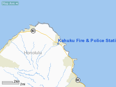
Kahuku Fire And Police Station Heliport |
Location
& QuickFacts
|
FAA
Information Effective: |
2007-07-05 |
|
Airport
Identifier: |
HI57 |
|
Airport
Status: |
Operational |
|
Longitude/Latitude: |
157-56-49.0900W/21-40-30.5450N
-157.946969/21.675151 (Estimated) |
|
Elevation: |
11 ft / 3.35 m (Estimated) |
|
Land: |
0 acres |
|
From
nearest city: |
0 nautical miles N of Kahuku, HI |
|
Location: |
Honolulu County, HI |
|
Magnetic Variation: |
11E (1985) |
Owner
& Manager
|
Ownership: |
Publicly
owned |
|
Owner: |
C & C Of Honolulu |
|
Address: |
120 Kap0alulu Place Rm 5
Honolulu, HI 96819 |
|
Phone
number: |
808-836-3722 |
|
Manager: |
Harold Evangelista |
|
Address: |
120 Kapalulu Pl., Room 105
Honolulu, HI 96819 |
|
Phone number: |
808-836-3722 |
Airport Operations and Facilities
|
Airport
Use: |
Private |
|
Wind
indicator: |
Yes |
|
Segmented Circle: |
No |
|
Control
Tower: |
No |
|
Sectional chart: |
Hawaiian Islands |
|
Region: |
AWP - Western-Pacific |
|
Boundary
ARTCC: |
ZHN - Honolulu Control Facility |
|
Tie-in
FSS: |
HNL - Honolulu |
|
FSS
Phone: |
808-836-8049 |
|
FSS
Toll Free: |
1-800-WX-BRIEF |
|
Runway Information
Helipad H1
|
Dimension: |
60
x 60 ft / 18.3 x 18.3 m |
|
Surface: |
ASPH, |
|
|
Runway H1 |
Runway |
|
Traffic
Pattern: |
Left |
Left |
|
Radio Navigation
Aids
|
ID |
Type |
Name |
Ch |
Freq |
Var |
Dist |
|
HHI |
NDB |
Wheeler |
|
373.00 |
11E |
12.8 nm |
|
HN |
NDB |
Ewabe |
|
242.00 |
11E |
21.8 nm |
|
NGF |
TACAN |
Kaneohe Bay |
093X |
|
11E |
16.9 nm |
|
HNL |
VORTAC |
Honolulu |
095X |
114.80 |
11E |
22.1 nm |
|
CKH |
VORTAC |
Koko Head |
086X |
113.90 |
11E |
28.2 nm |
|
HNL |
VOT |
Honolulu |
|
111.00 |
|
20.6 nm |
Remarks
Kahuku
Fire And Police Station Heliport
Address:
Honolulu County, HI
Tel:
808-836-3722
Images
and information placed above are from
http://www.airport-data.com/airport/HI57/
We
thank them for the data!
| General
Info |
| Country |
United
States |
| State |
HAWAII
|
| FAA ID |
HI57 |
| Latitude |
21-40-30.545N
|
| Longitude |
157-56-49.090W
|
| Elevation |
11 feet
|
| Near City |
KAHUKU
|
We don't guarantee the information is fresh and accurate. The data may
be wrong or outdated.
For more up-to-date information please refer to other sources.
|
|


