 |
|
Kaalaiki Airstrip Airport |
|
|
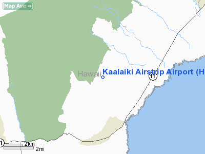
Location
& QuickFacts
|
FAA
Information Effective: |
2007-07-05 |
|
Airport
Identifier: |
HI25 |
|
Airport
Status: |
Operational |
|
Longitude/Latitude: |
155-34-40.9810W/19-07-22.1680N
-155.578050/19.122824 (Estimated) |
|
Elevation: |
1964 ft / 598.63 m (Estimated) |
|
Land: |
0 acres |
|
From
nearest city: |
3 nautical miles N of Naalehu, HI |
|
Location: |
Hawaii County, HI |
|
Magnetic Variation: |
11E (1985) |
Owner
& Manager
|
Ownership: |
Privately
owned |
|
Owner: |
Ka'u Agribusiness Co., Inc |
|
Address: |
Po Box 130
Pahala, HI 96777 |
|
Manager: |
Richard B. Cushnie |
|
Address: |
Ka'u Agribusiness Co., Inc
Pahala, HI 96777 |
|
Phone number: |
808-928-8311 |
Airport Operations and Facilities
|
Airport Use: |
Private |
|
Wind indicator: |
No |
|
Segmented Circle: |
No |
|
Control Tower: |
No |
|
Landing fee charge: |
No |
|
Sectional chart: |
Hawaiian Islands |
|
Region: |
AWP - Western-Pacific |
|
Boundary ARTCC: |
ZHN - Honolulu Control Facility |
|
Tie-in FSS: |
HNL - Honolulu |
|
FSS on Airport: |
No |
|
FSS Phone: |
808-836-8049 |
|
FSS Toll Free: |
1-800-WX-BRIEF |
Airport Services
|
Airframe
Repair: |
NONE |
|
Power
Plant Repair: |
NONE |
|
Runway
Information
Runway NE/SW
|
Dimension: |
2000
x 40 ft / 609.6 x 12.2 m |
|
Surface: |
GRVL-TRTD, |
|
|
Runway NE |
Runway SW |
|
Traffic
Pattern: |
Left |
Left |
|
Radio Navigation
Aids
|
ID |
Type |
Name |
Ch |
Freq |
Var |
Dist |
|
BSF |
NDB |
Bradshaw |
|
339.00 |
10E |
38.5 nm |
|
POA |
NDB |
Pahoa |
|
332.00 |
11E |
42.6 nm |
|
IAI |
VORTAC |
Kona |
104X |
115.70 |
11E |
40.8 nm |
|
ITO |
VORTAC |
Hilo |
116X |
116.90 |
11E |
48.2 nm |
Remarks
- APT
USED FOR FERTILIZER & HERBICIDE APPLICATION.
- OWNER
DESIRES ARPT NOT BE CHARTED.
Kaalaiki Airstrip Airport
Address:
Hawaii County, HI
Tel:
808-928-8311
Images
and information placed above are from
http://www.airport-data.com/airport/HI25/
We
thank them for the data!
| General
Info |
| Country |
United
States |
| State |
HAWAII
|
| FAA ID |
HI25 |
| Latitude |
19-07-22.168N
|
| Longitude |
155-34-40.981W
|
| Elevation |
1964 feet
|
| Near City |
NAALEHU
|
We don't guarantee the information is fresh and accurate. The data may
be wrong or outdated.
For more up-to-date information please refer to other sources.
|
|


