 |
|
Location
& QuickFacts
|
FAA
Information Effective: |
2007-07-05 |
|
Airport
Identifier: |
HI46 |
|
Airport
Status: |
Operational |
|
Longitude/Latitude: |
159-25-37.9340W/21-57-56.7090N
-159.427204/21.965753 (Estimated) |
|
Elevation: |
480 ft / 146.30 m (Estimated) |
|
Land: |
0 acres |
|
From
nearest city: |
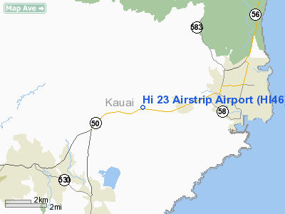
2 nautical miles W of Puhi, HI |
|
Location: |
Kauai County, HI |
|
Magnetic Variation: |
11E (1985) |
Owner
& Manager
|
Ownership: |
Privately
owned |
|
Owner: |
The Lihue Plantation Co; Ltd |
|
Address: |
2970 Kele Street
Lihue, HI 96766 |
|
Phone number: |
808-245-7325 |
|
Manager: |
Michael H. Furukawa |
|
Address: |
2970 Kele Street
Lihue, HI 96766 |
|
Phone number: |
808-245-7325 |
Airport
Operations and Facilities
|
Airport
Use: |
Private |
|
Wind
indicator: |
No |
|
Segmented Circle: |
No |
|
Control
Tower: |
No |
|
Landing
fee charge: |
No |
|
Sectional chart: |
Hawaiian Islands |
|
Region: |
AWP - Western-Pacific |
|
Boundary
ARTCC: |
ZHN - Honolulu Control Facility |
|
Tie-in
FSS: |
HNL - Honolulu |
|
FSS
on Airport: |
No |
|
FSS
Phone: |
808-836-8049 |
|
FSS
Toll Free: |
1-800-WX-BRIEF |
|
Runway
Information
Runway NE/SW
|
Dimension: |
2000
x 26 ft / 609.6 x 7.9 m |
|
Surface: |
ASPH-CONC, |
|
|
Runway NE |
Runway SW |
|
Traffic
Pattern: |
Left |
Left |
|
Radio Navigation
Aids
|
ID |
Type |
Name |
Ch |
Freq |
Var |
Dist |
|
NBS |
TACAN |
Barking Sands Pmrf |
073X |
|
12E |
20.4 nm |
|
LIH |
VORTAC |
Lihue |
082X |
113.50 |
11E |
5.0 nm |
|
SOK |
VORTAC |
South Kauai |
101X |
115.40 |
11E |
6.9 nm |
Remarks
- AERIAL
AGRICULTURAL OPERATIONS CONDUCTED CONTINUALLY.
- OWNER
DESIRES ARPT NOT BE CHARTED.
- VFR
ONLY.
Hi 23 Airstrip Airport
Address:
Kauai County, HI
Tel:
808-245-7325
Images
and information placed above are from
http://www.airport-data.com/airport/HI46/
We
thank them for the data!
| General
Info |
| Country |
United
States |
| State |
HAWAII
|
| FAA ID |
HI46 |
| Latitude |
21-57-56.709N
|
| Longitude |
159-25-37.934W
|
| Elevation |
480 feet
|
| Near City |
PUHI |
We don't guarantee the information is fresh and accurate. The data may
be wrong or outdated.
For more up-to-date information please refer to other sources.
|
|


