 |
|
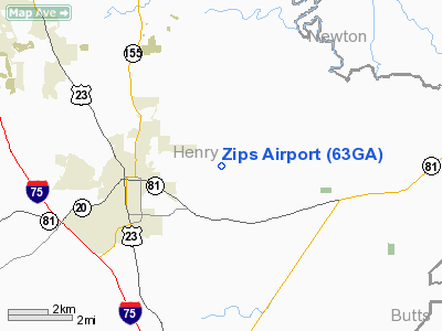
Location
& QuickFacts
|
FAA Information Effective: |
2007-07-05 |
|
Airport
Identifier: |
63GA |
|
Airport
Status: |
Operational |
|
Longitude/Latitude: |
084-05-42.6940W/33-27-10.4110N
-84.095193/33.452892 (Estimated) |
|
Elevation: |
880 ft / 268.22 m (Estimated) |
|
Land: |
0
acres |
|
From
nearest city: |
4 nautical miles E of Mc Donough, GA |
|
Location: |
Henry County, GA |
|
Magnetic Variation: |
02W (1985) |
Owner
& Manager
|
Ownership: |
Privately owned |
|
Owner: |
Zack's Properties Inc |
|
Address: |
12 North Cedar St
Mc Donough, GA 30253 |
|
Phone number: |
404-957-1546 |
|
Address: |
|
Airport
Operations and Facilities
|
Airport Use: |
Private
PERSONAL USE. |
|
Segmented
Circle: |
No |
|
Control
Tower: |
No |
|
Sectional
chart: |
Atlanta |
|
Region: |
ASO - Southern |
|
Boundary
ARTCC: |
ZTL - Atlanta |
|
Tie-in
FSS: |
MCN - Macon |
|
FSS
Toll Free: |
1-800-WX-BRIEF |
|
Runway Information
Runway 10/28
|
Dimension: |
2700 x 100 ft / 823.0 x 30.5 m |
|
Surface: |
TURF, |
|
|
Runway 10 |
Runway 28 |
|
Traffic
Pattern: |
Left |
Left |
|
Radio Navigation
Aids
|
ID |
Type |
Name |
Ch |
Freq |
Var |
Dist |
|
BR |
NDB |
Redan |
|
266.00 |
02W |
15.8 nm |
|
JHH |
NDB |
Griffin |
|
412.00 |
04W |
17.5 nm |
|
VOF |
NDB |
Alcovy |
|
370.00 |
03W |
19.0 nm |
|
FF |
NDB |
Pecat |
|
316.00 |
02W |
21.7 nm |
|
JNM |
NDB |
Monroe |
|
392.00 |
03W |
25.2 nm |
|
OP |
NDB |
Yates |
|
339.00 |
03W |
32.4 nm |
|
FT |
NDB |
Flanc |
|
344.00 |
02W |
33.0 nm |
|
EQQ |
NDB |
Coweta County |
|
234.00 |
03W |
33.2 nm |
|
BMW |
NDB |
Barrow County |
|
404.00 |
03W |
38.5 nm |
|
FKV |
NDB |
Flowery Branch |
|
365.00 |
03W |
46.1 nm |
|
DDA |
NDB |
Commerce |
|
244.00 |
03W |
46.5 nm |
|
DOB |
TACAN |
Dobbins |
077X |
|
01W |
34.6 nm |
|
PDK |
VOR/DME |
Peachtree |
113X |
116.60 |
02W |
27.4 nm |
|
ATL |
VORTAC |
Atlanta |
116X |
116.90 |
00W |
20.1 nm |
|
AHN |
VORTAC |
Athens |
33 |
109.60 |
00E |
48.7 nm |
|
ATL |
VOT |
Atlanta Muni |
|
111.00 |
|
20.6 nm |
Remarks
- PRVDD
VFR/PERSONAL USE ONLY.
Zips Airport
Address:
Henry County, GA
Tel:
404-957-1546
Images
and information placed above are from
http://www.airport-data.com/airport/63GA/
We
thank them for the data!
| General
Info |
| Country |
United
States |
| State |
GEORGIA
|
| FAA ID |
63GA
|
| Latitude |
33-27-10.411N
|
| Longitude |
084-05-42.694W
|
| Elevation |
880 feet
|
| Near City |
MC DONOUGH
|
We don't guarantee the information is fresh and accurate. The data may
be wrong or outdated.
For more up-to-date information please refer to other sources.
|
|


