 |
|
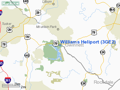
Location
& QuickFacts
|
FAA Information Effective: |
2007-07-05 |
|
Airport
Identifier: |
3GE2 |
|
Airport
Status: |
Operational |
|
Longitude/Latitude: |
084-07-41.0000W/33-49-15.0000N
-84.128056/33.820833 (Estimated) |
|
Elevation: |
990 ft / 301.75 m (Estimated) |
|
Land: |
1
acres |
|
From
nearest city: |
1 nautical miles NE of Stone Mountain, GA |
|
Location: |
Gwinnett County, GA |
|
Magnetic Variation: |
03W (1995) |
Owner
& Manager
|
Ownership: |
Privately owned |
|
Owner: |
Virgil R. Williams |
|
Address: |
Williams Group Intl, 2076 West Park Place
Stone Mountain, GA 30087 |
|
Phone
number: |
770-879-4046 |
|
Manager: |
Chief Pilot |
|
Address: |
Williams Group Intl, 2076 West Park Place
Stone Mountain, GA 30087 |
|
Phone number: |
770-879-4132 |
Airport
Operations and Facilities
|
Airport Use: |
Private |
|
Wind
indicator: |
Yes |
|
Segmented
Circle: |
No |
|
Control
Tower: |
No |
|
Sectional
chart: |
Atlanta |
|
Region: |
ASO - Southern |
|
Boundary
ARTCC: |
ZTL - Atlanta |
|
Tie-in
FSS: |
MCN - Macon |
|
FSS
Toll Free: |
1-800-WX-BRIEF |
|
Runway Information
Helipad H1
|
Dimension: |
250 x 100 ft / 76.2 x 30.5 m |
|
Surface: |
TURF, |
|
|
Runway H1 |
Runway |
|
Traffic
Pattern: |
Left |
Left |
|
Radio Navigation
Aids
|
ID |
Type |
Name |
Ch |
Freq |
Var |
Dist |
|
BR |
NDB |
Redan |
|
266.00 |
02W |
14.0 nm |
|
JNM |
NDB |
Monroe |
|
392.00 |
03W |
20.7 nm |
|
VOF |
NDB |
Alcovy |
|
370.00 |
03W |
20.8 nm |
|
FKV |
NDB |
Flowery Branch |
|
365.00 |
03W |
25.5 nm |
|
FT |
NDB |
Flanc |
|
344.00 |
02W |
25.8 nm |
|
BMW |
NDB |
Barrow County |
|
404.00 |
03W |
27.7 nm |
|
DJD |
NDB |
Canton |
|
415.00 |
04W |
31.5 nm |
|
DDA |
NDB |
Commerce |
|
244.00 |
03W |
33.6 nm |
|
FF |
NDB |
Pecat |
|
316.00 |
02W |
36.1 nm |
|
JHH |
NDB |
Griffin |
|
412.00 |
04W |
38.6 nm |
|
JZP |
NDB |
Pickens County |
|
285.00 |
04W |
41.6 nm |
|
EVZ |
NDB |
Cartersville |
|
308.00 |
04W |
42.3 nm |
|
EQQ |
NDB |
Coweta County |
|
234.00 |
03W |
44.8 nm |
|
BJT |
NDB |
Bulldog |
|
221.00 |
03W |
46.0 nm |
|
DOB |
TACAN |
Dobbins |
077X |
|
01W |
19.8 nm |
|
PDK |
VOR/DME |
Peachtree |
113X |
116.60 |
02W |
9.1 nm |
|
ATL |
VORTAC |
Atlanta |
116X |
116.90 |
00W |
19.2 nm |
|
AHN |
VORTAC |
Athens |
33 |
109.60 |
00E |
40.8 nm |
|
ATL |
VOT |
Atlanta Muni |
|
111.00 |
|
17.8 nm |
Remarks
- 50
FT POWER LINE 100 FT FROM HELIPAD & 50 FT TREES 100 FT FROM HELIPAD
IN ALL QUADRANTS.
- OWNER
DESIRES HELIPORT NOT BE CHARTED.
- PRVDD
VFR/PVT USE, AREA IS MKD, WIND INDICATOR IS MAINTAINED.
Based
Aircraft
|
Aircraft
based on field: |
1 |
|
Helicopters: |
1 |
Williams Heliport
Address:
Gwinnett County, GA
Tel:
770-879-4046,
770-879-4132
Images
and information placed above are from
http://www.airport-data.com/airport/3GE2/
We
thank them for the data!
| General
Info |
| Country |
United
States |
| State |
GEORGIA
|
| FAA ID |
3GE2
|
| Latitude |
33-49-15.000N
|
| Longitude |
084-07-41.000W
|
| Elevation |
990 feet
|
| Near City |
STONE
MOUNTAIN |
We don't guarantee the information is fresh and accurate. The data may
be wrong or outdated.
For more up-to-date information please refer to other sources.
|
|


