 |
|
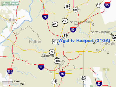
Location
& QuickFacts
|
FAA Information Effective: |
2007-07-05 |
|
Airport
Identifier: |
31GA |
|
Airport
Status: |
Operational |
|
Longitude/Latitude: |
084-24-03.7900W/33-47-14.4700N
-84.401053/33.787353 (Estimated) |
|
Elevation: |
939 ft / 286.21 m (Estimated) |
|
Land: |
0
acres |
|
From
nearest city: |
0 nautical miles of Atlanta, GA |
|
Location: |
Fulton County, GA |
|
Magnetic Variation: |
04W (2000) |
Owner
& Manager
|
Ownership: |
Privately owned |
|
Owner: |
Meredith Corporation |
|
Address: |
425 14th Street Nw
Atlanta, GA 30318 |
|
Phone
number: |
404-325-4646 |
|
Manager: |
David H. Rhodes |
|
Address: |
12725 Morris Road Suite 200
Alpharetta, GA 30004 |
|
Phone number: |
678-336-2086 |
Airport
Operations and Facilities
|
Airport Use: |
Private |
|
Segmented
Circle: |
No |
|
Control
Tower: |
No |
|
Sectional
chart: |
Atlanta |
|
Region: |
ASO - Southern |
|
Boundary
ARTCC: |
ZTL - Atlanta |
|
Tie-in
FSS: |
MCN - Macon |
|
FSS
Toll Free: |
1-800-WX-BRIEF |
|
Runway Information
Helipad H1
|
Dimension: |
40 x 30 ft / 12.2 x 9.1 m |
|
Surface: |
CONC, |
|
|
Runway H1 |
Runway |
|
Traffic
Pattern: |
Left |
Left |
|
Radio Navigation
Aids
|
ID |
Type |
Name |
Ch |
Freq |
Var |
Dist |
|
BR |
NDB |
Redan |
|
266.00 |
02W |
9.6 nm |
|
FT |
NDB |
Flanc |
|
344.00 |
02W |
12.0 nm |
|
DJD |
NDB |
Canton |
|
415.00 |
04W |
28.3 nm |
|
FF |
NDB |
Pecat |
|
316.00 |
02W |
29.6 nm |
|
VOF |
NDB |
Alcovy |
|
370.00 |
03W |
32.4 nm |
|
EVZ |
NDB |
Cartersville |
|
308.00 |
04W |
33.2 nm |
|
JNM |
NDB |
Monroe |
|
392.00 |
03W |
33.8 nm |
|
FKV |
NDB |
Flowery Branch |
|
365.00 |
03W |
35.1 nm |
|
EQQ |
NDB |
Coweta County |
|
234.00 |
03W |
35.5 nm |
|
JHH |
NDB |
Griffin |
|
412.00 |
04W |
37.3 nm |
|
GPQ |
NDB |
Carrollton |
|
278.00 |
02W |
38.9 nm |
|
JZP |
NDB |
Pickens County |
|
285.00 |
04W |
40.3 nm |
|
BMW |
NDB |
Barrow County |
|
404.00 |
03W |
41.5 nm |
|
OUK |
NDB |
Calhoun |
|
323.00 |
02W |
45.2 nm |
|
DDA |
NDB |
Commerce |
|
244.00 |
03W |
46.9 nm |
|
OYD |
NDB |
Floyd |
|
388.00 |
02W |
48.9 nm |
|
DOB |
TACAN |
Dobbins |
077X |
|
01W |
9.3 nm |
|
PDK |
VOR/DME |
Peachtree |
113X |
116.60 |
02W |
7.4 nm |
|
ATL |
VORTAC |
Atlanta |
116X |
116.90 |
00W |
9.7 nm |
|
RMG |
VORTAC |
Rome |
101X |
115.40 |
01E |
42.3 nm |
|
ATL |
VOT |
Atlanta Muni |
|
111.00 |
|
7.9 nm |
Remarks
- PRVDD
VFR OPNS, PRIVATE USE, AREA IS MARKED, AND WIND INDICATOR IS MAINTAINED.
Wgcl-tv Heliport
Address:
Fulton County, GA
Tel:
404-325-4646,
678-336-2086
Images
and information placed above are from
http://www.airport-data.com/airport/31GA/
We
thank them for the data!
We don't guarantee the information is fresh and accurate. The data may
be wrong or outdated.
For more up-to-date information please refer to other sources.
|
|


