 |
|
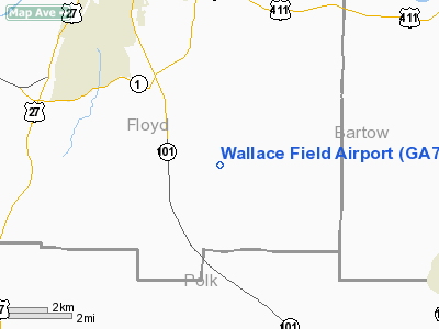
Location
& QuickFacts
|
FAA Information Effective: |
2007-07-05 |
|
Airport
Identifier: |
GA77 |
|
Airport
Status: |
Operational |
|
Longitude/Latitude: |
085-06-44.0000W/34-08-09.0000N
-85.112222/34.135833 (Estimated) |
|
Elevation: |
810 ft / 246.89 m (Estimated) |
|
Land: |
0
acres |
|
From
nearest city: |
7 nautical miles SE of Rome, GA |
|
Location: |
Floyd County, GA |
|
Magnetic Variation: |
02W (1995) |
Owner
& Manager
|
Ownership: |
Privately owned |
|
Owner: |
James H Wallace |
|
Address: |
166 Williams Rd, Se
Silver Creek, GA 30173 |
|
Phone
number: |
706-232-0434 |
|
Manager: |
James H Wallace |
|
Address: |
166 Williams Rd, Se
Silver Creek, GA 30173 |
|
Phone number: |
706-232-0434 |
Airport
Operations and Facilities
|
Airport Use: |
Private |
|
Segmented
Circle: |
No |
|
Control
Tower: |
No |
|
Sectional
chart: |
Atlanta |
|
Region: |
ASO - Southern |
|
Boundary
ARTCC: |
ZTL - Atlanta |
|
Tie-in
FSS: |
MCN - Macon |
|
FSS
Toll Free: |
1-800-WX-BRIEF |
|
Runway Information
Runway 01/19
|
Dimension: |
1856 x 60 ft / 565.7 x 18.3 m |
|
Surface: |
TURF, |
|
|
Runway 01 |
Runway 19 |
|
Traffic
Pattern: |
Left |
Left |
|
Radio Navigation
Aids
|
ID |
Type |
Name |
Ch |
Freq |
Var |
Dist |
|
OYD |
NDB |
Floyd |
|
388.00 |
02W |
10.1 nm |
|
EVZ |
NDB |
Cartersville |
|
308.00 |
04W |
13.9 nm |
|
OUK |
NDB |
Calhoun |
|
323.00 |
02W |
18.4 nm |
|
DJD |
NDB |
Canton |
|
415.00 |
04W |
31.8 nm |
|
FT |
NDB |
Flanc |
|
344.00 |
02W |
32.6 nm |
|
GPQ |
NDB |
Carrollton |
|
278.00 |
02W |
34.3 nm |
|
FTP |
NDB |
Fort Payne |
|
426.00 |
01W |
36.2 nm |
|
JZP |
NDB |
Pickens County |
|
285.00 |
04W |
37.7 nm |
|
UWI |
NDB |
Whitfield |
|
400.00 |
03W |
40.1 nm |
|
BR |
NDB |
Redan |
|
266.00 |
02W |
49.7 nm |
|
DOB |
TACAN |
Dobbins |
077X |
|
01W |
32.9 nm |
|
PDK |
VOR/DME |
Peachtree |
113X |
116.60 |
02W |
43.4 nm |
|
GAD |
VOR/DME |
Gadsden |
070X |
112.30 |
02E |
49.3 nm |
|
RMG |
VORTAC |
Rome |
101X |
115.40 |
01E |
1.6 nm |
|
ATL |
VORTAC |
Atlanta |
116X |
116.90 |
00W |
45.5 nm |
|
GQO |
VORTAC |
Choo Choo |
105X |
115.80 |
01E |
49.7 nm |
|
ATL |
VOT |
Atlanta Muni |
|
111.00 |
|
44.7 nm |
Remarks
Based Aircraft
|
Aircraft
based on field: |
1 |
|
Single
Engine Airplanes: |
1 |
Wallace Field Airport
Address:
Floyd County, GA
Tel:
706-232-0434
Images
and information placed above are from
http://www.airport-data.com/airport/GA77/
We
thank them for the data!
| General
Info |
| Country |
United
States |
| State |
GEORGIA
|
| FAA ID |
GA77
|
| Latitude |
34-08-09.000N
|
| Longitude |
085-06-44.000W
|
| Elevation |
810 feet
|
| Near City |
ROME
|
We don't guarantee the information is fresh and accurate. The data may
be wrong or outdated.
For more up-to-date information please refer to other sources.
|
|


