 |
|
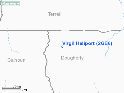
Location
& QuickFacts
|
FAA Information Effective: |
2007-07-05 |
|
Airport
Identifier: |
2GE6 |
|
Airport
Status: |
Operational |
|
Longitude/Latitude: |
084-25-22.0000W/31-35-43.0000N
-84.422778/31.595278 (Estimated) |
|
Elevation: |
300 ft / 91.44 m (Estimated) |
|
Land: |
2
acres |
|
From
nearest city: |
0 nautical miles N of Albany, GA |
|
Location: |
Dougherty County, GA |
|
Magnetic Variation: |
03W (1995) |
Owner
& Manager
|
Ownership: |
Privately owned |
|
Owner: |
Virgil R. Williams |
|
Address: |
2076 West Park Place
Stone Mountain, GA 30087 |
|
Phone
number: |
770-879-4046 |
|
Manager: |
Bruce Palmer |
|
Address: |
2076 West Park Place
Stone Mountain, GA 30087 |
|
Phone number: |
770-879-4039 |
Airport
Operations and Facilities
|
Airport Use: |
Private |
|
Wind
indicator: |
Yes |
|
Segmented
Circle: |
No |
|
Control
Tower: |
No |
|
Lighting
Schedule: |
DUSK-DAWN |
|
Sectional
chart: |
Jacksonville |
|
Region: |
ASO - Southern |
|
Boundary
ARTCC: |
ZJX - Jacksonville |
|
Tie-in
FSS: |
MCN - Macon |
|
FSS
Toll Free: |
1-800-WX-BRIEF |
|
Runway Information
Helipad H1
|
Dimension: |
500 x 100 ft / 152.4 x 30.5 m |
|
Surface: |
CONC, Good Condition |
|
|
Runway H1 |
Runway |
|
Traffic
Pattern: |
Left |
Left |
|
Obstruction: |
50 ft trees, 100.0 ft from runway |
|
|
Radio Navigation
Aids
|
ID |
Type |
Name |
Ch |
Freq |
Var |
Dist |
|
AB |
NDB |
Putny |
|
227.00 |
02W |
11.2 nm |
|
IWJ |
NDB |
Blaak |
|
344.00 |
03W |
22.0 nm |
|
CXU |
NDB |
Camilla |
|
369.00 |
02W |
24.8 nm |
|
OHY |
NDB |
Coney |
|
400.00 |
02W |
37.5 nm |
|
LYZ |
NDB |
Willis |
|
359.00 |
01W |
37.8 nm |
|
LKG |
NDB |
Lindbergh |
|
242.00 |
03W |
38.3 nm |
|
CYR |
NDB |
Caidy |
|
338.00 |
01W |
44.6 nm |
|
GTP |
NDB |
Patten |
|
245.00 |
02W |
49.1 nm |
|
IFM |
VOR |
Tift Myers |
|
112.50 |
01W |
48.9 nm |
|
MGR |
VOR/DME |
Moultrie |
025X |
108.80 |
02W |
44.3 nm |
|
PZD |
VORTAC |
Pecan |
108X |
116.10 |
02W |
7.6 nm |
|
EUF |
VORTAC |
Eufaula |
029X |
109.20 |
02E |
42.0 nm |
Remarks
- 50
FT TREES 100 FT FROM PAD, ALL QUADRANTS.
- OWNER
DESIRES HELIPORT NOT BE CHARTED.
- PRVDD
VFR/PVT USE, AREA IS MKD, APCH/DEP 350-010 DEGS ONLY.
Based Aircraft
|
Aircraft
based on field: |
1 |
|
Helicopters: |
1 |
Virgil Heliport
Address:
Dougherty County, GA
Tel:
770-879-4046,
770-879-4039
Images
and information placed above are from
http://www.airport-data.com/airport/2GE6/
We
thank them for the data!
| General
Info |
| Country |
United
States |
| State |
GEORGIA
|
| FAA ID |
2GE6
|
| Latitude |
31-35-43.000N
|
| Longitude |
084-25-22.000W
|
| Elevation |
300 feet
|
| Near City |
ALBANY
|
We don't guarantee the information is fresh and accurate. The data may
be wrong or outdated.
For more up-to-date information please refer to other sources.
|
|


