 |
|
Location
& QuickFacts
|
FAA Information Effective: |
2007-07-05 |
|
Airport
Identifier: |
9GA4 |
|
Airport
Status: |
Operational |
|
Longitude/Latitude: |
084-20-20.7280W/33-39-51.3900N
-84.339091/33.664275 (Estimated) |
|
Elevation: |
950 ft / 289.56 m (Estimated) |
|
Land: |
0
acres |
|
From
nearest city: |
1 nautical miles NW of Conley, GA |
|
Location: |
De Kalb County, GA |
|
Magnetic Variation: |
02W (1985) |
Owner
& Manager
|
Ownership: |
Privately owned |
|
Owner: |
Matsco Inc--trico Equip Div |
|
Address: |
1600 Kenview Drive
Marietta, GA 30060 |
|
Phone number: |
404-422-7520 |
|
Manager: |
William S. Bakos |
|
Address: |
3185 Moreland Avenue
Conley, GA 30027 |
|
Phone number: |
404-363-9201 |
Airport
Operations and Facilities
|
Airport Use: |
Private |
|
Wind
indicator: |
Yes |
|
Segmented
Circle: |
No |
|
Control
Tower: |
No |
|
Landing
fee charge: |
No |
|
Sectional
chart: |
Atlanta |
|
Region: |
ASO - Southern |
|
Boundary
ARTCC: |
ZTL - Atlanta |
|
Tie-in
FSS: |
MCN - Macon |
|
FSS
on Airport: |
No |
|
FSS
Toll Free: |
1-800-WX-BRIEF |
|
Runway Information
Helipad H1
|
Dimension: |
60 x 12 ft / 18.3 x 3.7 m |
|
Surface: |
CONC, |
|
|
Runway H1 |
Runway |
|
Traffic
Pattern: |
Left |
Left |
|
Radio Navigation
Aids
|
ID |
Type |
Name |
Ch |
Freq |
Var |
Dist |
|
BR |
NDB |
Redan |
|
266.00 |
02W |
1.8 nm |
|
FT |
NDB |
Flanc |
|
344.00 |
02W |
16.1 nm |
|
FF |
NDB |
Pecat |
|
316.00 |
02W |
23.1 nm |
|
VOF |
NDB |
Alcovy |
|
370.00 |
03W |
27.9 nm |
|
JHH |
NDB |
Griffin |
|
412.00 |
04W |
29.4 nm |
|
EQQ |
NDB |
Coweta County |
|
234.00 |
03W |
30.8 nm |
|
JNM |
NDB |
Monroe |
|
392.00 |
03W |
30.9 nm |
|
DJD |
NDB |
Canton |
|
415.00 |
04W |
36.1 nm |
|
FKV |
NDB |
Flowery Branch |
|
365.00 |
03W |
38.9 nm |
|
GPQ |
NDB |
Carrollton |
|
278.00 |
02W |
40.1 nm |
|
EVZ |
NDB |
Cartersville |
|
308.00 |
04W |
40.8 nm |
|
BMW |
NDB |
Barrow County |
|
404.00 |
03W |
40.8 nm |
|
OP |
NDB |
Yates |
|
339.00 |
03W |
45.4 nm |
|
DDA |
NDB |
Commerce |
|
244.00 |
03W |
47.3 nm |
|
JZP |
NDB |
Pickens County |
|
285.00 |
04W |
48.0 nm |
|
DOB |
TACAN |
Dobbins |
077X |
|
01W |
17.2 nm |
|
PDK |
VOR/DME |
Peachtree |
113X |
116.60 |
02W |
12.9 nm |
|
ATL |
VORTAC |
Atlanta |
116X |
116.90 |
00W |
5.2 nm |
|
RMG |
VORTAC |
Rome |
101X |
115.40 |
01E |
49.1 nm |
|
ATL |
VOT |
Atlanta Muni |
|
111.00 |
|
4.4 nm |
Remarks
- VFR,
PRIVATE USE ONLY; LETTER OF AGREEMENT IS MAINTAINED WITH ATLANTA ATCT
COVERING OPERATING PROCEDURES WITHIN THE ATLANTA CONTROL ZONE.
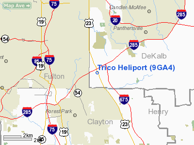
Trico Heliport
Address:
De Kalb County, GA
Tel:
404-422-7520, 404-363-9201
Images
and information placed above are from
http://www.airport-data.com/airport/9GA4/
We
thank them for the data!
| General
Info |
| Country |
United
States |
| State |
GEORGIA
|
| FAA ID |
9GA4
|
| Latitude |
33-39-51.390N
|
| Longitude |
084-20-20.728W
|
| Elevation |
950 feet
|
| Near City |
CONLEY
|
We don't guarantee the information is fresh and accurate. The data may
be wrong or outdated.
For more up-to-date information please refer to other sources.
|
|


