 |
|
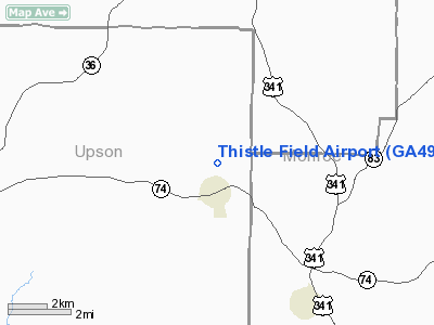
Location
& QuickFacts
|
FAA Information Effective: |
2007-07-05 |
|
Airport
Identifier: |
GA49 |
|
Airport
Status: |
Operational |
|
Longitude/Latitude: |
084-08-28.6920W/32-55-40.4750N
-84.141303/32.927910 (Estimated) |
|
Elevation: |
730 ft / 222.50 m (Estimated) |
|
Land: |
0
acres |
|
From
nearest city: |
2 nautical miles N of Yatesville, GA |
|
Location: |
Upson County, GA |
|
Magnetic Variation: |
02W (1990) |
Owner
& Manager
|
Ownership: |
Privately owned |
|
Owner: |
Harold & Cecilia Distel |
|
Address: |
460 Ytsv. Bnv. Hwy.
Yatesville, GA 31097 |
|
Phone
number: |
706-472-3860 |
|
Manager: |
Harold & Cecilia Distel |
|
Address: |
460 Ytsv. Bnv. Hwy.
Yatesville, GA 31097 |
|
Phone number: |
706-472-3860 |
Airport
Operations and Facilities
|
Airport Use: |
Private
PERSONAL. |
|
Wind
indicator: |
Yes |
|
Segmented
Circle: |
No |
|
Control
Tower: |
No |
|
Sectional
chart: |
Atlanta |
|
Region: |
ASO - Southern |
|
Boundary
ARTCC: |
ZTL - Atlanta |
|
Tie-in
FSS: |
MCN - Macon |
|
FSS
Toll Free: |
1-800-WX-BRIEF |
|
Runway Information
Runway 17/35
|
Dimension: |
2500 x 60 ft / 762.0 x 18.3 m |
|
Surface: |
TURF, |
|
|
Runway 17 |
Runway 35 |
|
Traffic
Pattern: |
Left |
Left |
|
Radio Navigation
Aids
|
ID |
Type |
Name |
Ch |
Freq |
Var |
Dist |
|
OP |
NDB |
Yates |
|
339.00 |
03W |
2.4 nm |
|
JHH |
NDB |
Griffin |
|
412.00 |
04W |
16.0 nm |
|
FF |
NDB |
Pecat |
|
316.00 |
02W |
28.4 nm |
|
BEP |
NDB |
Bay Creek |
|
350.00 |
03W |
34.1 nm |
|
IZS |
NDB |
Montezuma |
|
426.00 |
04W |
34.4 nm |
|
EQQ |
NDB |
Coweta County |
|
234.00 |
03W |
34.9 nm |
|
PIM |
NDB |
Pine Mountain |
|
272.00 |
03W |
37.3 nm |
|
BR |
NDB |
Redan |
|
266.00 |
02W |
44.0 nm |
|
LKG |
NDB |
Lindbergh |
|
242.00 |
03W |
45.3 nm |
|
VOF |
NDB |
Alcovy |
|
370.00 |
03W |
45.9 nm |
|
MCN |
VORTAC |
Macon |
089X |
114.20 |
01E |
28.7 nm |
|
ATL |
VORTAC |
Atlanta |
116X |
116.90 |
00W |
44.7 nm |
|
CSG |
VORTAC |
Columbus |
118X |
117.10 |
01E |
48.1 nm |
|
ATL |
VOT |
Atlanta Muni |
|
111.00 |
|
46.1 nm |
Remarks
- PRVDD
ALL OPNS ARE CONDUCTED IN VFR WX CONDITIONS; THE LDG AREA IS LIMITED
PERSONAL USE, I.E., EXCLUSIVE USE BY THE PROPONENT.
Based
Aircraft
|
Aircraft
based on field: |
1 |
|
Multi
Engine Airplanes: |
1 |
Thistle Field Airport
Address:
Upson County, GA
Tel:
706-472-3860
Images
and information placed above are from
http://www.airport-data.com/airport/GA49/
We
thank them for the data!
| General
Info |
| Country |
United
States |
| State |
GEORGIA
|
| FAA ID |
GA49
|
| Latitude |
32-55-40.475N
|
| Longitude |
084-08-28.692W
|
| Elevation |
730 feet
|
| Near City |
YATESVILLE
|
We don't guarantee the information is fresh and accurate. The data may
be wrong or outdated.
For more up-to-date information please refer to other sources.
|
|


