 |
|
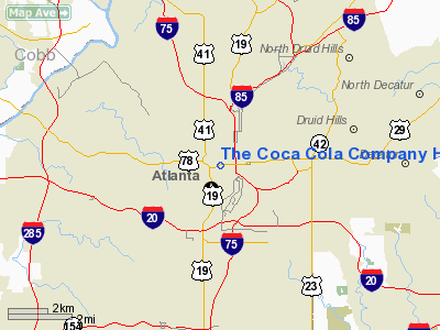
The Coca Cola Company Heliport |
Location
& QuickFacts
|
FAA Information Effective: |
2007-07-05 |
|
Airport
Identifier: |
GA56 |
|
Airport
Status: |
Operational |
|
Longitude/Latitude: |
084-23-55.7380W/33-46-15.3810N
-84.398816/33.770939 (Estimated) |
|
Elevation: |
1050 ft / 320.04 m (Estimated) |
|
Land: |
0
acres |
|
From
nearest city: |
7 nautical miles SW of Atlanta, GA |
|
Location: |
Fulton County, GA |
|
Magnetic Variation: |
02W (1985) |
Owner
& Manager
|
Ownership: |
Privately owned |
|
Owner: |
The Coca Cola Company |
|
Address: |
Po Drawer 1734
Atlanta, GA 30301 |
|
Phone
number: |
404-898-2121 |
|
Manager: |
Eric House |
|
Address: |
The Coca Cola Company, Po Box 43427
Atlanta, GA 30336 |
|
Phone number: |
404-691-0700 |
Airport
Operations and Facilities
|
Airport Use: |
Private |
|
Wind indicator: |
Yes |
|
Segmented Circle: |
Yes |
|
Control Tower: |
No |
|
Landing fee charge: |
No |
|
Sectional chart: |
Atlanta |
|
Region: |
ASO - Southern |
|
Boundary ARTCC: |
ZTL - Atlanta |
|
Tie-in FSS: |
MCN - Macon |
|
FSS on Airport: |
No |
|
FSS Toll Free: |
1-800-WX-BRIEF |
Airport
Services
|
Airframe Repair: |
NONE |
|
Power Plant Repair: |
NONE |
|
Runway Information
Helipad H1
|
Dimension: |
60 x 60 ft / 18.3 x 18.3 m |
|
Surface: |
CONC, |
|
|
Runway H1 |
Runway |
|
Traffic
Pattern: |
Left |
Left |
|
Radio Navigation
Aids
|
ID |
Type |
Name |
Ch |
Freq |
Var |
Dist |
|
BR |
NDB |
Redan |
|
266.00 |
02W |
8.7 nm |
|
FT |
NDB |
Flanc |
|
344.00 |
02W |
12.0 nm |
|
FF |
NDB |
Pecat |
|
316.00 |
02W |
28.6 nm |
|
DJD |
NDB |
Canton |
|
415.00 |
04W |
29.3 nm |
|
VOF |
NDB |
Alcovy |
|
370.00 |
03W |
32.0 nm |
|
JNM |
NDB |
Monroe |
|
392.00 |
03W |
33.6 nm |
|
EVZ |
NDB |
Cartersville |
|
308.00 |
04W |
34.0 nm |
|
EQQ |
NDB |
Coweta County |
|
234.00 |
03W |
34.7 nm |
|
FKV |
NDB |
Flowery Branch |
|
365.00 |
03W |
35.8 nm |
|
JHH |
NDB |
Griffin |
|
412.00 |
04W |
36.3 nm |
|
GPQ |
NDB |
Carrollton |
|
278.00 |
02W |
38.6 nm |
|
JZP |
NDB |
Pickens County |
|
285.00 |
04W |
41.3 nm |
|
BMW |
NDB |
Barrow County |
|
404.00 |
03W |
41.6 nm |
|
OUK |
NDB |
Calhoun |
|
323.00 |
02W |
46.1 nm |
|
DDA |
NDB |
Commerce |
|
244.00 |
03W |
47.2 nm |
|
OYD |
NDB |
Floyd |
|
388.00 |
02W |
49.6 nm |
|
DOB |
TACAN |
Dobbins |
077X |
|
01W |
10.2 nm |
|
PDK |
VOR/DME |
Peachtree |
113X |
116.60 |
02W |
8.0 nm |
|
ATL |
VORTAC |
Atlanta |
116X |
116.90 |
00W |
8.7 nm |
|
RMG |
VORTAC |
Rome |
101X |
115.40 |
01E |
42.9 nm |
|
ATL |
VOT |
Atlanta Muni |
|
111.00 |
|
6.9 nm |
Remarks
The Coca Cola Company Heliport
Address:
Fulton County, GA
Tel:
404-898-2121,
404-691-0700
Images
and information placed above are from
http://www.airport-data.com/airport/GA56/
We
thank them for the data!
| General
Info |
| Country |
United
States |
| State |
GEORGIA
|
| FAA ID |
GA56
|
| Latitude |
33-46-15.381N
|
| Longitude |
084-23-55.738W
|
| Elevation |
1050 feet
|
| Near City |
ATLANTA
|
We don't guarantee the information is fresh and accurate. The data may
be wrong or outdated.
For more up-to-date information please refer to other sources.
|
|


