 |
|
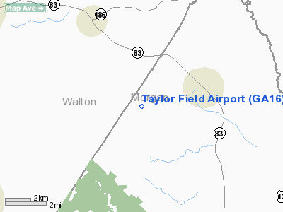
Location
& QuickFacts
|
FAA Information Effective: |
2007-07-05 |
|
Airport
Identifier: |
GA16 |
|
Airport
Status: |
Operational |
|
Longitude/Latitude: |
083-34-00.6020W/33-43-27.4340N
-83.566834/33.724287 (Estimated) |
|
Elevation: |
710 ft / 216.41 m (Estimated) |
|
Land: |
156 acres |
|
From
nearest city: |
3 nautical miles SW of Bostwick, GA |
|
Location: |
Morgan County, GA |
|
Magnetic Variation: |
02W (1985) |
Owner
& Manager
|
Ownership: |
Privately owned |
|
Owner: |
Larry J. Taylor |
|
Address: |
1090 Hardeman Mill Rd
Madison, GA 30650 |
|
Phone
number: |
706-342-0496 |
|
Manager: |
Larry J. Taylor |
|
Address: |
1090 Hardeman Mill Rd
Madison, GA 30650 |
|
Phone number: |
706-342-0496 |
Airport
Operations and Facilities
|
Airport Use: |
Private |
|
Wind
indicator: |
Yes |
|
Segmented
Circle: |
No |
|
Control
Tower: |
No |
|
Sectional
chart: |
Atlanta |
|
Region: |
ASO - Southern |
|
Boundary
ARTCC: |
ZTL - Atlanta |
|
Tie-in
FSS: |
MCN - Macon |
|
FSS
Toll Free: |
1-800-WX-BRIEF |
|
Runway Information
Runway 10/28
|
Dimension: |
2100
x 50 ft / 640.1 x 15.2 m
HAS 400' STOPWAYS BOTH ENDS. |
|
Surface: |
TURF, |
|
|
Runway 10 |
Runway 28 |
|
Traffic
Pattern: |
Left |
Right |
|
Displaced
threshold: |
400.00
ft |
400.00
ft |
|
Obstruction: |
20 ft pline, 500.0 ft from runway |
30 ft pline, 500.0 ft from runway |
|
Radio Navigation
Aids
|
ID |
Type |
Name |
Ch |
Freq |
Var |
Dist |
|
JNM |
NDB |
Monroe |
|
392.00 |
03W |
8.0 nm |
|
VOF |
NDB |
Alcovy |
|
370.00 |
03W |
12.2 nm |
|
BMW |
NDB |
Barrow County |
|
404.00 |
03W |
12.7 nm |
|
DDA |
NDB |
Commerce |
|
244.00 |
03W |
20.4 nm |
|
BJT |
NDB |
Bulldog |
|
221.00 |
03W |
22.1 nm |
|
VV |
NDB |
Junne |
|
353.00 |
05W |
27.7 nm |
|
FKV |
NDB |
Flowery Branch |
|
365.00 |
03W |
33.4 nm |
|
BR |
NDB |
Redan |
|
266.00 |
02W |
37.5 nm |
|
IIY |
NDB |
Washington/wilkes County |
|
435.00 |
03W |
37.8 nm |
|
UMB |
NDB |
Culvr |
|
380.00 |
04W |
40.0 nm |
|
JHH |
NDB |
Griffin |
|
412.00 |
04W |
46.4 nm |
|
AJR |
NDB |
Habersham |
|
347.00 |
03W |
46.7 nm |
|
AA |
NDB |
Cedar |
|
341.00 |
04W |
49.0 nm |
|
DOB |
TACAN |
Dobbins |
077X |
|
01W |
48.3 nm |
|
PDK |
VOR/DME |
Peachtree |
113X |
116.60 |
02W |
37.7 nm |
|
AHN |
VORTAC |
Athens |
33 |
109.60 |
00E |
18.1 nm |
|
ATL |
VORTAC |
Atlanta |
116X |
116.90 |
00W |
43.8 nm |
|
ATL |
VOT |
Atlanta Muni |
|
111.00 |
|
43.1 nm |
Remarks
- ALL
TFC PATTERNS ARE N OF THE ARPT PER AGREEMENT WITH KLOCKNER FIELD.
- VFR;
PRIVATE USE; ALL OPERATIONS NORTH OF RWY; LETTER OF AGREEMENT WITH KLOCKNER
ARPT.
Based
Aircraft
|
Aircraft
based on field: |
1 |
|
Single
Engine Airplanes: |
1 |
Taylor Field Airport
Address:
Morgan County, GA
Tel:
706-342-0496
Images
and information placed above are from
http://www.airport-data.com/airport/GA16/
We
thank them for the data!
| General
Info |
| Country |
United
States |
| State |
GEORGIA
|
| FAA ID |
GA16
|
| Latitude |
33-43-27.434N
|
| Longitude |
083-34-00.602W
|
| Elevation |
710 feet
|
| Near City |
BOSTWICK
|
We don't guarantee the information is fresh and accurate. The data may
be wrong or outdated.
For more up-to-date information please refer to other sources.
|
|


