 |
|
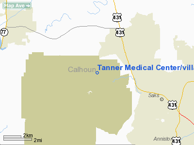
Tanner Medical Center / Villa Rica Heliport |
Location
& QuickFacts
|
FAA Information Effective: |
2007-07-05 |
|
Airport
Identifier: |
87GA |
|
Airport
Status: |
Operational |
|
Longitude/Latitude: |
085-55-26.8850W/33-44-10.3620N
-85.924135/33.736212 (Estimated) |
|
Elevation: |
1000 ft / 304.80 m (Estimated) |
|
Land: |
0
acres |
|
From
nearest city: |
0 nautical miles N of Villa Rica, GA |
|
Location: |
Carroll County, GA |
|
Magnetic Variation: |
01W (1990) |
Owner
& Manager
|
Ownership: |
Publicly owned |
|
Owner: |
Tanner Medical Ctr/villa Rica |
|
Address: |
P.o. Box 638, 601 Dallas Rd
Villa Rica, GA 30180 |
|
Phone number: |
404-459-3681 |
|
Address: |
|
Airport
Operations and Facilities
|
Airport Use: |
Private
MEDICAL USE. |
|
Segmented
Circle: |
No |
|
Control
Tower: |
No |
|
Sectional
chart: |
Atlanta |
|
Region: |
ASO - Southern |
|
Boundary
ARTCC: |
ZTL - Atlanta |
|
Tie-in
FSS: |
MCN - Macon |
|
FSS
on Airport: |
No |
|
FSS
Toll Free: |
1-800-WX-BRIEF |
|
Runway Information
Helipad H1
|
Dimension: |
400 x 200 ft / 121.9 x 61.0 m |
|
Surface: |
ASPH, |
|
|
Runway H1 |
Runway |
|
Traffic
Pattern: |
Left |
Left |
|
Radio Navigation
Aids
|
ID |
Type |
Name |
Ch |
Freq |
Var |
Dist |
|
PLR |
NDB |
Pell City |
|
257.00 |
01E |
19.5 nm |
|
ARF |
NDB |
Saratoga |
|
296.00 |
02W |
34.5 nm |
|
SCD |
NDB |
Sylacauga |
|
284.00 |
03W |
39.1 nm |
|
GPQ |
NDB |
Carrollton |
|
278.00 |
02W |
41.0 nm |
|
BH |
NDB |
Mcden |
|
224.00 |
01W |
48.1 nm |
|
FTP |
NDB |
Fort Payne |
|
426.00 |
01W |
48.8 nm |
|
TDG |
VOR/DME |
Talladega |
025X |
108.80 |
02E |
11.4 nm |
|
GAD |
VOR/DME |
Gadsden |
070X |
112.30 |
02E |
16.5 nm |
|
RMG |
VORTAC |
Rome |
101X |
115.40 |
01E |
47.6 nm |
|
VUZ |
VORTAC |
Vulcan |
091X |
114.40 |
02E |
48.9 nm |
|
BHM |
VOT |
Birmingham Muni |
|
110.00 |
|
42.9 nm |
Remarks
- PRVDD
VFR/PR USE; APCH/DEP RTES ARE FROM 340-020 DEG AND FROM 180-210 DEG;
TKOF/LNDG AREA MKD; & WIND INDICATOR MNTND.
Tanner Medical Center/villa Rica Heliport
Address:
Carroll County, GA
Tel:
404-459-3681
Images
and information placed above are from
http://www.airport-data.com/airport/87GA/
We
thank them for the data!
| General
Info |
| Country |
United
States |
| State |
GEORGIA
|
| FAA ID |
87GA
|
| Latitude |
33-44-10.362N
|
| Longitude |
085-55-26.885W
|
| Elevation |
1000 feet
|
| Near City |
VILLA
RICA |
We don't guarantee the information is fresh and accurate. The data may
be wrong or outdated.
For more up-to-date information please refer to other sources.
|
|


