|
|
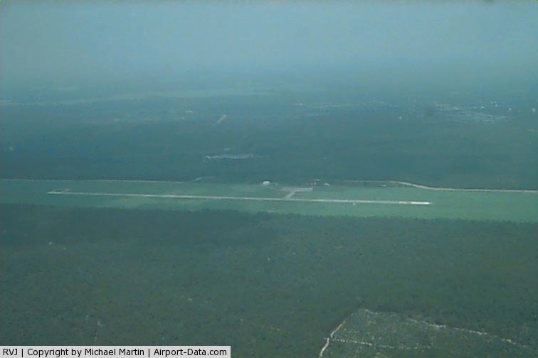
Swinton Smith Field At Reidsville Municipal Airport |
|
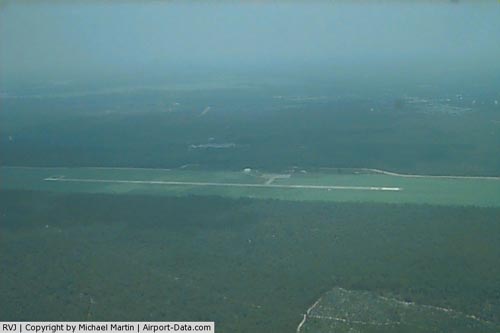 |
(Click on the photo to enlarge) |
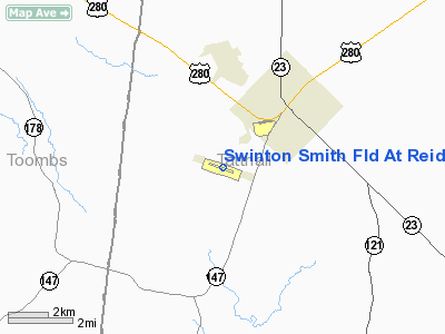
Location
& QuickFacts
|
FAA Information Effective: |
2007-07-05 |
|
Airport
Identifier: |
RVJ |
|
Airport
Status: |
Operational |
|
Longitude/Latitude: |
082-09-06.2000W/32-03-32.3000N
-82.151722/32.058972 (Estimated) |
|
Elevation: |
195 ft / 59.44 m (Surveyed) |
|
Land: |
298 acres |
|
From
nearest city: |
3 nautical miles SW of Reidsville, GA |
|
Location: |
Tattnall County, GA |
|
Magnetic Variation: |
03W (1985) |
Owner
& Manager
|
Ownership: |
Publicly owned |
|
Owner: |
City Of Reidsville |
|
Address: |
Po Box 830, City Hall
Reidsville, GA 30453 |
|
Phone
number: |
912-557-4786 |
|
Manager: |
Burt Register
ALTERNATE AIRPORT CONTACT LAMAR SMITH PO BOX 777 REIDSVILLE,
GA 30453 912-663-6391 |
|
Address: |
Box 2351
Reidsville, GA 30453 |
|
Phone number: |
912-557-7186 |
Airport
Operations and Facilities
|
Airport Use: |
Open to public |
|
Wind
indicator: |
Yes |
|
Segmented
Circle: |
Yes |
|
Control
Tower: |
No |
|
Lighting
Schedule: |
DUSK-DAWN
ACTVT PAPI RYS 11 & 29 - CTAF. MIRL RY 11/29 PRESET
LOW INTST DUSK-2130; TO INCR INTST & ACTVT AFTER 2130
- CTAF. |
|
Beacon
Color: |
Clear-Green (lighted land airport)
OTS INDEFLY. |
|
Landing
fee charge: |
No |
|
Sectional
chart: |
Atlanta |
|
Region: |
ASO - Southern |
|
Boundary
ARTCC: |
ZJX - Jacksonville |
|
Tie-in
FSS: |
MCN - Macon |
|
FSS
on Airport: |
No |
|
FSS
Toll Free: |
1-800-WX-BRIEF |
|
NOTAMs
Facility: |
MCN (NOTAM-d service avaliable) |
|
Federal Agreements: |
NGY |
Airport
Communications
Airport
Services
|
Fuel available: |
100LL |
|
Airframe Repair: |
NONE |
|
Power Plant Repair: |
NONE |
|
Bottled
Oxygen: |
NONE |
|
Bulk
Oxygen: |
NONE |
|
Runway Information
Runway 11/29
|
Dimension: |
3802 x 75 ft / 1158.8 x 22.9 m |
|
Surface: |
ASPH, Fair Condition |
|
Weight
Limit: |
Single wheel: 30000 lbs. |
|
Edge
Lights: |
Medium |
|
|
Runway 11 |
Runway 29 |
|
Longitude: |
082-09-27.2430W |
082-08-45.2412W |
|
Latitude: |
32-03-38.1406N |
32-03-26.4854N |
|
Elevation: |
173.00
ft |
195.00
ft |
|
Alignment: |
108 |
127 |
|
Traffic
Pattern: |
Left |
Left |
|
Markings: |
Non-precision instrument, Poor Condition
RUNWAY MARKINGS BADLY FADED. |
Non-precision instrument, Poor Condition
RUNWAY MARKINGS BADLY FADED. |
|
Crossing
Height: |
28.00
ft |
33.00
ft |
|
VASI: |
2-light PAPI on left side |
2-light PAPI on left side |
|
Visual
Glide Angle: |
3.00° |
3.00° |
|
Radio Navigation
Aids
|
ID |
Type |
Name |
Ch |
Freq |
Var |
Dist |
|
UQN |
NDB |
Onyun |
|
372.00 |
04W |
12.4 nm |
|
CWV |
NDB |
Claxton |
|
395.50 |
04W |
16.1 nm |
|
MHP |
NDB |
Metter |
|
432.00 |
03W |
19.2 nm |
|
BHC |
NDB |
Baxley |
|
376.00 |
04W |
24.1 nm |
|
AZE |
NDB |
Hazlehurst |
|
414.00 |
03W |
27.5 nm |
|
BZ |
NDB |
Bullo |
|
407.00 |
05W |
32.8 nm |
|
JES |
NDB |
Slover |
|
340.00 |
04W |
33.3 nm |
|
MOQ |
NDB |
Mc Intosh |
|
263.00 |
04W |
35.5 nm |
|
MQW |
NDB |
Mc Rae |
|
280.00 |
03W |
37.3 nm |
|
EEX |
NDB |
Emanuel County |
|
309.00 |
04W |
39.6 nm |
|
JYL |
NDB |
Sylvania |
|
245.00 |
04W |
45.4 nm |
|
AMG |
VORTAC |
Alma |
098X |
115.10 |
00E |
36.3 nm |
|
DBN |
VORTAC |
Dublin |
078X |
113.10 |
01W |
45.9 nm |
|
SAV |
VORTAC |
Savannah |
106Y |
115.95 |
06W |
48.8 nm |
|
SAV |
VOT |
Savannah Travis Fld |
|
111.00 |
|
48.5 nm |
Based
Aircraft
|
Aircraft
based on field: |
8 |
|
Single
Engine Airplanes: |
6 |
|
Helicopters: |
2 |
Operational Statistics
Time Period: 2005-06-13
- 2006-06-12
|
Aircraft
Operations: |
79/Week |
|
General
Aviation Local: |
48.8% |
|
General
Aviation Itinerant: |
48.8% |
|
Military: |
2.4% |
Swinton Smith Field At Reidsville Municipal
Airport
Address:
Tattnall County, GA
Tel:
912-557-4786
Images
and information placed above are from
http://www.airport-data.com/airport/RVJ/
We
thank them for the data!
| General
Info |
| Country |
United
States |
| State |
GEORGIA
|
| FAA ID |
RVJ
|
| Time |
UTC-5(-4DT)
|
| Latitude |
32.058971
32° 03' 32.30" N |
| Longitude |
-82.151722
082° 09' 06.20" W |
| Elevation |
195 feet
59 meters |
| Magnetic
Variation |
005° W
(07/06) |
| Beacon |
Yes
|
| Operating
Agency |
U.S.CIVIL
AIRPORT WHEREIN PERMIT COVERS USE BY TRANSIT MILITARY AIRCRAFT
|
| Operating
Hours |
SEE REMARKS
FOR OPERATING HOURS OR COMMUNICATIONS FOR POSSIBLE HOURS |
| Daylight
Saving Time |
Second
Sunday in March at 0200 to first Sunday in November at 0200 local
time (Exception Arizona and that portion of Indiana in the Eastern
Time Zone) |
We don't guarantee the information is fresh and accurate. The data may
be wrong or outdated.
For more up-to-date information please refer to other sources.
|
|