 |
|
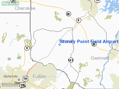
Stoney Point Field Airport |
Location
& QuickFacts
|
FAA Information Effective: |
2007-07-05 |
|
Airport
Identifier: |
6GA0 |
|
Airport
Status: |
Operational |
|
Longitude/Latitude: |
084-11-57.7050W/34-07-57.3520N
-84.199363/34.132598 (Estimated) |
|
Elevation: |
1150 ft / 350.52 m (Estimated) |
|
Land: |
75
acres |
|
From
nearest city: |
5 nautical miles SW of Cumming, GA |
|
Location: |
Forsyth County, GA |
|
Magnetic Variation: |
02W (1985) |
Owner
& Manager
|
Ownership: |
Privately owned |
|
Owner: |
John T. Downing |
|
Address: |
1711 Barnesdale Way, Ne
Atlanta, GA 30309-2601 |
|
Phone
number: |
404-889-0180 |
|
Manager: |
John T. Downing |
|
Address: |
2198 Stoney Point Rd
Cumming, GA 30130 |
|
Phone number: |
404-889-0180 |
Airport
Operations and Facilities
|
Airport Use: |
Private |
|
Wind indicator: |
Yes |
|
Segmented Circle: |
No |
|
Control Tower: |
No |
|
Landing fee charge: |
No |
|
Sectional chart: |
Atlanta |
|
Region: |
ASO - Southern |
|
Boundary ARTCC: |
ZTL - Atlanta |
|
Tie-in FSS: |
MCN - Macon |
|
FSS on Airport: |
No |
|
FSS Toll Free: |
1-800-WX-BRIEF |
Airport
Services
|
Runway Information
Runway 15/33
|
Dimension: |
2500 x 100 ft / 762.0 x 30.5 m |
|
Surface: |
TURF, |
|
|
Runway 15 |
Runway 33 |
|
Traffic
Pattern: |
Left |
Left |
|
Radio Navigation
Aids
|
ID |
Type |
Name |
Ch |
Freq |
Var |
Dist |
|
FKV |
NDB |
Flowery Branch |
|
365.00 |
03W |
15.2 nm |
|
DJD |
NDB |
Canton |
|
415.00 |
04W |
16.0 nm |
|
JZP |
NDB |
Pickens County |
|
285.00 |
04W |
23.4 nm |
|
BR |
NDB |
Redan |
|
266.00 |
02W |
29.8 nm |
|
FT |
NDB |
Flanc |
|
344.00 |
02W |
31.2 nm |
|
EVZ |
NDB |
Cartersville |
|
308.00 |
04W |
32.3 nm |
|
BMW |
NDB |
Barrow County |
|
404.00 |
03W |
32.6 nm |
|
JNM |
NDB |
Monroe |
|
392.00 |
03W |
33.5 nm |
|
DDA |
NDB |
Commerce |
|
244.00 |
03W |
34.0 nm |
|
VOF |
NDB |
Alcovy |
|
370.00 |
03W |
36.7 nm |
|
AJR |
NDB |
Habersham |
|
347.00 |
03W |
39.1 nm |
|
OUK |
NDB |
Calhoun |
|
323.00 |
02W |
39.6 nm |
|
OYD |
NDB |
Floyd |
|
388.00 |
02W |
49.0 nm |
|
BJT |
NDB |
Bulldog |
|
221.00 |
03W |
50.0 nm |
|
DOB |
TACAN |
Dobbins |
077X |
|
01W |
20.2 nm |
|
PDK |
VOR/DME |
Peachtree |
113X |
116.60 |
02W |
16.2 nm |
|
ATL |
VORTAC |
Atlanta |
116X |
116.90 |
00W |
32.5 nm |
|
AHN |
VORTAC |
Athens |
33 |
109.60 |
00E |
45.0 nm |
|
RMG |
VORTAC |
Rome |
101X |
115.40 |
01E |
45.8 nm |
|
ATL |
VOT |
Atlanta Muni |
|
111.00 |
|
30.7 nm |
Remarks
- HANG
GLIDER ACTIVITIES INVOF ARPT.
- VFR
WEATHER CONDITIONS; LANDING AREA IS LIMITED TO PRIVATE USE.
Based
Aircraft
|
Aircraft
based on field: |
1 |
|
Single
Engine Airplanes: |
1 |
Stoney Point Field Airport
Address:
Forsyth County, GA
Tel:
404-889-0180
Images
and information placed above are from
http://www.airport-data.com/airport/6GA0/
We
thank them for the data!
| General
Info |
| Country |
United
States |
| State |
GEORGIA
|
| FAA ID |
6GA0
|
| Latitude |
34-07-57.352N
|
| Longitude |
084-11-57.705W
|
| Elevation |
1150 feet
|
| Near City |
CUMMING
|
We don't guarantee the information is fresh and accurate. The data may
be wrong or outdated.
For more up-to-date information please refer to other sources.
|
|


