 |
|
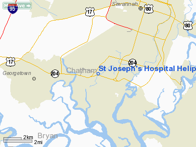
St Joseph's Hospital Heliport |
Location
& QuickFacts
|
FAA Information Effective: |
2007-07-05 |
|
Airport
Identifier: |
46GA |
|
Airport
Status: |
Operational |
|
Longitude/Latitude: |
081-09-20.4000W/31-59-05.7580N
-81.155667/31.984933 (Estimated) |
|
Elevation: |
26
ft / 7.92 m (Estimated) |
|
Land: |
0
acres |
|
From
nearest city: |
7 nautical miles N of Savannah, GA |
|
Location: |
Chatham County, GA |
|
Magnetic Variation: |
04W (1986) |
Owner
& Manager
|
Ownership: |
Privately owned |
|
Owner: |
St Joseph's Hospital |
|
Address: |
11705 Mercy Blvd.
Savannah, GA 31419 |
|
Phone
number: |
912-925-4100 |
|
Manager: |
John Britt |
|
Address: |
11705 Mercy Blvd
Savannah, GA 31419 |
|
Phone number: |
912-927-5421 |
Airport
Operations and Facilities
|
Airport Use: |
Private
MEDICAL. |
|
Wind
indicator: |
No |
|
Segmented
Circle: |
No |
|
Control
Tower: |
No |
|
Lighting
Schedule: |
DUSK-DAWN |
|
Landing
fee charge: |
No |
|
Sectional
chart: |
Charlotte |
|
Region: |
ASO - Southern |
|
Boundary
ARTCC: |
ZJX - Jacksonville |
|
Tie-in
FSS: |
MCN - Macon |
|
FSS
on Airport: |
No |
|
FSS
Toll Free: |
1-800-WX-BRIEF |
|
Runway Information
Helipad H1
|
Dimension: |
45 x 45 ft / 13.7 x 13.7 m |
|
Surface: |
CONC, |
|
|
Runway H1 |
Runway |
|
Traffic
Pattern: |
Left |
Left |
|
Radio Navigation
Aids
|
ID |
Type |
Name |
Ch |
Freq |
Var |
Dist |
|
MOQ |
NDB |
Mc Intosh |
|
263.00 |
04W |
20.3 nm |
|
BZ |
NDB |
Bullo |
|
407.00 |
05W |
36.6 nm |
|
CWV |
NDB |
Claxton |
|
395.50 |
04W |
39.1 nm |
|
JES |
NDB |
Slover |
|
340.00 |
04W |
45.5 nm |
|
JYL |
NDB |
Sylvania |
|
245.00 |
04W |
45.7 nm |
|
NBC |
TACAN |
Beaufort |
042X |
|
05W |
37.1 nm |
|
SVN |
VOR/DME |
Hunter |
53X |
111.60 |
02W |
1.8 nm |
|
SAV |
VORTAC |
Savannah |
106Y |
115.95 |
06W |
9.9 nm |
|
SAV |
VOT |
Savannah Travis Fld |
|
111.00 |
|
8.9 nm |
|
BQK |
VOT |
Brunswick |
|
111.00 |
|
45.5 nm |
Remarks
St Joseph's Hospital Heliport
Address:
Chatham County, GA
Tel:
912-925-4100,
912-927-5421
Images
and information placed above are from
http://www.airport-data.com/airport/46GA/
We
thank them for the data!
| General
Info |
| Country |
United
States |
| State |
GEORGIA
|
| FAA ID |
46GA
|
| Latitude |
31-59-05.758N
|
| Longitude |
081-09-20.400W
|
| Elevation |
26 feet
|
| Near City |
SAVANNAH
|
We don't guarantee the information is fresh and accurate. The data may
be wrong or outdated.
For more up-to-date information please refer to other sources.
|
|


