 |
|
Location
& QuickFacts
|
FAA Information Effective: |
2007-07-05 |
|
Airport
Identifier: |
18GA |
|
Airport
Status: |
Operational |
|
Longitude/Latitude: |
083-39-27.6200W/33-41-35.4250N
-83.657672/33.693174 (Estimated) |
|
Elevation: |
750 ft / 228.60 m (Estimated) |
|
Land: |
0 acres |
|
From
nearest city: |
3 nautical miles NE of Social Circle, GA |
|
Location: |
Walton County, GA |
|
Magnetic Variation: |
03W (1985) |
Owner
& Manager
|
Ownership: |
Privately owned |
|
Owner: |
C. S. Thomas |
|
Address: |
3825 Mt Paran Church Rd, Se
Social Circle, GA 30279 |
|
Phone
number: |
404-464-2042 |
|
Manager: |
C. S. Thomas |
|
Address: |
3825 Mt Paran Church Rd, Se
Social Circle, GA 30279 |
|
Phone number: |
404-464-2042 |
Airport
Operations and Facilities
|
Airport Use: |
Private |
|
Wind
indicator: |
Yes |
|
Segmented
Circle: |
No |
|
Control
Tower: |
No |
|
Landing
fee charge: |
No |
|
Sectional
chart: |
Charlotte |
|
Region: |
ASO - Southern |
|
Boundary
ARTCC: |
ZTL - Atlanta |
|
Tie-in
FSS: |
MCN - Macon |
|
FSS
on Airport: |
No |
|
FSS
Toll Free: |
1-800-WX-BRIEF |
|
Runway Information
Runway 16/34
|
Dimension: |
2600 x 22 ft / 792.5 x 6.7 m |
|
Surface: |
ASPH, |
|
|
Runway 16 |
Runway 34 |
|
Traffic
Pattern: |
Left |
Left |
|
Obstruction: |
40 ft trees, 1000.0 ft from runway |
60 ft trees, 600.0 ft from runway |
|
Radio Navigation
Aids
|
ID |
Type |
Name |
Ch |
Freq |
Var |
Dist |
|
JNM |
NDB |
Monroe |
|
392.00 |
03W |
4.4 nm |
|
VOF |
NDB |
Alcovy |
|
370.00 |
03W |
7.3 nm |
|
BMW |
NDB |
Barrow County |
|
404.00 |
03W |
15.0 nm |
|
DDA |
NDB |
Commerce |
|
244.00 |
03W |
23.2 nm |
|
BJT |
NDB |
Bulldog |
|
221.00 |
03W |
26.8 nm |
|
VV |
NDB |
Junne |
|
353.00 |
05W |
32.0 nm |
|
BR |
NDB |
Redan |
|
266.00 |
02W |
32.8 nm |
|
FKV |
NDB |
Flowery Branch |
|
365.00 |
03W |
33.1 nm |
|
UMB |
NDB |
Culvr |
|
380.00 |
04W |
41.0 nm |
|
JHH |
NDB |
Griffin |
|
412.00 |
04W |
41.9 nm |
|
IIY |
NDB |
Washington/wilkes County |
|
435.00 |
03W |
42.5 nm |
|
FF |
NDB |
Pecat |
|
316.00 |
02W |
47.8 nm |
|
AJR |
NDB |
Habersham |
|
347.00 |
03W |
48.9 nm |
|
FT |
NDB |
Flanc |
|
344.00 |
02W |
49.2 nm |
|
DOB |
TACAN |
Dobbins |
077X |
|
01W |
44.5 nm |
|
PDK |
VOR/DME |
Peachtree |
113X |
116.60 |
02W |
33.9 nm |
|
AHN |
VORTAC |
Athens |
33 |
109.60 |
00E |
22.6 nm |
|
ATL |
VORTAC |
Atlanta |
116X |
116.90 |
00W |
39.1 nm |
|
ATL |
VOT |
Atlanta Muni |
|
111.00 |
|
38.5 nm |
Remarks
Based
Aircraft
|
Aircraft
based on field: |
1 |
|
Single
Engine Airplanes: |
1 |
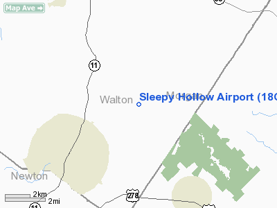
Sleepy Hollow Airport
Address:
Walton County, GA
Tel:
404-464-2042
Images
and information placed above are from
http://www.airport-data.com/airport/18GA/
We
thank them for the data!
| General
Info |
| Country |
United
States |
| State |
GEORGIA
|
| FAA ID |
18GA
|
| Latitude |
33-41-35.425N
|
| Longitude |
083-39-27.620W
|
| Elevation |
750 feet
|
| Near City |
SOCIAL
CIRCLE |
We don't guarantee the information is fresh and accurate. The data may
be wrong or outdated.
For more up-to-date information please refer to other sources.
|
|


