 |
|
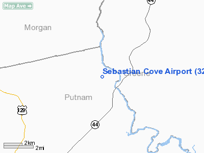
Location
& QuickFacts
|
FAA Information Effective: |
2007-07-05 |
|
Airport
Identifier: |
32GA |
|
Airport
Status: |
Operational |
|
Longitude/Latitude: |
083-16-40.0000W/33-27-15.0000N
-83.277778/33.454167 (Estimated) |
|
Elevation: |
490 ft / 149.35 m (Estimated) |
|
Land: |
0 acres |
|
From
nearest city: |
9 nautical miles NE of Eatonton, GA |
|
Location: |
Putnam County, GA |
|
Magnetic Variation: |
03W (1990) |
Owner
& Manager
|
Ownership: |
Privately owned |
|
Owner: |
Airstrip Homeowners Assn, Inc |
|
Address: |
96 Whitney Street, Ne
Eatonton, GA 31024 |
|
Phone
number: |
706-485-0809 |
|
Manager: |
Joseph E. Schneider |
|
Address: |
96 Whitney Street, Ne
Eatonton, GA 31024 |
|
Phone number: |
706-485-0809 |
Airport
Operations and Facilities
|
Airport Use: |
Private |
|
Wind
indicator: |
Yes |
|
Segmented
Circle: |
No |
|
Control
Tower: |
No |
|
Sectional
chart: |
Atlanta |
|
Region: |
ASO - Southern |
|
Boundary
ARTCC: |
ZTL - Atlanta |
|
Tie-in
FSS: |
MCN - Macon |
|
FSS
on Airport: |
No |
|
FSS
Toll Free: |
1-800-WX-BRIEF |
|
Runway Information
Runway 08/26
|
Dimension: |
2700 x 175 ft / 823.0 x 53.3 m |
|
Surface: |
TURF, Fair Condition |
|
|
Runway 08 |
Runway 26 |
|
Traffic
Pattern: |
Left |
Left |
|
Radio Navigation
Aids
|
ID |
Type |
Name |
Ch |
Freq |
Var |
Dist |
|
VV |
NDB |
Junne |
|
353.00 |
05W |
17.3 nm |
|
UMB |
NDB |
Culvr |
|
380.00 |
04W |
19.1 nm |
|
VOF |
NDB |
Alcovy |
|
370.00 |
03W |
27.4 nm |
|
JNM |
NDB |
Monroe |
|
392.00 |
03W |
28.2 nm |
|
BJT |
NDB |
Bulldog |
|
221.00 |
03W |
30.0 nm |
|
IIY |
NDB |
Washington/wilkes County |
|
435.00 |
03W |
30.2 nm |
|
HIT |
NDB |
Kaolin |
|
360.00 |
05W |
31.3 nm |
|
BMW |
NDB |
Barrow County |
|
404.00 |
03W |
32.9 nm |
|
AA |
NDB |
Cedar |
|
341.00 |
04W |
33.6 nm |
|
HQU |
NDB |
Thomson-mcduffie |
|
333.00 |
04W |
38.5 nm |
|
DDA |
NDB |
Commerce |
|
244.00 |
03W |
38.5 nm |
|
AHN |
VORTAC |
Athens |
33 |
109.60 |
00E |
29.8 nm |
|
MCN |
VORTAC |
Macon |
089X |
114.20 |
01E |
49.5 nm |
Remarks
- 1043
FT MSL TWR (OBSTR MARKED & LIGHTED) 1.7 NM EAST OF RY 26.
- PROVIDED
ALL OPERS CONDUCTED IN VFR CONDITIONS & LNDG AREA IS PVT USE.
Based
Aircraft
|
Aircraft
based on field: |
3 |
|
Single
Engine Airplanes: |
2 |
|
Multi
Engine Airplanes: |
1 |
Sebastian Cove Airport
Address:
Putnam County, GA
Tel:
706-485-0809
Images
and information placed above are from
http://www.airport-data.com/airport/32GA/
We
thank them for the data!
| General
Info |
| Country |
United
States |
| State |
GEORGIA
|
| FAA ID |
32GA
|
| Latitude |
33-27-15.000N
|
| Longitude |
083-16-40.000W
|
| Elevation |
490 feet
|
| Near City |
EATONTON
|
We don't guarantee the information is fresh and accurate. The data may
be wrong or outdated.
For more up-to-date information please refer to other sources.
|
|


