 |
|
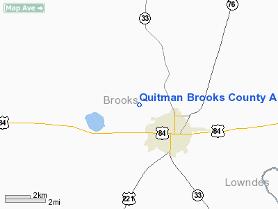
Quitman Brooks County Airport |
|
|
Location
& QuickFacts
|
FAA Information Effective: |
2007-07-05 |
|
Airport
Identifier: |
4J5 |
|
Airport
Status: |
Operational |
|
Longitude/Latitude: |
083-35-11.5760W/30-48-20.7050N
-83.586549/30.805751 (Estimated) |
|
Elevation: |
185 ft / 56.39 m (Surveyed) |
|
Land: |
200 acres |
|
From
nearest city: |
2 nautical miles NW of Quitman, GA |
|
Location: |
Brooks County, GA |
|
Magnetic Variation: |
02W (1985) |
Owner
& Manager
|
Ownership: |
Publicly owned |
|
Owner: |
City Of Quitman / Brooks County |
|
Address: |
610 South Highland Rd
Quitman, GA 31643 |
|
Phone
number: |
229-263-5561 |
|
Manager: |
Gavin Laurie, Cmn A/p Auth |
|
Address: |
Po Box 495, 1575 Moultrie Hwy
Quitman, GA 31643 |
|
Phone number: |
229-263-8621 |
Airport
Operations and Facilities
|
Airport Use: |
Open to public |
|
Wind
indicator: |
Yes |
|
Segmented
Circle: |
No |
|
Control
Tower: |
No |
|
Lighting
Schedule: |
DUSK-2000
MIRL RY 09/27 & PAPI RYS 09 & 27 PRESET ON LOW INTST
DUSK-2000, TO INCR INTST ACTVT - CTAF. AFTER 2000 ACTVT - CTAF. |
|
Landing
fee charge: |
No |
|
Sectional
chart: |
Jacksonville |
|
Region: |
ASO - Southern |
|
Boundary
ARTCC: |
ZJX - Jacksonville |
|
Tie-in
FSS: |
MCN - Macon |
|
FSS
on Airport: |
No |
|
FSS
Toll Free: |
1-800-WX-BRIEF |
|
NOTAMs
Facility: |
MCN (NOTAM-d service avaliable) |
|
Federal Agreements: |
N1 |
Airport
Communications
Airport
Services
|
Fuel available: |
100LLA |
|
Airframe Repair: |
MINOR |
|
Power Plant Repair: |
MINOR |
|
Runway Information
Runway 09/27
|
Dimension: |
3600 x 75 ft / 1097.3 x 22.9 m |
|
Surface: |
ASPH, Good Condition |
|
Edge
Lights: |
Medium |
|
|
Runway 09 |
Runway 27 |
|
Traffic
Pattern: |
Left |
Left |
|
Markings: |
Non-precision instrument, Fair Condition
RY 09/27 MARKINGS FADED. |
Non-precision instrument, Fair Condition |
|
VASI: |
2-light PAPI on left side |
2-light PAPI on left side |
|
Obstruction: |
40 ft trees, 200.0 ft from runway, 39L/ ft
right of centerline
+30 FT TREES 175 FT FM THLD 135 FT RIGHT & LEFT OF CNTRLN. |
22 ft pole, 926.0 ft from runway, 150 ft left
of centerline, 33:1 slope to clear |
|
Radio Navigation
Aids
|
ID |
Type |
Name |
Ch |
Freq |
Var |
Dist |
|
GTP |
NDB |
Patten |
|
245.00 |
02W |
15.4 nm |
|
CYR |
NDB |
Caidy |
|
338.00 |
01W |
30.0 nm |
|
TM |
NDB |
Tifto |
|
409.00 |
03W |
34.3 nm |
|
CXU |
NDB |
Camilla |
|
369.00 |
02W |
41.5 nm |
|
HOE |
NDB |
Homerville |
|
209.00 |
03W |
44.6 nm |
|
FPY |
NDB |
Foley |
|
254.00 |
03W |
48.7 nm |
|
TL |
NDB |
Wakul |
|
379.00 |
01W |
49.3 nm |
|
LYZ |
NDB |
Willis |
|
359.00 |
01W |
49.5 nm |
|
OWC |
NDB |
Coffee County |
|
390.00 |
03W |
49.6 nm |
|
IFM |
VOR |
Tift Myers |
|
112.50 |
01W |
37.8 nm |
|
OTK |
VOR/DME |
Valdosta |
095X |
114.80 |
02W |
15.9 nm |
|
MGR |
VOR/DME |
Moultrie |
025X |
108.80 |
02W |
20.1 nm |
|
GEF |
VORTAC |
Greenville |
027X |
109.00 |
01E |
18.4 nm |
|
VAD |
VORTAC |
Moody |
080X |
113.30 |
03W |
22.3 nm |
|
SZW |
VORTAC |
Seminole |
122X |
117.50 |
02E |
43.4 nm |
|
TLH |
VOT |
Tallahassee Muni |
|
111.00 |
|
46.7 nm |
Remarks
Based
Aircraft
|
Aircraft
based on field: |
29 |
|
Single
Engine Airplanes: |
19 |
|
Multi
Engine Airplanes: |
3 |
|
Gliders: |
3 |
|
Ultralights: |
4 |
Operational Statistics
Time Period: 2006-04-17
- 2007-04-16
|
Aircraft
Operations: |
212/Week |
|
General
Aviation Local: |
81.8% |
|
General
Aviation Itinerant: |
18.2% |
Quitman Brooks County Airport
Address:
Brooks County, GA
Tel:
229-263-5561,
229-263-8621
Images
and information placed above are from
http://www.airport-data.com/airport/4J5/
We
thank them for the data!
| General
Info |
| Country |
United
States |
| State |
GEORGIA
|
| FAA ID |
4J5
|
| Latitude |
30-48-20.705N
|
| Longitude |
083-35-11.576W
|
| Elevation |
185 feet
|
| Near City |
QUITMAN
|
We don't guarantee the information is fresh and accurate. The data may
be wrong or outdated.
For more up-to-date information please refer to other sources.
|
|


