 |
|
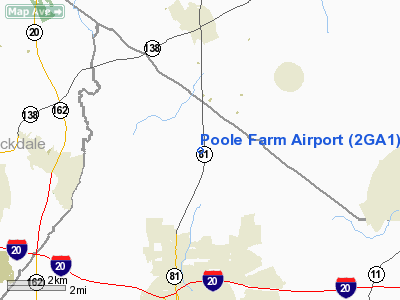
Location
& QuickFacts
|
FAA Information Effective: |
2007-07-05 |
|
Airport
Identifier: |
2GA1 |
|
Airport
Status: |
Operational |
|
Longitude/Latitude: |
083-51-09.6550W/33-40-50.4070N
-83.852682/33.680669 (Estimated) |
|
Elevation: |
830 ft / 252.98 m (Estimated) |
|
Land: |
0
acres |
|
From
nearest city: |
3 nautical miles N of Oxford, GA |
|
Location: |
Newton County, GA |
|
Magnetic Variation: |
02W (1985) |
Owner
& Manager
|
Ownership: |
Privately owned |
|
Owner: |
Irene B. Poole |
|
Address: |
3151 Laventure Drive
Atlanta, GA 30341 |
|
Phone
number: |
770-457-7340 |
|
Manager: |
Joseph D. Poole & Robert E. Poole |
|
Address: |
3151 Laventure Drive
Atlanta, GA 30341 |
|
Phone number: |
770-457-7340 |
Airport
Operations and Facilities
|
Airport Use: |
Private |
|
Segmented Circle: |
No |
|
Control Tower: |
No |
|
Landing fee charge: |
No |
|
Sectional chart: |
Atlanta |
|
Region: |
ASO - Southern |
|
Boundary ARTCC: |
ZTL - Atlanta |
|
Tie-in FSS: |
MCN - Macon |
|
FSS on Airport: |
No |
|
FSS Toll Free: |
1-800-WX-BRIEF |
Airport
Services
|
Airframe Repair: |
NONE |
|
Power Plant Repair: |
NONE |
|
Runway Information
Runway 12/30
|
Dimension: |
1400 x 80 ft / 426.7 x 24.4 m |
|
Surface: |
TURF, |
|
|
Runway 12 |
Runway 30 |
|
Traffic
Pattern: |
Left |
Left |
|
Runway 17/35
|
Dimension: |
2000 x 200 ft / 609.6 x 61.0 m |
|
Surface: |
TURF, |
|
|
Runway 17 |
Runway 35 |
|
Traffic
Pattern: |
Left |
Left |
|
Radio Navigation
Aids
|
ID |
Type |
Name |
Ch |
Freq |
Var |
Dist |
|
VOF |
NDB |
Alcovy |
|
370.00 |
03W |
4.7 nm |
|
JNM |
NDB |
Monroe |
|
392.00 |
03W |
7.2 nm |
|
BMW |
NDB |
Barrow County |
|
404.00 |
03W |
20.2 nm |
|
BR |
NDB |
Redan |
|
266.00 |
02W |
23.0 nm |
|
DDA |
NDB |
Commerce |
|
244.00 |
03W |
28.3 nm |
|
FKV |
NDB |
Flowery Branch |
|
365.00 |
03W |
31.5 nm |
|
JHH |
NDB |
Griffin |
|
412.00 |
04W |
35.3 nm |
|
BJT |
NDB |
Bulldog |
|
221.00 |
03W |
35.6 nm |
|
FF |
NDB |
Pecat |
|
316.00 |
02W |
39.1 nm |
|
FT |
NDB |
Flanc |
|
344.00 |
02W |
39.6 nm |
|
VV |
NDB |
Junne |
|
353.00 |
05W |
41.7 nm |
|
DJD |
NDB |
Canton |
|
415.00 |
04W |
46.7 nm |
|
UMB |
NDB |
Culvr |
|
380.00 |
04W |
47.1 nm |
|
OP |
NDB |
Yates |
|
339.00 |
03W |
48.8 nm |
|
DOB |
TACAN |
Dobbins |
077X |
|
01W |
35.6 nm |
|
PDK |
VOR/DME |
Peachtree |
113X |
116.60 |
02W |
25.2 nm |
|
ATL |
VORTAC |
Atlanta |
116X |
116.90 |
00W |
29.3 nm |
|
AHN |
VORTAC |
Athens |
33 |
109.60 |
00E |
30.9 nm |
|
ATL |
VOT |
Atlanta Muni |
|
111.00 |
|
28.7 nm |
Remarks
Based
Aircraft
|
Aircraft
based on field: |
1 |
|
Single
Engine Airplanes: |
1 |
Poole Farm Airport
Address:
Newton County, GA
Tel:
770-457-7340
Images
and information placed above are from
http://www.airport-data.com/airport/2GA1/
We
thank them for the data!
| General
Info |
| Country |
United
States |
| State |
GEORGIA
|
| FAA ID |
2GA1
|
| Latitude |
33-40-50.407N
|
| Longitude |
083-51-09.655W
|
| Elevation |
830 feet
|
| Near City |
OXFORD
|
We don't guarantee the information is fresh and accurate. The data may
be wrong or outdated.
For more up-to-date information please refer to other sources.
|
|


