 |
|
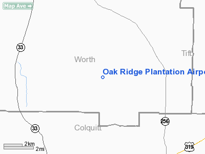
Oak Ridge Plantation Airport |
Location
& QuickFacts
|
FAA Information Effective: |
2007-07-05 |
|
Airport
Identifier: |
13GA |
|
Airport
Status: |
Operational |
|
Longitude/Latitude: |
083-45-17.6280W/31-21-59.6590N
-83.754897/31.366572 (Estimated) |
|
Elevation: |
350 ft / 106.68 m (Estimated) |
|
Land: |
0
acres |
|
From
nearest city: |
13 nautical miles SE of Sylvester, GA |
|
Location: |
Worth County, GA |
|
Magnetic Variation: |
02W (1985) |
Owner
& Manager
|
Ownership: |
Privately owned |
|
Owner: |
C. Laird/n. Crosswell |
|
Address: |
Route 1 Box 1000
Sumner, GA 31789 |
|
Phone
number: |
912-776-4900 |
|
Manager: |
John Cox |
|
Address: |
1684 Wrights Chapel Road
Sumner, GA 31789 |
|
Phone number: |
229-776-9643 |
Airport
Operations and Facilities
|
Airport Use: |
Private |
|
Wind indicator: |
Yes |
|
Segmented Circle: |
No |
|
Control Tower: |
No |
|
Sectional chart: |
Jacksonville |
|
Region: |
ASO - Southern |
|
Boundary ARTCC: |
ZJX - Jacksonville |
|
Tie-in FSS: |
MCN - Macon |
|
FSS Toll Free: |
1-800-WX-BRIEF |
Airport
Communications
|
Runway Information
Runway 16/34
|
Dimension: |
3400 x 150 ft / 1036.3 x 45.7 m |
|
Surface: |
TURF, |
|
|
Runway 16 |
Runway 34 |
|
Traffic
Pattern: |
Left |
Left |
|
Obstruction: |
75 ft trees, 100.0 ft from runway |
75 ft trees, 250.0 ft from runway |
|
Radio Navigation
Aids
|
ID |
Type |
Name |
Ch |
Freq |
Var |
Dist |
|
TM |
NDB |
Tifto |
|
409.00 |
03W |
16.0 nm |
|
GTP |
NDB |
Patten |
|
245.00 |
02W |
24.9 nm |
|
CXU |
NDB |
Camilla |
|
369.00 |
02W |
26.4 nm |
|
AB |
NDB |
Putny |
|
227.00 |
02W |
27.3 nm |
|
SUR |
NDB |
Fitzgerald |
|
362.00 |
03W |
28.0 nm |
|
CYR |
NDB |
Caidy |
|
338.00 |
01W |
35.5 nm |
|
OHY |
NDB |
Coney |
|
400.00 |
02W |
38.3 nm |
|
OWC |
NDB |
Coffee County |
|
390.00 |
03W |
42.7 nm |
|
LYZ |
NDB |
Willis |
|
359.00 |
01W |
46.2 nm |
|
IFM |
VOR |
Tift Myers |
|
112.50 |
01W |
14.2 nm |
|
MGR |
VOR/DME |
Moultrie |
025X |
108.80 |
02W |
17.3 nm |
|
OTK |
VOR/DME |
Valdosta |
095X |
114.80 |
02W |
42.9 nm |
|
PZD |
VORTAC |
Pecan |
108X |
116.10 |
02W |
32.6 nm |
|
VAD |
VORTAC |
Moody |
080X |
113.30 |
03W |
37.8 nm |
|
GEF |
VORTAC |
Greenville |
027X |
109.00 |
01E |
49.0 nm |
Remarks
Based Aircraft
|
Aircraft
based on field: |
1 |
|
Multi
Engine Airplanes: |
1 |
Oak Ridge Plantation Airport
Address:
Worth County, GA
Tel:
912-776-4900,
229-776-9643
Images
and information placed above are from
http://www.airport-data.com/airport/13GA/
We
thank them for the data!
| General
Info |
| Country |
United
States |
| State |
GEORGIA
|
| FAA ID |
13GA
|
| Latitude |
31-21-59.659N
|
| Longitude |
083-45-17.628W
|
| Elevation |
350 feet
|
| Near City |
SYLVESTER
|
We don't guarantee the information is fresh and accurate. The data may
be wrong or outdated.
For more up-to-date information please refer to other sources.
|
|


