 |
|
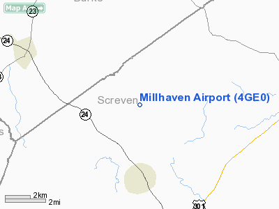
Location
& QuickFacts
|
FAA Information Effective: |
2007-07-05 |
|
Airport
Identifier: |
4GE0 |
|
Airport
Status: |
Operational |
|
Longitude/Latitude: |
081-39-43.3990W/32-56-09.5700N
-81.662055/32.935992 (Estimated) |
|
Elevation: |
164 ft / 49.99 m (Surveyed) |
|
Land: |
10
acres |
|
From
nearest city: |
1 nautical miles W of Millhaven, GA |
|
Location: |
Screven County, GA |
|
Magnetic Variation: |
04W (1985) |
Owner
& Manager
|
Ownership: |
Privately owned |
|
Owner: |
Millhaven Corp. |
|
Address: |
1545 Millhaven Rd
Sylvania, GA 30467 |
|
Phone
number: |
912-829-4742 |
|
Manager: |
Charles J. Gentry |
|
Address: |
Millhaven Corp., 1545 Millhaven Rd
Sylvania, GA 30467 |
|
Phone number: |
912-829-4742 |
Airport
Operations and Facilities
|
Airport Use: |
Private |
|
Wind indicator: |
Yes |
|
Segmented Circle: |
No |
|
Control Tower: |
No |
|
Landing fee charge: |
No |
|
Sectional chart: |
Atlanta |
|
Region: |
ASO - Southern |
|
Boundary ARTCC: |
ZJX - Jacksonville |
|
Tie-in FSS: |
MCN - Macon |
|
FSS on Airport: |
No |
|
FSS Toll Free: |
1-800-WX-BRIEF |
Airport
Services
|
Airframe Repair: |
NONE |
|
Power Plant Repair: |
NONE |
|
Runway Information
Runway 07/25
|
Dimension: |
1875 x 80 ft / 571.5 x 24.4 m |
|
Surface: |
TURF, |
|
|
Runway 07 |
Runway 25 |
|
Traffic
Pattern: |
Left |
Left |
|
Obstruction: |
48 ft pline, 200.0 ft from runway, 4:1 slope
to clear |
54 ft trees, 201.0 ft from runway, 90 ft left
of centerline, 3:1 slope to clear |
|
Runway 13/31
|
Dimension: |
3400 x 135 ft / 1036.3 x 41.1 m |
|
Surface: |
TURF, |
|
|
Runway 13 |
Runway 31 |
|
Traffic
Pattern: |
Left |
Left |
|
Obstruction: |
78 ft trees, 1770.0 ft from runway, 22:1 slope
to clear |
47 ft trees, 300.0 ft from runway, 99 ft left
of centerline, 6:1 slope to clear |
|
Radio Navigation
Aids
|
ID |
Type |
Name |
Ch |
Freq |
Var |
Dist |
|
LNH |
NDB |
Millen |
|
205.00 |
05W |
15.6 nm |
|
JYL |
NDB |
Sylvania |
|
245.00 |
04W |
17.6 nm |
|
BXG |
NDB |
Burke County |
|
356.00 |
04W |
18.4 nm |
|
BKO |
NDB |
Barnwell |
|
392.00 |
06W |
27.4 nm |
|
BZ |
NDB |
Bullo |
|
407.00 |
05W |
31.3 nm |
|
EMR |
NDB |
Emory |
|
385.00 |
04W |
35.9 nm |
|
MHP |
NDB |
Metter |
|
432.00 |
03W |
40.0 nm |
|
AIK |
NDB |
Aiken |
|
347.00 |
04W |
43.0 nm |
|
EEX |
NDB |
Emanuel County |
|
309.00 |
04W |
43.1 nm |
|
CWV |
NDB |
Claxton |
|
395.50 |
04W |
45.8 nm |
|
OYI |
NDB |
Orangeburg |
|
226.00 |
05W |
47.8 nm |
|
ALD |
VOR |
Allendale |
|
116.70 |
01W |
19.2 nm |
Remarks
Millhaven Airport
Address:
Screven County, GA
Tel:
912-829-4742
Images
and information placed above are from
http://www.airport-data.com/airport/4GE0/
We
thank them for the data!
| General
Info |
| Country |
United
States |
| State |
GEORGIA
|
| FAA ID |
4GE0
|
| Latitude |
32-56-09.570N
|
| Longitude |
081-39-43.399W
|
| Elevation |
164 feet
|
| Near City |
MILLHAVEN
|
We don't guarantee the information is fresh and accurate. The data may
be wrong or outdated.
For more up-to-date information please refer to other sources.
|
|


