 |
|
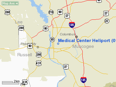
Location
& QuickFacts
|
FAA Information Effective: |
2007-07-05 |
|
Airport
Identifier: |
01GA |
|
Airport
Status: |
Operational |
|
Longitude/Latitude: |
084-58-44.7540W/32-28-45.5120N
-84.979098/32.479309 (Estimated) |
|
Elevation: |
319 ft / 97.23 m (Estimated) |
|
Land: |
0
acres |
|
From
nearest city: |
3 nautical miles NW of Columbus, GA |
|
Location: |
Muscogee County, GA |
|
Magnetic Variation: |
01W (1985) |
Owner
& Manager
|
Ownership: |
Privately owned |
|
Owner: |
The Medical Center, Inc. |
|
Address: |
Po Box 951
Columbus, GA 31994 |
|
Phone number: |
404-571-1000 |
|
Manager: |
Robert E. Brown |
|
Address: |
Po Box 951
Columbus, GA 31994 |
|
Phone number: |
404-571-1299 |
Airport
Operations and Facilities
|
Airport Use: |
Private
MEDICAL. |
|
Wind
indicator: |
Yes |
|
Segmented
Circle: |
Yes |
|
Control
Tower: |
No |
|
Lighting
Schedule: |
DUSK-DAWN |
|
Sectional
chart: |
Atlanta |
|
Region: |
ASO - Southern |
|
Boundary
ARTCC: |
ZTL - Atlanta |
|
Tie-in
FSS: |
MCN - Macon |
|
FSS
Toll Free: |
1-800-WX-BRIEF |
|
Runway Information
Helipad H1
|
Dimension: |
65 x 65 ft / 19.8 x 19.8 m |
|
Surface: |
CONC, |
|
|
Runway H1 |
Runway |
|
Traffic
Pattern: |
Left |
Left |
|
Radio Navigation
Aids
|
ID |
Type |
Name |
Ch |
Freq |
Var |
Dist |
|
AWS |
NDB |
Lawson |
|
335.00 |
02W |
11.4 nm |
|
PIM |
NDB |
Pine Mountain |
|
272.00 |
03W |
22.5 nm |
|
LKG |
NDB |
Lindbergh |
|
242.00 |
03W |
47.9 nm |
|
OP |
NDB |
Yates |
|
339.00 |
03W |
48.0 nm |
|
EQQ |
NDB |
Coweta County |
|
234.00 |
03W |
48.6 nm |
|
IZS |
NDB |
Montezuma |
|
426.00 |
04W |
49.8 nm |
|
LSF |
VOR/DME |
Lawson |
051X |
111.40 |
02W |
8.9 nm |
|
TGE |
VOR/DME |
Tuskegee |
120X |
117.30 |
02E |
35.0 nm |
|
CSG |
VORTAC |
Columbus |
118X |
117.10 |
01E |
8.4 nm |
|
EUF |
VORTAC |
Eufaula |
029X |
109.20 |
02E |
32.7 nm |
|
LGC |
VORTAC |
Lagrange |
103X |
115.60 |
01E |
36.1 nm |
Remarks
Medical Center Heliport
Address:
Muscogee County, GA
Tel:
404-571-1000, 404-571-1299
Images
and information placed above are from
http://www.airport-data.com/airport/01GA/
We
thank them for the data!
| General
Info |
| Country |
United
States |
| State |
GEORGIA
|
| FAA ID |
01GA
|
| Latitude |
32-28-45.512N
|
| Longitude |
084-58-44.754W
|
| Elevation |
319 feet
|
| Near City |
COLUMBUS
|
We don't guarantee the information is fresh and accurate. The data may
be wrong or outdated.
For more up-to-date information please refer to other sources.
|
|


