 |
|
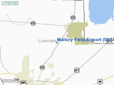
Location
& QuickFacts
|
FAA Information Effective: |
2007-07-05 |
|
Airport
Identifier: |
50GA |
|
Airport
Status: |
Operational |
|
Longitude/Latitude: |
083-14-03.0000W/30-57-03.0000N
-83.234167/30.950833 (Estimated) |
|
Elevation: |
202 ft / 61.57 m (Estimated) |
|
Land: |
10
acres |
|
From
nearest city: |
8 nautical miles N of Valdosta, GA |
|
Location: |
Lowndes County, GA |
|
Magnetic Variation: |
03W (1995) |
Owner
& Manager
|
Ownership: |
Privately owned |
|
Owner: |
Tyrone D. Mallory |
|
Address: |
5131 Bemiss Road
Valdosta, GA 31605 |
|
Phone number: |
912-244-9117 |
|
Manager: |
Tyrone D. Mallory |
|
Address: |
5131 Bemiss Road
Valdosta, GA 31605 |
|
Phone number: |
912-244-9117 |
Airport
Operations and Facilities
|
Airport Use: |
Private |
|
Wind
indicator: |
No |
|
Segmented
Circle: |
No |
|
Control
Tower: |
No |
|
Sectional
chart: |
Jacksonville |
|
Region: |
ASO - Southern |
|
Boundary
ARTCC: |
ZJX - Jacksonville |
|
Tie-in
FSS: |
MCN - Macon |
|
FSS
Toll Free: |
1-800-WX-BRIEF |
|
Runway Information
Runway 18/36
|
Dimension: |
2000 x 100 ft / 609.6 x 30.5 m |
|
Surface: |
TURF, |
|
|
Runway 18 |
Runway 36 |
|
Traffic
Pattern: |
Left |
Left |
|
Obstruction: |
|
30 ft trees, 800.0 ft from runway |
|
Radio Navigation
Aids
|
ID |
Type |
Name |
Ch |
Freq |
Var |
Dist |
|
HOE |
NDB |
Homerville |
|
209.00 |
03W |
24.6 nm |
|
TM |
NDB |
Tifto |
|
409.00 |
03W |
27.0 nm |
|
GTP |
NDB |
Patten |
|
245.00 |
02W |
30.5 nm |
|
OWC |
NDB |
Coffee County |
|
390.00 |
03W |
31.6 nm |
|
SUR |
NDB |
Fitzgerald |
|
362.00 |
03W |
39.9 nm |
|
CYR |
NDB |
Caidy |
|
338.00 |
01W |
47.9 nm |
|
IFM |
VOR |
Tift Myers |
|
112.50 |
01W |
31.6 nm |
|
OTK |
VOR/DME |
Valdosta |
095X |
114.80 |
02W |
10.5 nm |
|
MGR |
VOR/DME |
Moultrie |
025X |
108.80 |
02W |
30.4 nm |
|
VAD |
VORTAC |
Moody |
080X |
113.30 |
03W |
2.2 nm |
|
GEF |
VORTAC |
Greenville |
027X |
109.00 |
01E |
37.2 nm |
|
AYS |
VORTAC |
Waycross |
039X |
110.20 |
00E |
39.8 nm |
|
TAY |
VORTAC |
Taylor |
076X |
112.90 |
03W |
44.3 nm |
Remarks
- 60
FT TREES 2000 WEST OF ARPT.
- PRVDD
VFR, PVT USE, AGREEMENT WITH MOODY AFB.
Based
Aircraft
|
Aircraft
based on field: |
1 |
|
Single
Engine Airplanes: |
1 |
Mallory Field Airport
Address:
Lowndes County, GA
Tel:
912-244-9117
Images
and information placed above are from
http://www.airport-data.com/airport/50GA/
We
thank them for the data!
| General
Info |
| Country |
United
States |
| State |
GEORGIA
|
| FAA ID |
50GA
|
| Latitude |
30-57-03.000N
|
| Longitude |
083-14-03.000W
|
| Elevation |
202 feet
|
| Near City |
VALDOSTA
|
We don't guarantee the information is fresh and accurate. The data may
be wrong or outdated.
For more up-to-date information please refer to other sources.
|
|


