 |
|
|
|
|
|
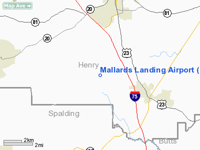
Location
& QuickFacts
|
FAA Information Effective: |
2007-07-05 |
|
Airport
Identifier: |
GA04 |
|
Airport
Status: |
Operational |
|
Longitude/Latitude: |
084-09-54.7070W/33-21-56.4130N
-84.165196/33.365670 (Estimated) |
|
Elevation: |
837 ft / 255.12 m (Surveyed) |
|
Land: |
10
acres |
|
From
nearest city: |
3 nautical miles NW of Locust Grove, GA |
|
Location: |
Henry County, GA |
|
Magnetic Variation: |
02W (1985) |
Owner
& Manager
|
Ownership: |
Privately owned |
|
Owner: |
Zack's Properties Inc |
|
Address: |
12 N. Cedar Street
Mc Donough, GA 30253 |
|
Phone
number: |
404-957-1546 |
|
Manager: |
Zip Hinton |
|
Address: |
53 Teal Ct
Locust Grove, GA 30248 |
|
Phone number: |
404-957-6521 |
Airport
Operations and Facilities
|
Airport Use: |
Private |
|
Wind
indicator: |
Yes |
|
Segmented
Circle: |
Yes |
|
Control
Tower: |
No |
|
Lighting
Schedule: |
RDO-CTL
ACTVT LIRL RY 07/25 - 123.7. |
|
Landing fee charge: |
No |
|
Sectional chart: |
Atlanta |
|
Region: |
ASO - Southern |
|
Boundary ARTCC: |
ZTL - Atlanta |
|
Tie-in FSS: |
MCN - Macon |
|
FSS on Airport: |
No |
|
FSS Toll Free: |
1-800-WX-BRIEF |
Airport
Services
|
Airframe Repair: |
NONE |
|
Power Plant Repair: |
NONE |
|
Runway Information
Runway 07/25
|
Dimension: |
2800 x 150 ft / 853.4 x 45.7 m |
|
Surface: |
TURF, |
|
Edge
Lights: |
Low |
|
|
Runway 07 |
Runway 25 |
|
Traffic
Pattern: |
Left |
Right |
|
Radio Navigation
Aids
|
ID |
Type |
Name |
Ch |
Freq |
Var |
Dist |
|
JHH |
NDB |
Griffin |
|
412.00 |
04W |
11.3 nm |
|
FF |
NDB |
Pecat |
|
316.00 |
02W |
16.6 nm |
|
BR |
NDB |
Redan |
|
266.00 |
02W |
18.3 nm |
|
VOF |
NDB |
Alcovy |
|
370.00 |
03W |
24.9 nm |
|
OP |
NDB |
Yates |
|
339.00 |
03W |
26.9 nm |
|
EQQ |
NDB |
Coweta County |
|
234.00 |
03W |
28.3 nm |
|
JNM |
NDB |
Monroe |
|
392.00 |
03W |
31.3 nm |
|
FT |
NDB |
Flanc |
|
344.00 |
02W |
33.6 nm |
|
BMW |
NDB |
Barrow County |
|
404.00 |
03W |
44.7 nm |
|
PIM |
NDB |
Pine Mountain |
|
272.00 |
03W |
47.5 nm |
|
GPQ |
NDB |
Carrollton |
|
278.00 |
02W |
49.9 nm |
|
DOB |
TACAN |
Dobbins |
077X |
|
01W |
37.2 nm |
|
PDK |
VOR/DME |
Peachtree |
113X |
116.60 |
02W |
31.4 nm |
|
ATL |
VORTAC |
Atlanta |
116X |
116.90 |
00W |
20.8 nm |
|
MCN |
VORTAC |
Macon |
089X |
114.20 |
01E |
48.2 nm |
|
ATL |
VOT |
Atlanta Muni |
|
111.00 |
|
21.9 nm |
Remarks
- ARPT
LCTD AT FLY IN COMMUNITY.
- PROVIDED
VFR ONLY & PVT USE. ALSO A COMPATIBLE OPERATIONAL AGREEMENT IS MAINTAINED
WITH HOLDER'S FIELD.
Based Aircraft
|
Aircraft
based on field: |
20 |
|
Single
Engine Airplanes: |
15 |
|
Multi
Engine Airplanes: |
3 |
|
Gliders: |
1 |
|
Ultralights: |
1 |
Mallards Landing Airport
Address:
Henry County, GA
Tel:
404-957-1546,
404-957-6521
Images
and information placed above are from
http://www.airport-data.com/airport/GA04/
We
thank them for the data!
| General
Info |
| Country |
United
States |
| State |
GEORGIA
|
| FAA ID |
GA04
|
| Latitude |
33-21-56.413N
|
| Longitude |
084-09-54.707W
|
| Elevation |
837 feet
|
| Near City |
LOCUST
GROVE |
We don't guarantee the information is fresh and accurate. The data may
be wrong or outdated.
For more up-to-date information please refer to other sources.
|
|


