 |
|
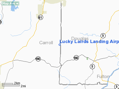
Lucky Lairds Landing Airport |
Location
& QuickFacts
|
FAA Information Effective: |
2007-07-05 |
|
Airport
Identifier: |
81GA |
|
Airport
Status: |
Operational |
|
Longitude/Latitude: |
084-54-17.7840W/33-38-27.3940N
-84.904940/33.640943 (Estimated) |
|
Elevation: |
1130 ft / 344.42 m (Estimated) |
|
Land: |
0
acres |
|
From
nearest city: |
6 nautical miles S of Villa Rica, GA |
|
Location: |
Carroll County, GA |
|
Magnetic Variation: |
02W (1990) |
Owner
& Manager
|
Ownership: |
Privately owned |
|
Owner: |
Bruce Laird, Jr |
|
Address: |
6005 North Helton Road
Villa Rica, GA 30180 |
|
Phone number: |
404-949-2465 |
|
Address: |
|
Airport
Operations and Facilities
|
Airport Use: |
Private |
|
Segmented
Circle: |
No |
|
Control
Tower: |
No |
|
Sectional
chart: |
Atlanta |
|
Region: |
ASO - Southern |
|
Boundary
ARTCC: |
ZTL - Atlanta |
|
Tie-in
FSS: |
MCN - Macon |
|
FSS
on Airport: |
No |
|
FSS
Toll Free: |
1-800-WX-BRIEF |
|
Runway Information
Runway 05/23
|
Dimension: |
1650 x 60 ft / 502.9 x 18.3 m |
|
Surface: |
TURF, |
|
|
Runway 05 |
Runway 23 |
|
Traffic
Pattern: |
Right |
Left |
|
Radio Navigation
Aids
|
ID |
Type |
Name |
Ch |
Freq |
Var |
Dist |
|
GPQ |
NDB |
Carrollton |
|
278.00 |
02W |
12.2 nm |
|
FT |
NDB |
Flanc |
|
344.00 |
02W |
15.2 nm |
|
EQQ |
NDB |
Coweta County |
|
234.00 |
03W |
25.0 nm |
|
FF |
NDB |
Pecat |
|
316.00 |
02W |
29.3 nm |
|
BR |
NDB |
Redan |
|
266.00 |
02W |
29.7 nm |
|
EVZ |
NDB |
Cartersville |
|
308.00 |
04W |
33.7 nm |
|
OYD |
NDB |
Floyd |
|
388.00 |
02W |
41.6 nm |
|
DJD |
NDB |
Canton |
|
415.00 |
04W |
42.2 nm |
|
JHH |
NDB |
Griffin |
|
412.00 |
04W |
43.7 nm |
|
OUK |
NDB |
Calhoun |
|
323.00 |
02W |
45.7 nm |
|
PIM |
NDB |
Pine Mountain |
|
272.00 |
03W |
48.0 nm |
|
DOB |
TACAN |
Dobbins |
077X |
|
01W |
25.8 nm |
|
PDK |
VOR/DME |
Peachtree |
113X |
116.60 |
02W |
33.4 nm |
|
ATL |
VORTAC |
Atlanta |
116X |
116.90 |
00W |
23.5 nm |
|
RMG |
VORTAC |
Rome |
101X |
115.40 |
01E |
33.1 nm |
|
LGC |
VORTAC |
Lagrange |
103X |
115.60 |
01E |
38.7 nm |
|
ATL |
VOT |
Atlanta Muni |
|
111.00 |
|
24.0 nm |
Remarks
- PRVDD
VFR/PR USE; AND ALL TRAFFIC PATTERNS OPNS SE OF RY CNTRLN.
Based
Aircraft
|
Aircraft
based on field: |
1 |
|
Single
Engine Airplanes: |
1 |
Lucky Lairds Landing Airport
Address:
Carroll County, GA
Tel:
404-949-2465
Images
and information placed above are from
http://www.airport-data.com/airport/81GA/
We
thank them for the data!
| General
Info |
| Country |
United
States |
| State |
GEORGIA
|
| FAA ID |
81GA
|
| Latitude |
33-38-27.394N
|
| Longitude |
084-54-17.784W
|
| Elevation |
1130 feet
|
| Near City |
VILLA
RICA |
We don't guarantee the information is fresh and accurate. The data may
be wrong or outdated.
For more up-to-date information please refer to other sources.
|
|


