 |
|
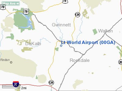
Location
& QuickFacts
|
FAA Information Effective: |
2007-07-05 |
|
Airport
Identifier: |
00GA |
|
Airport
Status: |
Operational |
|
Longitude/Latitude: |
084-04-06.0000W/33-46-03.0000N
-84.068333/33.767500 (Estimated) |
|
Elevation: |
700 ft / 213.36 m (Estimated) |
|
Land: |
5
acres |
|
From
nearest city: |
4 nautical miles SW of Lithonia, GA |
|
Location: |
De Kalb County, GA |
|
Magnetic Variation: |
03W (1995) |
Owner
& Manager
|
Ownership: |
Privately owned |
|
Owner: |
Lacy Thompson, Jr. |
|
Address: |
7980 Lt Parkway
Lithonia, GA 30058 |
|
Phone number: |
770-482-4836 |
|
Manager: |
Lacy Thompson, Jr. |
|
Address: |
7980 Lt Parkway
Lithonia, GA 30058 |
|
Phone number: |
770-482-4836 |
Airport
Operations and Facilities
|
Airport Use: |
Private |
|
Wind
indicator: |
Yes |
|
Segmented
Circle: |
No |
|
Control
Tower: |
No |
|
Sectional
chart: |
Atlanta |
|
Region: |
ASO - Southern |
|
Boundary
ARTCC: |
ZTL - Atlanta |
|
Tie-in
FSS: |
MCN - Macon |
|
FSS
Toll Free: |
1-800-WX-BRIEF |
|
Runway Information
Runway 09/27
|
Dimension: |
2600 x 80 ft / 792.5 x 24.4 m |
|
Surface: |
TURF, |
|
|
Runway 09 |
Runway 27 |
|
Traffic
Pattern: |
Left |
Left |
|
Obstruction: |
90 ft tree, 200.0 ft from runway |
|
|
Radio Navigation
Aids
|
ID |
Type |
Name |
Ch |
Freq |
Var |
Dist |
|
BR |
NDB |
Redan |
|
266.00 |
02W |
14.2 nm |
|
VOF |
NDB |
Alcovy |
|
370.00 |
03W |
16.5 nm |
|
JNM |
NDB |
Monroe |
|
392.00 |
03W |
17.2 nm |
|
BMW |
NDB |
Barrow County |
|
404.00 |
03W |
25.9 nm |
|
FKV |
NDB |
Flowery Branch |
|
365.00 |
03W |
27.4 nm |
|
FT |
NDB |
Flanc |
|
344.00 |
02W |
28.5 nm |
|
DDA |
NDB |
Commerce |
|
244.00 |
03W |
32.5 nm |
|
FF |
NDB |
Pecat |
|
316.00 |
02W |
35.0 nm |
|
DJD |
NDB |
Canton |
|
415.00 |
04W |
35.9 nm |
|
JHH |
NDB |
Griffin |
|
412.00 |
04W |
36.0 nm |
|
BJT |
NDB |
Bulldog |
|
221.00 |
03W |
43.8 nm |
|
EQQ |
NDB |
Coweta County |
|
234.00 |
03W |
44.6 nm |
|
JZP |
NDB |
Pickens County |
|
285.00 |
04W |
45.8 nm |
|
EVZ |
NDB |
Cartersville |
|
308.00 |
04W |
46.5 nm |
|
DOB |
TACAN |
Dobbins |
077X |
|
01W |
23.6 nm |
|
PDK |
VOR/DME |
Peachtree |
113X |
116.60 |
02W |
13.2 nm |
|
ATL |
VORTAC |
Atlanta |
116X |
116.90 |
00W |
20.1 nm |
|
AHN |
VORTAC |
Athens |
33 |
109.60 |
00E |
38.7 nm |
|
ATL |
VOT |
Atlanta Muni |
|
111.00 |
|
19.0 nm |
Remarks
- 445
TOWER 2.5 NM SOUTHWEST OF ARPT.
- ALL
APCHS FROM WEST & ALL DEPS TO EAST.
- PRVDD
VFR, PVT USE, CHOORDINATED ARRIVALS & DEPS WITH OTR ADJ LNDG AREAS
PRIOR TO OPNS.
Based
Aircraft
|
Aircraft
based on field: |
1 |
|
Helicopters: |
1 |
Lt World Airport
Address:
De Kalb County, GA
Tel:
770-482-4836
Images
and information placed above are from
http://www.airport-data.com/airport/00GA/
We
thank them for the data!
| General
Info |
| Country |
United
States |
| State |
GEORGIA
|
| FAA ID |
00GA
|
| Latitude |
33-46-03.000N
|
| Longitude |
084-04-06.000W
|
| Elevation |
700 feet
|
| Near City |
LITHONIA
|
We don't guarantee the information is fresh and accurate. The data may
be wrong or outdated.
For more up-to-date information please refer to other sources.
|
|


