 |
|
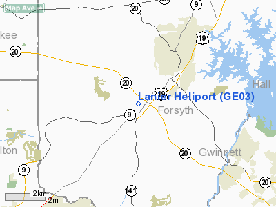
Location
& QuickFacts
|
FAA Information Effective: |
2007-07-05 |
|
Airport
Identifier: |
GE03 |
|
Airport
Status: |
Operational |
|
Longitude/Latitude: |
084-10-16.0000W/34-10-08.0000N
-84.171111/34.168889 (Estimated) |
|
Elevation: |
1225 ft / 373.38 m (Estimated) |
|
Land: |
0
acres |
|
From
nearest city: |
3 nautical miles SW of Cumming, GA |
|
Location: |
Forsyth County, GA |
|
Magnetic Variation: |
() |
Owner
& Manager
|
Ownership: |
Privately owned |
|
Owner: |
Lanier Heliport Llc |
|
Address: |
5175 Performance Drive
Cumming, GA 30040 |
|
Phone number: |
770-844-8687 |
|
Manager: |
Rich Maresco |
|
Address: |
5175 Performance Drive
Cumming, GA 30040 |
|
Phone number: |
770-844-8687 |
Airport
Operations and Facilities
|
Airport Use: |
Private |
|
Control
Tower: |
No |
|
Sectional
chart: |
Atlanta |
|
Region: |
ASO - Southern |
|
Boundary
ARTCC: |
ZTL - Atlanta |
|
Responsible
ARTCC: |
ZTL - Atlanta |
|
Tie-in
FSS: |
MCN - Macon |
|
FSS
Toll Free: |
1-800-WX-BRIEF |
|
Runway Information
Helipad H1
|
Dimension: |
30
x 30 ft / 9.1 x 9.1 m |
|
Surface: |
CONC, |
|
|
Runway H1 |
Runway |
|
Traffic
Pattern: |
Left |
Left |
|
Radio Navigation
Aids
|
ID |
Type |
Name |
Ch |
Freq |
Var |
Dist |
|
FKV |
NDB |
Flowery Branch |
|
365.00 |
03W |
13.3 nm |
|
DJD |
NDB |
Canton |
|
415.00 |
04W |
16.5 nm |
|
JZP |
NDB |
Pickens County |
|
285.00 |
04W |
22.5 nm |
|
BMW |
NDB |
Barrow County |
|
404.00 |
03W |
32.2 nm |
|
BR |
NDB |
Redan |
|
266.00 |
02W |
32.2 nm |
|
DDA |
NDB |
Commerce |
|
244.00 |
03W |
33.0 nm |
|
EVZ |
NDB |
Cartersville |
|
308.00 |
04W |
33.5 nm |
|
FT |
NDB |
Flanc |
|
344.00 |
02W |
33.8 nm |
|
JNM |
NDB |
Monroe |
|
392.00 |
03W |
34.1 nm |
|
AJR |
NDB |
Habersham |
|
347.00 |
03W |
36.7 nm |
|
VOF |
NDB |
Alcovy |
|
370.00 |
03W |
37.8 nm |
|
OUK |
NDB |
Calhoun |
|
323.00 |
02W |
40.0 nm |
|
BJT |
NDB |
Bulldog |
|
221.00 |
03W |
49.2 nm |
|
OYD |
NDB |
Floyd |
|
388.00 |
02W |
50.0 nm |
|
DOB |
TACAN |
Dobbins |
077X |
|
01W |
22.7 nm |
|
PDK |
VOR/DME |
Peachtree |
113X |
116.60 |
02W |
18.7 nm |
|
ATL |
VORTAC |
Atlanta |
116X |
116.90 |
00W |
35.0 nm |
|
AHN |
VORTAC |
Athens |
33 |
109.60 |
00E |
44.2 nm |
|
RMG |
VORTAC |
Rome |
101X |
115.40 |
01E |
47.2 nm |
|
HRS |
VORTAC |
Harris |
035X |
109.80 |
00E |
48.2 nm |
|
ATL |
VOT |
Atlanta Muni |
|
111.00 |
|
33.2 nm |
Remarks
- SEVERAL
TWRS FROM 100 FT AGL TO 305 FT AGL ALL QUADRANTS.
- PRVDD
VFR OPNS, PVT USE, AREA IS MARKED, AND WIND INDICATOR IS MAINTAINED.
Lanier Heliport
Address:
Forsyth County, GA
Tel:
770-844-8687
Images
and information placed above are from
http://www.airport-data.com/airport/GE03/
We
thank them for the data!
We don't guarantee the information is fresh and accurate. The data may
be wrong or outdated.
For more up-to-date information please refer to other sources.
|
|


