 |
|
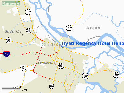
Hyatt Regency Hotel Heliport |
Location
& QuickFacts
|
FAA Information Effective: |
2007-07-05 |
|
Airport
Identifier: |
45GA |
|
Airport
Status: |
Operational |
|
Longitude/Latitude: |
081-05-31.4030W/32-04-54.7470N
-81.092056/32.081874 (Estimated) |
|
Elevation: |
123 ft / 37.49 m (Estimated) |
|
Land: |
0
acres |
|
From
nearest city: |
0 nautical miles W of Savannah, GA |
|
Location: |
Chatham County, GA |
|
Magnetic Variation: |
04W (1986) |
Owner
& Manager
|
Ownership: |
Privately owned |
|
Owner: |
Waterfront Hotel Co. |
|
Address: |
2 West Bay St.
Savannah, GA 31402 |
|
Phone
number: |
912-238-1234 |
|
Manager: |
Mark Kopke |
|
Address: |
2 West Bay St.
Savannah, GA 31402 |
|
Phone number: |
912-238-1234 |
Airport
Operations and Facilities
|
Airport Use: |
Private |
|
Wind
indicator: |
Yes |
|
Segmented
Circle: |
No |
|
Control
Tower: |
No |
|
Lighting
Schedule: |
PHONE REQ
FOR PERIMETER LGTS RWY H1 & H2 CALL 912-238-1234. |
|
Sectional
chart: |
Charlotte |
|
Region: |
ASO - Southern |
|
Boundary
ARTCC: |
ZJX - Jacksonville |
|
Tie-in
FSS: |
MCN - Macon |
|
FSS
on Airport: |
No |
|
FSS
Toll Free: |
1-800-WX-BRIEF |
|
Runway Information
Helipad H1
|
Dimension: |
20
x 20 ft / 6.1 x 6.1 m |
|
Surface: |
ASPH,
ROOF TOP |
|
|
Runway H1 |
Runway |
|
Traffic
Pattern: |
Left |
Left |
|
Helipad H2
|
Dimension: |
20
x 20 ft / 6.1 x 6.1 m |
|
Surface: |
ASPH,
ROOF TOP |
|
|
Runway H2 |
Runway |
|
Traffic
Pattern: |
Left |
Left |
|
Radio Navigation
Aids
|
ID |
Type |
Name |
Ch |
Freq |
Var |
Dist |
|
MOQ |
NDB |
Mc Intosh |
|
263.00 |
04W |
26.1 nm |
|
BZ |
NDB |
Bullo |
|
407.00 |
05W |
35.3 nm |
|
CWV |
NDB |
Claxton |
|
395.50 |
04W |
40.7 nm |
|
JYL |
NDB |
Sylvania |
|
245.00 |
04W |
42.6 nm |
|
NBC |
TACAN |
Beaufort |
042X |
|
05W |
30.5 nm |
|
SVN |
VOR/DME |
Hunter |
53X |
111.60 |
02W |
4.9 nm |
|
SAV |
VORTAC |
Savannah |
106Y |
115.95 |
06W |
6.7 nm |
|
SAV |
VOT |
Savannah Travis Fld |
|
111.00 |
|
6.2 nm |
Remarks
Hyatt Regency Hotel Heliport
Address:
Chatham County, GA
Tel:
912-238-1234
Images
and information placed above are from
http://www.airport-data.com/airport/45GA/
We
thank them for the data!
| General
Info |
| Country |
United
States |
| State |
GEORGIA
|
| FAA ID |
45GA
|
| Latitude |
32-04-54.747N
|
| Longitude |
081-05-31.403W
|
| Elevation |
123 feet
|
| Near City |
SAVANNAH
|
We don't guarantee the information is fresh and accurate. The data may
be wrong or outdated.
For more up-to-date information please refer to other sources.
|
|


