 |
|
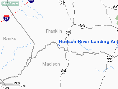
Hudson River Landing Airport |
|
|
Location
& QuickFacts
|
FAA Information Effective: |
2007-07-05 |
|
Airport
Identifier: |
33GA |
|
Airport
Status: |
Operational |
|
Longitude/Latitude: |
083-17-12.0000W/34-15-36.0000N
-83.286667/34.260000 (Estimated) |
|
Elevation: |
665 ft / 202.69 m (Estimated) |
|
Land: |
0 acres |
|
From
nearest city: |
7 nautical miles NE of Carnesville, GA |
|
Location: |
Franklin County, GA |
|
Magnetic Variation: |
04W (1995) |
Owner
& Manager
|
Ownership: |
Privately owned
NORTH HALF OF STRIP OWNED BY GENE & ROSE LINVILLE AT
ADDRESS ABV. SOUTH HALF OF STRIP OWNED BY WILLIAM &
BONNIE FRITZ AT ADDRESS ABV. |
|
Owner: |
William J & Bonnie J Fritz |
|
Address: |
795 Cape Road
Carnesville, GA 30521 |
|
Phone number: |
706-335-9423 |
|
Manager: |
William J Fritz |
|
Address: |
795 Cape Road
Carnesville, GA 30521 |
|
Phone number: |
706-335-9423
OR 404-651-2272. |
Airport
Operations and Facilities
|
Airport Use: |
Private |
|
Wind
indicator: |
Yes |
|
Segmented
Circle: |
No |
|
Control
Tower: |
No |
|
Sectional
chart: |
Atlanta |
|
Region: |
ASO - Southern |
|
Boundary
ARTCC: |
ZTL - Atlanta |
|
Tie-in
FSS: |
MCN - Macon |
|
FSS
on Airport: |
No |
|
FSS
Toll Free: |
1-800-WX-BRIEF |
|
Runway Information
Runway 01/19
|
Dimension: |
2000 x 50 ft / 609.6 x 15.2 m |
|
Surface: |
TURF, |
|
|
Runway 01 |
Runway 19 |
|
Traffic
Pattern: |
Left |
Left |
|
Obstruction: |
|
50
ft trees |
|
Radio Navigation
Aids
|
ID |
Type |
Name |
Ch |
Freq |
Var |
Dist |
|
DDA |
NDB |
Commerce |
|
244.00 |
03W |
16.6 nm |
|
BJT |
NDB |
Bulldog |
|
221.00 |
03W |
18.8 nm |
|
AJR |
NDB |
Habersham |
|
347.00 |
03W |
19.5 nm |
|
BMW |
NDB |
Barrow County |
|
404.00 |
03W |
24.7 nm |
|
FKV |
NDB |
Flowery Branch |
|
365.00 |
03W |
31.0 nm |
|
CEU |
NDB |
Clemson |
|
257.00 |
05W |
31.8 nm |
|
AND |
NDB |
Anderson County |
|
230.00 |
04W |
32.1 nm |
|
IIY |
NDB |
Washington/wilkes County |
|
435.00 |
03W |
37.5 nm |
|
JNM |
NDB |
Monroe |
|
392.00 |
03W |
38.3 nm |
|
VV |
NDB |
Junne |
|
353.00 |
05W |
39.2 nm |
|
LQK |
NDB |
Lake Keowee |
|
408.00 |
04W |
43.9 nm |
|
VOF |
NDB |
Alcovy |
|
370.00 |
03W |
45.2 nm |
|
GY |
NDB |
Dyana |
|
338.00 |
03W |
49.2 nm |
|
AHN |
VORTAC |
Athens |
33 |
109.60 |
00E |
18.9 nm |
|
ODF |
VORTAC |
Foothills |
081X |
113.40 |
00E |
26.2 nm |
|
ELW |
VORTAC |
Electric City |
023X |
108.60 |
00E |
26.7 nm |
Remarks
- PRVDD
ALL OPNS VFR/PVT USE.
Based
Aircraft
|
Aircraft
based on field: |
4 |
|
Single
Engine Airplanes: |
3 |
|
Ultralights: |
1 |
Hudson River Landing Airport
Address:
Franklin County, GA
Tel:
706-335-9423, 404-651-2272
Images
and information placed above are from
http://www.airport-data.com/airport/33GA/
We
thank them for the data!
| General
Info |
| Country |
United
States |
| State |
GEORGIA
|
| FAA ID |
33GA
|
| Latitude |
34-15-36.000N
|
| Longitude |
083-17-12.000W
|
| Elevation |
665 feet
|
| Near City |
CARNESVILLE
|
We don't guarantee the information is fresh and accurate. The data may
be wrong or outdated.
For more up-to-date information please refer to other sources.
|
|


