 |
|
|
|
|
|
Location
& QuickFacts
|
FAA Information Effective: |
2007-07-05 |
|
Airport
Identifier: |
HOE |
|
Airport
Status: |
Operational |
|
Longitude/Latitude: |
082-46-26.9000W/31-03-21.3000N
-82.774139/31.055917 (Estimated) |
|
Elevation: |
186 ft / 56.69 m (Surveyed) |
|
Land: |
239 acres |
|
From
nearest city: |
2 nautical miles NW of Homerville, GA |
|
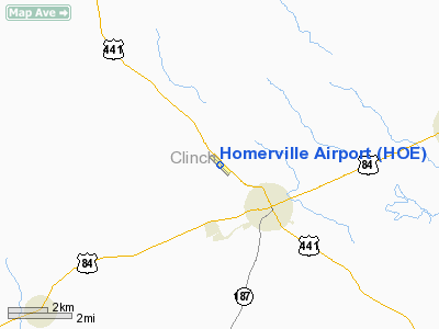
Location: |
Clinch County, GA |
|
Magnetic Variation: |
03W (1985) |
Owner
& Manager
|
Ownership: |
Publicly owned |
|
Owner: |
City Of Homerville |
|
Address: |
Po Box 535
Homerville, GA 31634 |
|
Phone number: |
912-487-2375 |
|
Manager: |
Albert Thornton |
|
Address: |
Po Box 535
Homerville, GA 31634 |
|
Phone number: |
912-487-2375 |
Airport
Operations and Facilities
|
Airport Use: |
Open to public |
|
Wind
indicator: |
Yes |
|
Segmented
Circle: |
Yes |
|
Control
Tower: |
No |
|
Lighting
Schedule: |
DUSK-DAWN
OTS INDEFLY. |
|
Beacon
Color: |
Clear-Green (lighted land airport) |
|
Landing
fee charge: |
No |
|
Sectional
chart: |
Jacksonville |
|
Region: |
ASO - Southern |
|
Boundary
ARTCC: |
ZJX - Jacksonville |
|
Tie-in
FSS: |
MCN - Macon |
|
FSS
on Airport: |
No |
|
FSS
Toll Free: |
1-800-WX-BRIEF |
|
NOTAMs
Facility: |
MCN (NOTAM-d service avaliable) |
|
Federal Agreements: |
NY1 |
Airport
Communications
Airport
Services
|
Fuel available: |
100LLA |
|
Airframe Repair: |
NONE |
|
Power Plant Repair: |
NONE |
|
Bottled
Oxygen: |
NONE |
|
Bulk
Oxygen: |
NONE |
|
Runway Information
Runway 14/32
|
Dimension: |
4000
x 75 ft / 1219.2 x 22.9 m
75 FT WIDE ASPH OVERLAY; REMAINING 37 1/2 FT WIDTH ON EACH SIDE
IS OLD ASPH WITH LOOSE GRAVEL. |
|
Surface: |
ASPH, Good Condition |
|
Weight
Limit: |
Single wheel: 30000 lbs. |
|
Edge
Lights: |
Medium |
|
|
Runway 14 |
Runway 32 |
|
Longitude: |
082-46-43.0629W |
082-46-10.7650W |
|
Latitude: |
31-03-35.3470N |
31-03-07.1680N |
|
Elevation: |
185.00
ft |
182.00
ft |
|
Alignment: |
127 |
127 |
|
Traffic
Pattern: |
Left |
Left |
|
Markings: |
Non-precision instrument, Good Condition |
Non-precision instrument, Good Condition |
|
VASI: |
2-box on left side
OTS INDEFLY. |
|
|
Obstruction: |
32 ft trees, 424.0 ft from runway, 250 ft right
of centerline, 7:1 slope to clear |
82 ft trees, 2004.0 ft from runway, 275 ft
right of centerline, 22:1 slope to clear |
|
Radio Navigation
Aids
|
ID |
Type |
Name |
Ch |
Freq |
Var |
Dist |
|
HOE |
NDB |
Homerville |
|
209.00 |
03W |
0.1 nm |
|
OWC |
NDB |
Coffee County |
|
390.00 |
03W |
22.3 nm |
|
TM |
NDB |
Tifto |
|
409.00 |
03W |
39.1 nm |
|
SUR |
NDB |
Fitzgerald |
|
362.00 |
03W |
42.7 nm |
|
BHC |
NDB |
Baxley |
|
376.00 |
04W |
44.1 nm |
|
AZE |
NDB |
Hazlehurst |
|
414.00 |
03W |
50.0 nm |
|
IFM |
VOR |
Tift Myers |
|
112.50 |
01W |
43.0 nm |
|
OTK |
VOR/DME |
Valdosta |
095X |
114.80 |
02W |
30.9 nm |
|
AYS |
VORTAC |
Waycross |
039X |
110.20 |
00E |
17.0 nm |
|
VAD |
VORTAC |
Moody |
080X |
113.30 |
03W |
22.4 nm |
|
AMG |
VORTAC |
Alma |
098X |
115.10 |
00E |
32.0 nm |
|
TAY |
VORTAC |
Taylor |
076X |
112.90 |
03W |
35.1 nm |
Based
Aircraft
|
Aircraft
based on field: |
1 |
|
Single
Engine Airplanes: |
1 |
Operational Statistics
Time Period: 2005-03-13
- 2006-03-12
|
Aircraft
Operations: |
18/Week |
|
General
Aviation Local: |
66.7% |
|
General
Aviation Itinerant: |
33.3% |
Homerville Airport
Address:
Clinch County, GA
Tel:
912-487-2375
Images
and information placed above are from
http://www.airport-data.com/airport/HOE/
We
thank them for the data!
| General
Info |
| Country |
United
States |
| State |
GEORGIA
|
| FAA ID |
HOE
|
| Latitude |
31-03-21.300N
|
| Longitude |
082-46-26.900W
|
| Elevation |
186 feet
|
| Near City |
HOMERVILLE
|
We don't guarantee the information is fresh and accurate. The data may
be wrong or outdated.
For more up-to-date information please refer to other sources.
|
|


