 |
|
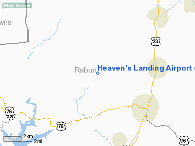
Location
& QuickFacts
|
FAA Information Effective: |
2007-07-05 |
|
Airport
Identifier: |
GE99 |
|
Airport
Status: |
Operational |
|
Longitude/Latitude: |
083-27-35.0000W/34-54-52.0000N
-83.459722/34.914444 (Estimated) |
|
Elevation: |
2724 ft / 830.28 m (Surveyed) |
|
Land: |
20
acres |
|
From
nearest city: |
4 nautical miles NW of Clayton, GA |
|
Location: |
Rabun County, GA |
|
Magnetic Variation: |
05W (2005) |
Owner
& Manager
|
Ownership: |
Privately owned |
|
Owner: |
Heaven's Landing, Llc |
|
Address: |
P.o. Box 1992
Clayton, GA 30525 |
|
Phone
number: |
706-212-0017 |
|
Manager: |
Mike Ciochetti, Jr |
|
Address: |
823 Rainbow Creek Road
Clayton, GA 30525 |
|
Phone number: |
706-782-6913 |
Airport
Operations and Facilities
|
Airport Use: |
Private |
|
Wind
indicator: |
Yes |
|
Segmented
Circle: |
No |
|
Control
Tower: |
No |
|
Sectional
chart: |
Atlanta |
|
Region: |
ASO - Southern |
|
Boundary
ARTCC: |
ZTL - Atlanta |
|
Tie-in
FSS: |
MCN - Macon |
|
FSS
Toll Free: |
1-800-WX-BRIEF |
|
Runway Information
Runway 05/23
|
Dimension: |
5069 x 50 ft / 1545.0 x 15.2 m |
|
Surface: |
CONC, |
|
|
Runway 05 |
Runway 23 |
|
Traffic
Pattern: |
Left |
Left |
|
Radio Navigation
Aids
|
ID |
Type |
Name |
Ch |
Freq |
Var |
Dist |
|
AJR |
NDB |
Habersham |
|
347.00 |
03W |
25.2 nm |
|
TTQ |
NDB |
Tomotla |
|
335.00 |
01W |
27.3 nm |
|
CEU |
NDB |
Clemson |
|
257.00 |
05W |
31.8 nm |
|
LQK |
NDB |
Lake Keowee |
|
408.00 |
04W |
37.8 nm |
|
AND |
NDB |
Anderson County |
|
230.00 |
04W |
44.8 nm |
|
FKV |
NDB |
Flowery Branch |
|
365.00 |
03W |
48.1 nm |
|
ODF |
VORTAC |
Foothills |
081X |
113.40 |
00E |
15.4 nm |
|
HRS |
VORTAC |
Harris |
035X |
109.80 |
00E |
22.5 nm |
|
ELW |
VORTAC |
Electric City |
023X |
108.60 |
00E |
44.7 nm |
Remarks
- MOUNTAINOUS
TERRAIN ALL QUADRANTS.
- PRVDD
VFR OPNS AND PVT USE.
Based
Aircraft
|
Aircraft
based on field: |
33 |
|
Single
Engine Airplanes: |
20 |
|
Multi
Engine Airplanes: |
10 |
|
Jet Engine
Airplanes: |
3 |
Heaven's Landing Airport
Address:
Rabun County, GA
Tel:
706-212-0017,
706-782-6913
Images
and information placed above are from
http://www.airport-data.com/airport/GE99/
We
thank them for the data!
| General
Info |
| Country |
United
States |
| State |
GEORGIA
|
| FAA ID |
GE99
|
| Latitude |
34.914444
34° 54' 52.00" N |
| Longitude |
-83.459722
083° 27' 35.00" W |
| Elevation |
2724 feet
830 meters |
| Magnetic
Variation |
005° W
(06/06) |
| Operating
Agency |
PRIVATE
|
We don't guarantee the information is fresh and accurate. The data may
be wrong or outdated.
For more up-to-date information please refer to other sources.
|
|


