 |
|
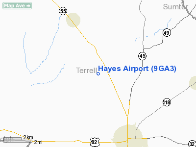
Location
& QuickFacts
|
FAA Information Effective: |
2007-07-05 |
|
Airport
Identifier: |
9GA3 |
|
Airport
Status: |
Operational |
|
Longitude/Latitude: |
084-28-53.6980W/31-50-22.5930N
-84.481583/31.839609 (Estimated) |
|
Elevation: |
401 ft / 122.22 m (Surveyed) |
|
Land: |
0
acres |
|
From
nearest city: |
5 nautical miles NW of Dawson, GA |
|
Location: |
Terrell County, GA |
|
Magnetic Variation: |
01W (1985) |
Owner
& Manager
|
Ownership: |
Privately owned |
|
Owner: |
James E. Hayes |
|
Address: |
Rt 3, Box 302
Dawson, GA 31742 |
|
Phone number: |
912-995-6161 |
|
Manager: |
James E. Hayes |
|
Address: |
Rt 3, Box 302
Dawson, GA 31742 |
|
Phone number: |
912-995-6161 |
Airport
Operations and Facilities
|
Airport Use: |
Private |
|
Wind
indicator: |
No |
|
Segmented
Circle: |
No |
|
Control
Tower: |
No |
|
Landing
fee charge: |
No |
|
Sectional
chart: |
Jacksonville |
|
Region: |
ASO - Southern |
|
Boundary
ARTCC: |
ZJX - Jacksonville |
|
Tie-in
FSS: |
MCN - Macon |
|
FSS
on Airport: |
No |
|
FSS
Toll Free: |
1-800-WX-BRIEF |
|
Runway
Information
Runway E/W
|
Dimension: |
2600 x 110 ft / 792.5 x 33.5 m |
|
Surface: |
TURF, |
|
|
Runway E |
Runway W |
|
Traffic
Pattern: |
Left |
Left |
|
Radio Navigation
Aids
|
ID |
Type |
Name |
Ch |
Freq |
Var |
Dist |
|
AB |
NDB |
Putny |
|
227.00 |
02W |
25.3 nm |
|
LKG |
NDB |
Lindbergh |
|
242.00 |
03W |
27.7 nm |
|
IWJ |
NDB |
Blaak |
|
344.00 |
03W |
28.8 nm |
|
OHY |
NDB |
Coney |
|
400.00 |
02W |
33.0 nm |
|
AWS |
NDB |
Lawson |
|
335.00 |
02W |
38.8 nm |
|
CXU |
NDB |
Camilla |
|
369.00 |
02W |
39.6 nm |
|
IZS |
NDB |
Montezuma |
|
426.00 |
04W |
39.9 nm |
|
LSF |
VOR/DME |
Lawson |
051X |
111.40 |
02W |
39.4 nm |
|
PZD |
VORTAC |
Pecan |
108X |
116.10 |
02W |
14.7 nm |
|
EUF |
VORTAC |
Eufaula |
029X |
109.20 |
02E |
33.8 nm |
Remarks
Based
Aircraft
|
Aircraft
based on field: |
2 |
|
Single
Engine Airplanes: |
2 |
Hayes Airport
Address:
Terrell County, GA
Tel:
912-995-6161
Images
and information placed above are from
http://www.airport-data.com/airport/9GA3/
We
thank them for the data!
| General
Info |
| Country |
United
States |
| State |
GEORGIA
|
| FAA ID |
9GA3
|
| Latitude |
31-50-22.593N
|
| Longitude |
084-28-53.698W
|
| Elevation |
401 feet
|
| Near City |
DAWSON
|
We don't guarantee the information is fresh and accurate. The data may
be wrong or outdated.
For more up-to-date information please refer to other sources.
|
|


