 |
|
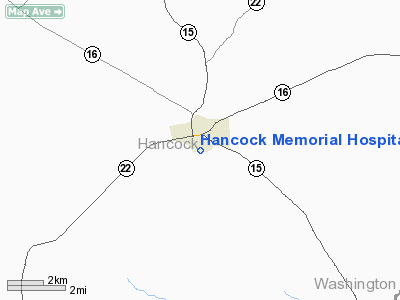
Hancock Memorial Hospital Heliport |
Location
& QuickFacts
|
FAA Information Effective: |
2007-07-05 |
|
Airport
Identifier: |
28GA |
|
Airport
Status: |
Operational |
|
Longitude/Latitude: |
082-58-18.5300W/33-16-05.5230N
-82.971814/33.268201 (Estimated) |
|
Elevation: |
542 ft / 165.20 m (Estimated) |
|
Land: |
0
acres |
|
From
nearest city: |
1 nautical miles S of Sparta, GA |
|
Location: |
Hancock County, GA |
|
Magnetic Variation: |
03W (1985) |
Owner
& Manager
|
Ownership: |
Privately owned |
|
Owner: |
Hancock Memorial Hospital |
|
Address: |
453 Boland Street
Sparta, GA 31087 |
|
Phone
number: |
404-444-7006 |
|
Manager: |
Daniel Holtz |
|
Address: |
453 Boland Street
Sparta, GA 31087 |
|
Phone number: |
404-444-7006 |
Airport
Operations and Facilities
|
Airport Use: |
Private
MEDICAL |
|
Wind
indicator: |
Yes |
|
Segmented
Circle: |
No |
|
Control
Tower: |
No |
|
Sectional
chart: |
Atlanta |
|
Region: |
ASO - Southern |
|
Boundary
ARTCC: |
ZTL - Atlanta |
|
Tie-in
FSS: |
MCN - Macon |
|
FSS
Toll Free: |
1-800-WX-BRIEF |
|
Runway Information
Helipad H1
|
Dimension: |
20
x 20 ft / 6.1 x 6.1 m |
|
Surface: |
CONC, |
|
|
Runway H1 |
Runway |
|
Traffic
Pattern: |
Left |
Left |
|
Markings: |
Basic, Good Condition |
, |
|
Radio Navigation
Aids
|
ID |
Type |
Name |
Ch |
Freq |
Var |
Dist |
|
UMB |
NDB |
Culvr |
|
380.00 |
04W |
11.8 nm |
|
HIT |
NDB |
Kaolin |
|
360.00 |
05W |
15.2 nm |
|
VV |
NDB |
Junne |
|
353.00 |
05W |
22.8 nm |
|
AA |
NDB |
Cedar |
|
341.00 |
04W |
24.0 nm |
|
HQU |
NDB |
Thomson-mcduffie |
|
333.00 |
04W |
27.7 nm |
|
IIY |
NDB |
Washington/wilkes County |
|
435.00 |
03W |
31.5 nm |
|
BJT |
NDB |
Bulldog |
|
221.00 |
03W |
42.9 nm |
|
EEX |
NDB |
Emanuel County |
|
309.00 |
04W |
44.6 nm |
|
VOF |
NDB |
Alcovy |
|
370.00 |
03W |
46.1 nm |
|
DB |
NDB |
Creke |
|
251.00 |
04W |
47.2 nm |
|
JNM |
NDB |
Monroe |
|
392.00 |
03W |
47.2 nm |
|
DBN |
VORTAC |
Dublin |
078X |
113.10 |
01W |
43.1 nm |
|
AHN |
VORTAC |
Athens |
33 |
109.60 |
00E |
44.5 nm |
|
IRQ |
VORTAC |
Colliers |
086X |
113.90 |
04W |
48.4 nm |
|
MCN |
VORTAC |
Macon |
089X |
114.20 |
01E |
48.6 nm |
Remarks
- PRVDD
VFR/PVT; APCH/DEP ROUTE OPERATIONS ARE CONDUCTED FROM 330 DEGS TO 090
DEGS CLOCKWISE; TAKEOFF/LANDING AREA MARKED; AND A WIND INDICATOR IS
MAINTAINED.
Hancock Memorial Hospital Heliport
Address:
Hancock County, GA
Tel:
404-444-7006
Images
and information placed above are from
http://www.airport-data.com/airport/28GA/
We
thank them for the data!
| General
Info |
| Country |
United
States |
| State |
GEORGIA
|
| FAA ID |
28GA
|
| Latitude |
33-16-05.523N
|
| Longitude |
082-58-18.530W
|
| Elevation |
542 feet
|
| Near City |
SPARTA
|
We don't guarantee the information is fresh and accurate. The data may
be wrong or outdated.
For more up-to-date information please refer to other sources.
|
|


