 |
|
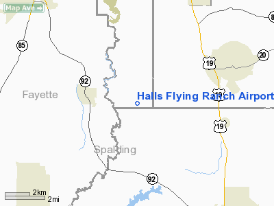
Halls Flying Ranch Airport |
Location
& QuickFacts
|
FAA Information Effective: |
2007-07-05 |
|
Airport
Identifier: |
0GA0 |
|
Airport
Status: |
Operational |
|
Longitude/Latitude: |
084-22-01.7270W/33-21-22.4140N
-84.367146/33.356226 (Estimated) |
|
Elevation: |
800 ft / 243.84 m (Estimated) |
|
Land: |
0
acres |
|
From
nearest city: |
4 nautical miles SW of Hampton, GA |
|
Location: |
Clayton County, GA |
|
Magnetic Variation: |
02W (1985) |
Owner
& Manager
|
Ownership: |
Privately owned |
|
Owner: |
J. R. Hall, Jr. |
|
Address: |
771 Hall Rd
Hampton, GA 30228-2222 |
|
Phone number: |
404-946-4357 |
|
Manager: |
Joey H. Keahey |
|
Address: |
879 Hall Rd
Hampton, GA 30228-2222 |
|
Phone number: |
404-946-8434 |
Airport
Operations and Facilities
|
Airport Use: |
Private |
|
Wind
indicator: |
Yes |
|
Segmented
Circle: |
No |
|
Control
Tower: |
No |
|
Landing
fee charge: |
No |
|
Sectional
chart: |
Atlanta |
|
Region: |
ASO - Southern |
|
Boundary
ARTCC: |
ZTL - Atlanta |
|
Tie-in
FSS: |
MCN - Macon |
|
FSS
on Airport: |
No |
|
FSS
Toll Free: |
1-800-WX-BRIEF |
Airport
Services
|
Airframe Repair: |
NONE |
|
Power Plant Repair: |
NONE |
|
Runway Information
Runway 01/19
|
Dimension: |
2150 x 50 ft / 655.3 x 15.2 m |
|
Surface: |
TURF, |
|
|
Runway 01 |
Runway 19 |
|
Traffic
Pattern: |
Left |
Left |
|
Radio Navigation
Aids
|
ID |
Type |
Name |
Ch |
Freq |
Var |
Dist |
|
FF |
NDB |
Pecat |
|
316.00 |
02W |
6.9 nm |
|
JHH |
NDB |
Griffin |
|
412.00 |
04W |
12.5 nm |
|
BR |
NDB |
Redan |
|
266.00 |
02W |
17.6 nm |
|
EQQ |
NDB |
Coweta County |
|
234.00 |
03W |
18.4 nm |
|
OP |
NDB |
Yates |
|
339.00 |
03W |
27.8 nm |
|
FT |
NDB |
Flanc |
|
344.00 |
02W |
28.0 nm |
|
VOF |
NDB |
Alcovy |
|
370.00 |
03W |
33.6 nm |
|
JNM |
NDB |
Monroe |
|
392.00 |
03W |
39.4 nm |
|
PIM |
NDB |
Pine Mountain |
|
272.00 |
03W |
40.0 nm |
|
GPQ |
NDB |
Carrollton |
|
278.00 |
02W |
40.3 nm |
|
DOB |
TACAN |
Dobbins |
077X |
|
01W |
34.3 nm |
|
PDK |
VOR/DME |
Peachtree |
113X |
116.60 |
02W |
31.4 nm |
|
ATL |
VORTAC |
Atlanta |
116X |
116.90 |
00W |
16.7 nm |
|
LGC |
VORTAC |
Lagrange |
103X |
115.60 |
01E |
46.1 nm |
|
ATL |
VOT |
Atlanta Muni |
|
111.00 |
|
18.4 nm |
Remarks
Based
Aircraft
|
Aircraft
based on field: |
6 |
|
Single
Engine Airplanes: |
6 |
Halls Flying Ranch Airport
Address:
Clayton County, GA
Tel:
404-946-4357, 404-946-8434
Images
and information placed above are from
http://www.airport-data.com/airport/0GA0/
We
thank them for the data!
| General
Info |
| Country |
United
States |
| State |
GEORGIA
|
| FAA ID |
0GA0
|
| Latitude |
33-21-22.414N
|
| Longitude |
084-22-01.727W
|
| Elevation |
800 feet
|
| Near City |
HAMPTON
|
We don't guarantee the information is fresh and accurate. The data may
be wrong or outdated.
For more up-to-date information please refer to other sources.
|
|


