 |
|
|
|
|
|
Location
& QuickFacts
|
FAA Information Effective: |
2007-01-18 |
|
Airport
Identifier: |
8GA1 |
|
Airport
Status: |
Operational |
|
Longitude/Latitude: |
085-09-42.8010W/33-25-16.4100N
-85.161889/33.421225 (Estimated) |
|
Elevation: |
1070 ft / 326.14 m (Estimated) |
|
Land: |
10
acres |
|
From
nearest city: |
3 nautical miles SW of Roopville, GA |
|
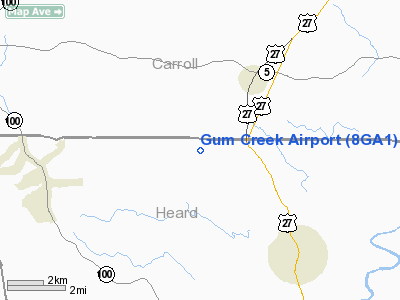
Location: |
Heard County, GA |
|
Magnetic Variation: |
01W (1985) |
Owner
& Manager
|
Ownership: |
Privately owned |
|
Owner: |
Robert L. Rowley |
|
Address: |
Rr 1, 647 Gum Creek Road
Roopville, GA 30170 |
|
Phone
number: |
404-854-8224 |
|
Manager: |
Robert L. Rowley |
|
Address: |
Rr 1, 647 Gum Creek Road
Roopville, GA 30170 |
|
Phone number: |
404-854-8224 |
Airport
Operations and Facilities
|
Airport Use: |
Private |
|
Wind
indicator: |
Yes |
|
Segmented
Circle: |
No |
|
Control
Tower: |
No |
|
Lighting
Schedule: |
PHONE REQ
FOR LIRL RWY 06/24 AND ROTG BCN CALL 404-854-8224. |
|
Beacon
Color: |
Clear-Green (lighted land airport) |
|
Landing
fee charge: |
No |
|
Sectional
chart: |
Atlanta |
|
Region: |
ASO - Southern |
|
Boundary
ARTCC: |
ZTL - Atlanta |
|
Tie-in
FSS: |
MCN - Macon |
|
FSS
on Airport: |
No |
|
FSS
Phone: |
478-784-1155 |
|
FSS
Toll Free: |
1-800-WX-BRIEF |
|
Runway Information
Runway 06/24
|
Dimension: |
2350
x 65 ft / 716.3 x 19.8 m
ONLY 1900' HAS LIRL. |
|
Surface: |
TURF, |
|
Edge
Lights: |
Low |
|
|
Runway 06 |
Runway 24 |
|
Traffic
Pattern: |
Left |
Left |
|
Displaced
threshold: |
0.00 ft |
350.00
ft |
|
Obstruction: |
|
30 ft trees, 300.0 ft from runway |
|
Radio Navigation
Aids
|
ID |
Type |
Name |
Ch |
Freq |
Var |
Dist |
|
GPQ |
NDB |
Carrollton |
|
278.00 |
02W |
8.8 nm |
|
EQQ |
NDB |
Coweta County |
|
234.00 |
03W |
24.6 nm |
|
FT |
NDB |
Flanc |
|
344.00 |
02W |
33.3 nm |
|
FF |
NDB |
Pecat |
|
316.00 |
02W |
34.7 nm |
|
PIM |
NDB |
Pine Mountain |
|
272.00 |
03W |
37.7 nm |
|
BR |
NDB |
Redan |
|
266.00 |
02W |
44.7 nm |
|
JHH |
NDB |
Griffin |
|
412.00 |
04W |
49.1 nm |
|
EVZ |
NDB |
Cartersville |
|
308.00 |
04W |
49.4 nm |
|
DOB |
TACAN |
Dobbins |
077X |
|
01W |
44.2 nm |
|
TDG |
VOR/DME |
Talladega |
025X |
108.80 |
02E |
45.1 nm |
|
LGC |
VORTAC |
Lagrange |
103X |
115.60 |
01E |
22.5 nm |
|
ATL |
VORTAC |
Atlanta |
116X |
116.90 |
00W |
38.5 nm |
|
RMG |
VORTAC |
Rome |
101X |
115.40 |
01E |
44.6 nm |
|
CSG |
VORTAC |
Columbus |
118X |
117.10 |
01E |
49.0 nm |
|
ATL |
VOT |
Atlanta Muni |
|
111.00 |
|
39.5 nm |
Remarks
- ALL
OPNS ARE CONDUCTED IN VFR WEATHER CONDITIONS; LNDG AREA IS LIMITED TO
PVT USE.
Based
Aircraft
|
Aircraft
based on field: |
5 |
|
Single
Engine Airplanes: |
4 |
|
Multi
Engine Airplanes: |
1 |
Gum Creek Airport
Address:
Heard County, GA
Tel:
404-854-8224
Images
and information placed above are from
http://www.airport-data.com/airport/8GA1/
We
thank them for the data!
| General
Info |
| Country |
United
States |
| State |
GEORGIA
|
| FAA ID |
8GA1
|
| Latitude |
33-25-16.410N
|
| Longitude |
085-09-42.801W
|
| Elevation |
1070 feet
|
| Near City |
ROOPVILLE
|
We don't guarantee the information is fresh and accurate. The data may
be wrong or outdated.
For more up-to-date information please refer to other sources.
|
|


