 |
|
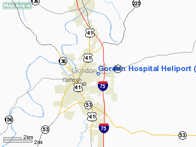
Location
& QuickFacts
|
FAA Information Effective: |
2007-01-18 |
|
Airport
Identifier: |
GE02 |
|
Airport
Status: |
Operational |
|
Longitude/Latitude: |
084-55-34.6400W/34-30-39.3600N
-84.926289/34.510933 (Estimated) |
|
Elevation: |
737 ft / 224.64 m (Estimated) |
|
Land: |
0
acres |
|
From
nearest city: |
1 nautical miles E of Calhoun, GA |
|
Location: |
Appling County, GA |
|
Magnetic Variation: |
() |
Owner
& Manager
|
Ownership: |
Privately owned |
|
Owner: |
Gordon Hospital |
|
Address: |
Po Box 12938
Calhoun, GA 30703 |
|
Phone number: |
706-629-2895 |
|
Manager: |
Director Of Facilities Maintenance |
|
Address: |
Po Box 12938
Calhoun, GA 30703 |
|
Phone number: |
706-629-2895 |
Airport
Operations and Facilities
|
Airport Use: |
Private |
|
Wind
indicator: |
Yes |
|
Control
Tower: |
No |
|
Lighting
Schedule: |
DUSK-DAWN |
|
Sectional
chart: |
Atlanta |
|
Region: |
ASO - Southern |
|
Boundary
ARTCC: |
ZTL - Atlanta |
|
Tie-in
FSS: |
MCN - Macon |
|
FSS
Phone: |
478-784-1155 |
|
FSS
Toll Free: |
1-800-WX-BRIEF |
|
Runway Information
Helipad H1
|
Dimension: |
70 x 70 ft / 21.3 x 21.3 m |
|
Surface: |
CONC-GRVL, |
|
Surface
Treatment: |
Porous Friction Course |
|
Weight
Limit: |
Single wheel: 14000 lbs. |
|
|
Runway H1 |
Runway |
|
Traffic
Pattern: |
Left |
Left |
|
Radio Navigation
Aids
|
ID |
Type |
Name |
Ch |
Freq |
Var |
Dist |
|
OUK |
NDB |
Calhoun |
|
323.00 |
02W |
6.6 nm |
|
UWI |
NDB |
Whitfield |
|
400.00 |
03W |
16.8 nm |
|
OYD |
NDB |
Floyd |
|
388.00 |
02W |
17.4 nm |
|
EVZ |
NDB |
Cartersville |
|
308.00 |
04W |
19.2 nm |
|
JZP |
NDB |
Pickens County |
|
285.00 |
04W |
23.3 nm |
|
DJD |
NDB |
Canton |
|
415.00 |
04W |
26.7 nm |
|
FTP |
NDB |
Fort Payne |
|
426.00 |
01W |
37.0 nm |
|
HDI |
NDB |
Hardwick |
|
369.00 |
01W |
38.6 nm |
|
CQN |
NDB |
Daisy |
|
341.00 |
02W |
41.0 nm |
|
APT |
NDB |
Jasper |
|
382.00 |
02W |
46.3 nm |
|
FT |
NDB |
Flanc |
|
344.00 |
02W |
47.2 nm |
|
DOB |
TACAN |
Dobbins |
077X |
|
01W |
41.5 nm |
|
PDK |
VOR/DME |
Peachtree |
113X |
116.60 |
02W |
49.3 nm |
|
RMG |
VORTAC |
Rome |
101X |
115.40 |
01E |
23.0 nm |
|
GQO |
VORTAC |
Choo Choo |
105X |
115.80 |
01E |
29.3 nm |
Remarks
- 118
FT TWR .5 NM SE; 183 FT TWR 1.1 NM S; 193 FT TWR 2.2 NM W OF HELIPAD.
- PRVD
VFR OPNS, PRIVATE USE, AREA IS MARKED AND WIND INDICATOR IS MAINTAINED
Gordon Hospital Heliport
Address:
Appling County, GA
Tel:
706-629-2895
Images
and information placed above are from
http://www.airport-data.com/airport/GE02/
We
thank them for the data!
We don't guarantee the information is fresh and accurate. The data may
be wrong or outdated.
For more up-to-date information please refer to other sources.
|
|


